Jump to content


Main menu


Navigation  


Main page
Contents
Current events
Random article
About Wikipedia
Contact us
Donate


Contribute  


Help
Learn to edit
Community portal
Recent changes
Upload file


Search  


Create account

Log in


Create account
 Log in


Pages for logged out editors learn more  


Contributions
Talk


Contents


(Top)


1 List of airports and heliports  


2 Defunct airports  


3 References  


List of airports in Yukon


فارسی
Français
Bahasa Indonesia


Edit links


Article
Talk


Read
Edit
View history


Tools


Actions  


Read
Edit
View history


General  


What links here
Related changes
Upload file
Special pages
Permanent link
Page information
Cite this page
Get shortened URL
Download QR code
Wikidata item


Print/export  


Download as PDF
Printable version


In other projects  


Wikimedia Commons


Appearance


From Wikipedia, the free encyclopedia


This is a list of airports in Yukon. It includes all Nav Canada certified and registered water and land airports, aerodromes and heliports in the Canadian territoryofYukon.[1][2] Airport names in italics are part of the National Airports System.[3]

Yukon

List of airports and heliports

[edit]
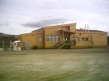
Whitehorse/Cousins Airport
Erik Nielsen Whitehorse International Airport
Watson Lake Airport
Old Crow Airport
Faro Airport

The list is sorted by the name of the community served; click the sort buttons in the table header to switch listing order.

Community   Airport name   ICAO   TC LID   IATA   Coordinates  
Beaver Creek Beaver Creek Airport CYXQ YXQ 62°24′37N 140°52′03W / 62.41028°N 140.86750°W / 62.41028; -140.86750 (Beaver Creek Airport)
Braeburn Lodge Braeburn Airport (Cinnamon Bun Airstrip) CEK2 61°29′04N 135°46′35W / 61.48444°N 135.77639°W / 61.48444; -135.77639 (Braeburn Airport)
Burwash Landing Burwash Airport CYDB YDB 61°22′14N 139°02′24W / 61.37056°N 139.04000°W / 61.37056; -139.04000 (Burwash Airport)
Carcross Carcross Airport CFA4 60°10′27N 134°41′52W / 60.17417°N 134.69778°W / 60.17417; -134.69778 (Carcross Airport)
Carcross Carcross Water Aerodrome CEB7 60°11′00N 134°42′00W / 60.18333°N 134.70000°W / 60.18333; -134.70000 (Carcross Water Aerodrome)
Carmacks Carmacks Airport CEX4 62°06′39N 136°10′42W / 62.11083°N 136.17833°W / 62.11083; -136.17833 (Carmacks Airport)
Chapman Lake Chapman Aerodrome CEZ2 64°54′13N 138°16′39W / 64.90361°N 138.27750°W / 64.90361; -138.27750 (Chapman Aerodrome)
Dawson City Dawson City Airport CYDA YDA 64°02′32N 139°07′48W / 64.04222°N 139.13000°W / 64.04222; -139.13000 (Dawson City Airport)
Eagle Plains Finlayson Lake Airport CFT3 61°41′29N 130°46′26W / 61.69139°N 130.77389°W / 61.69139; -130.77389 (Finlayson Lake Airport)
Eagle Plains Wiley Aerodrome CAJ2 66°29′28N 136°34′24W / 66.49111°N 136.57333°W / 66.49111; -136.57333 (Wiley Aerodrome)
Faro Faro Airport CZFA ZFA 62°12′27N 133°22′33W / 62.20750°N 133.37583°W / 62.20750; -133.37583 (Faro Airport)
Fort Selkirk Fort Selkirk Aerodrome CFS3 62°46′06N 137°23′05W / 62.76833°N 137.38472°W / 62.76833; -137.38472 (Fort Selkirk Aerodrome)
Haines Junction Haines Junction Airport CYHT YHT 60°47′21N 137°32′44W / 60.78917°N 137.54556°W / 60.78917; -137.54556 (Haines Junction Airport)
Hyland Hyland Airport CFT5 61°31′26N 128°16′11W / 61.52389°N 128.26972°W / 61.52389; -128.26972 (Hyland Airport)
La Biche River La Biche River Airport CFP6 60°07′45N 124°02′55W / 60.12917°N 124.04861°W / 60.12917; -124.04861 (La Biche River Airport)
Macmillan Pass Macmillan Pass Airport CFC4 63°10′34N 130°12′13W / 63.17611°N 130.20361°W / 63.17611; -130.20361 (Macmillan Pass Airport)
Mayo Mayo Airport CYMA YMA 63°36′59N 135°52′06W / 63.61639°N 135.86833°W / 63.61639; -135.86833 (Mayo Airport)
McQuesten McQuesten Airport CFP4 63°36′18N 137°33′49W / 63.60500°N 137.56361°W / 63.60500; -137.56361 (McQuesten Airport)
Minto Minto Landing Aerodrome CML7 62°35′38N 136°52′27W / 62.59389°N 136.87417°W / 62.59389; -136.87417 (Minto Landing Aerodrome)
Minto Mine Minto Aerodrome CMN4 62°36′17N 137°13′19W / 62.60472°N 137.22194°W / 62.60472; -137.22194 (Minto Aerodrome)
Ogilvie River Ogilvie Aerodrome CFS4 65°40′00N 138°07′00W / 65.66667°N 138.11667°W / 65.66667; -138.11667 (Ogilve Aerodrome)
Old Crow Old Crow Airport CYOC YOC 67°34′14N 139°50′21W / 67.57056°N 139.83917°W / 67.57056; -139.83917 (Old Crow Airport)
Pelly Crossing Pelly Crossing Airport CFQ6 62°50′15N 136°31′40W / 62.83750°N 136.52778°W / 62.83750; -136.52778 (Pelly Crossing Airport)
Pine Lake Pine Lake Aerodrome CFY5 60°06′11N 130°56′01W / 60.10306°N 130.93361°W / 60.10306; -130.93361 (Daughney Aerodrome)
Ross River Ross River Airport CYDM XRR 61°58′14N 132°25′20W / 61.97056°N 132.42222°W / 61.97056; -132.42222 (Ross River Airport)
Silver City Silver City Airport CFQ5 61°01′44N 138°24′27W / 61.02889°N 138.40750°W / 61.02889; -138.40750 (Silver City Airport)
Teslin Teslin Airport CYZW YZW 60°10′23N 132°44′30W / 60.17306°N 132.74167°W / 60.17306; -132.74167 (Teslin Airport)
Tincup Wilderness Lodge Tincup Lake Water Aerodrome CEF9 61°44′56N 139°14′45W / 61.74889°N 139.24583°W / 61.74889; -139.24583 (Tincup Lake Water Aerodrome)
Twin Creeks Twin Creeks Airport CFS7 62°37′10N 131°16′13W / 62.61944°N 131.27028°W / 62.61944; -131.27028 (Twin Creeks Airport)
Watson Lake Watson Lake Airport CYQH YQH 60°06′59N 128°49′21W / 60.11639°N 128.82250°W / 60.11639; -128.82250 (Watson Lake Airport)
Watson Lake Watson Lake Water Aerodrome CEJ9 60°07′00N 128°47′00W / 60.11667°N 128.78333°W / 60.11667; -128.78333 (Watson Lake Water Aerodrome)
Whitehorse Erik Nielsen Whitehorse International Airport CYXY YXY 60°42′34N 135°04′08W / 60.70944°N 135.06889°W / 60.70944; -135.06889 (Erik Nielsen Whitehorse International Airport)
Whitehorse Whitehorse/Cousins Airport CFP8 60°48′29N 135°10′38W / 60.80806°N 135.17722°W / 60.80806; -135.17722 (Whitehorse/Cousins Airport)
Whitehorse Whitehorse Water Aerodrome CEZ5 60°41′28N 135°02′13W / 60.69111°N 135.03694°W / 60.69111; -135.03694 (Whitehorse Water Aerodrome)

Defunct airports

[edit]
Community   Airport name   ICAO   TC LID   IATA   Coordinates  
Dawson City Dawson City Water Aerodrome CEG7 64°04′00N 139°26′00W / 64.06667°N 139.43333°W / 64.06667; -139.43333 (Dawson City Water Aerodrome)
Faro Faro/Johnson Lake Water Aerodrome CFC9 62°12′12N 133°23′33W / 62.20333°N 133.39250°W / 62.20333; -133.39250 (Faro/Johnson Lake Water Aerodrome)
Haines Junction Haines Junction/Pine Lake Water Aerodrome CFE8 60°48′10N 137°29′27W / 60.80278°N 137.49083°W / 60.80278; -137.49083 (Haines Junction/Pine Lake Water Aerodrome)
Teslin Teslin Water Aerodrome CEE9 60°10′00N 132°46′00W / 60.16667°N 132.76667°W / 60.16667; -132.76667 (Teslin Water Aerodrome)

References

[edit]
  1. ^ Canada Flight Supplement. Effective 0901Z 16 July 2020 to 0901Z 10 September 2020.
  • ^ Nav Canada's Water Aerodrome Supplement. Effective 0901Z 26 March 2020 to 0901Z 22 April 2021.
  • ^ National Airports System

  • Retrieved from "https://en.wikipedia.org/w/index.php?title=List_of_airports_in_Yukon&oldid=1088910884"

    Categories: 
    Airports in Yukon
    Lists of airports in Canada (provincial)
    Lists of buildings and structures in Yukon
    Hidden categories: 
    Articles with short description
    Short description is different from Wikidata
    Pages using gadget WikiMiniAtlas
    Lists of coordinates
    Geographic coordinate lists
    Articles with Geo
    Commons category link is on Wikidata


    This page was last edited on 20 May 2022, at 19:57 (UTC).

    Text is available under the Creative Commons Attribution-ShareAlike License 4.0; additional terms may apply. By using this site, you agree to the Terms of Use and Privacy Policy. Wikipedia® is a registered trademark of the Wikimedia Foundation, Inc., a non-profit organization.


    Privacy policy

    About Wikipedia

    Disclaimers

    Contact Wikipedia

    Code of Conduct

    Developers

    Statistics

    Cookie statement

    Mobile view


    Wikimedia Foundation
    Powered by MediaWiki