
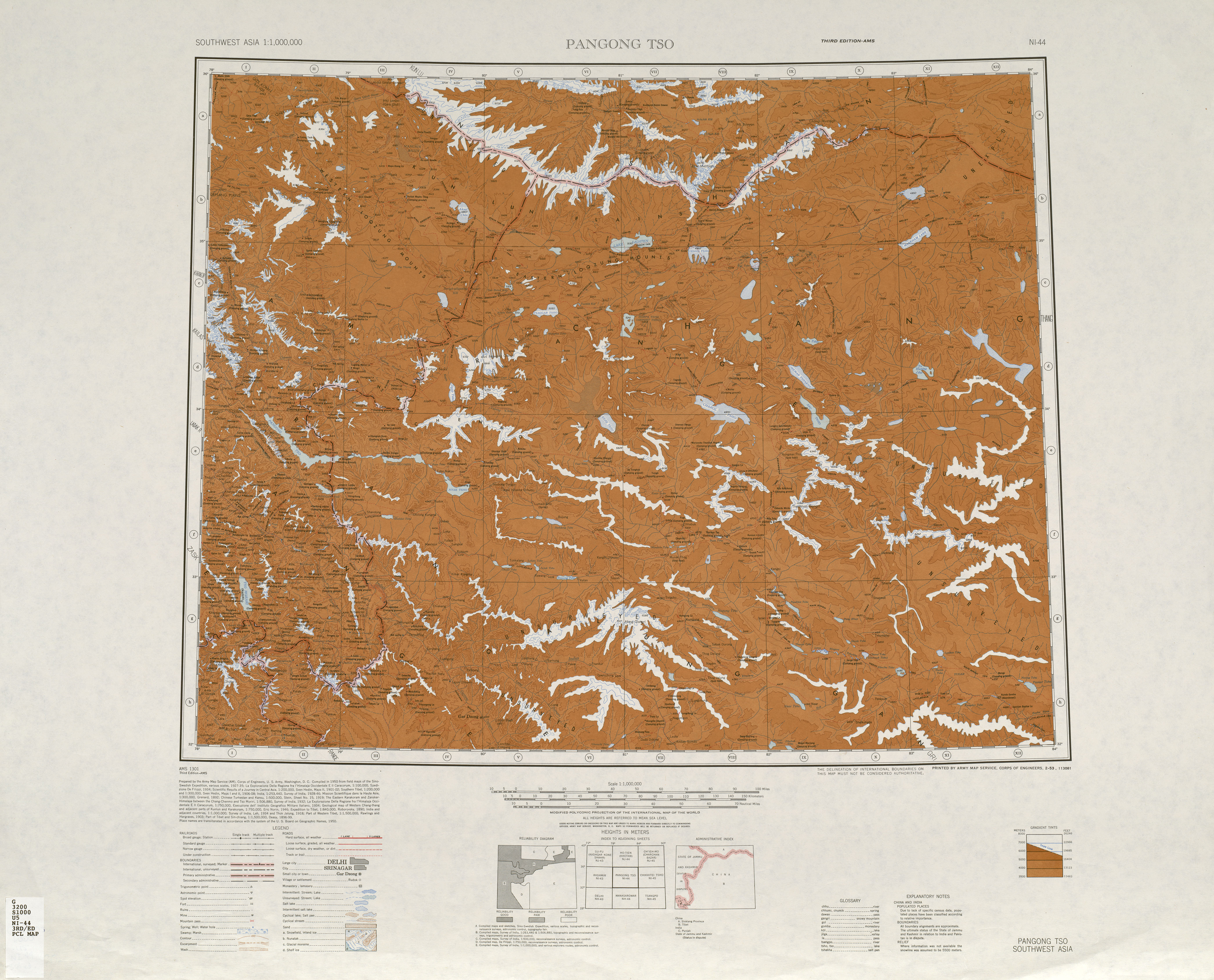
This is a list of basins, camping grounds, lakes, mountains, mountain passes, outposts, plains, rivers, ruins, settlements, streams, valleys, villages, and other geographical features located in (or partially included in) the sparsely populated Aksai Chin region administered by China and claimed by India as part of Ladakh. The alternate language names of locations in the Aksai Chin area are included for reference.


| Name | Purpose | In Use | Notes |
|---|---|---|---|
| Heweitan[1][2] | Border outpost | Yes | |
| Huoshaoyun[3][4] | Mining site | Yes | |
| Khurnak Fort | Ruins | Partial | Modern buildings nearby |
| Tianshuihai | Army service station | Yes | |
| Tianwendian | Border outpost | Yes | |
| Wenquan (output) [zh][5][6] | Border outpost | Yes | Also translated Hot Spring (温泉哨所). Not to be confused with the Indian border outpost at Hot Springs, Chang Chenmo Valley. |
On some maps, the road intersections in the region are also referred to with the simple named『(blank)岔口』where "(blank)" is the Chinese initial of the destination, and 岔口 simply means "road fork". For example, 天岔口, 河岔口, and 空岔口 for the road forks to Tianwendian, Heweinan, and Kongka Pass respectively.
Including camping grounds on historical caravan routes in Aksai Chin:
These are simply referred to as halting place which are places with sufficient vegetation, water, or natural shelter to warrant stopping or camping for historical caravans that depended upon beasts of burden.
'Dawan'[17] and 'La'[17] refer to a mountain pass.
'Lungpa' refers to a valley or stream
Tielongtan
Tielongtan
新藏公路由铁隆滩通向印控克什米尔边界的温泉边防哨卡的支线公路通过温泉达坂。
resulting in the formation of a series of pre-collisional granites (e.g. the adamellite (J2) at No. 509 Highway Maintenance Squad
Qitai Daban, a sweet water lake [sic], the No. 635 highway maintenance squad
Haji Langar (Qara Qāsh){...}Khitai Dawān{...}Aq-qum Dawān{...}Mapo-thang La{...}Mangrik Basin{...}Tso Thang{...}Konka La{...}Lanak La{...}Domjar La (Kone La){...}dawan-----pass{...}la----pass
In the Aksai Chin region he constructed a number of stone shelters (langar), and one of these was Haji Langar on the Karakash.
Khitai Dawan
|
| |||||||||||||||||||
|---|---|---|---|---|---|---|---|---|---|---|---|---|---|---|---|---|---|---|---|
| State symbols |
| ||||||||||||||||||
| History |
| ||||||||||||||||||
| Administration |
| ||||||||||||||||||
| Geography |
| ||||||||||||||||||
| Human settlements |
| ||||||||||||||||||
| Culture |
| ||||||||||||||||||
| Tourism and wildlife |
| ||||||||||||||||||
| Transport |
| ||||||||||||||||||
| Infrastructure |
| ||||||||||||||||||
| See also |
| ||||||||||||||||||


