Jump to content


Main menu


Navigation  


Main page
Contents
Current events
Random article
About Wikipedia
Contact us
Donate


Contribute  


Help
Learn to edit
Community portal
Recent changes
Upload file


Search  


Create account

Log in


Create account
 Log in


Pages for logged out editors learn more  


Contributions
Talk


Contents


(Top)


1 Falkenberg Municipality  


2 Halmstad Municipality  


3 Hylte Municipality  


4 Kungsbacka Municipality  


5 Laholm Municipality  


6 Varberg Municipality  


7 External links  


Listed buildings in Halland County


Svenska
 

Edit links


Article
Talk


Read
Edit
View history


Tools


Actions  


Read
Edit
View history


General  


What links here
Related changes
Upload file
Special pages
Permanent link
Page information
Cite this page
Get shortened URL
Download QR code
Wikidata item


Print/export  


Download as PDF
Printable version


In other projects  


Wikimedia Commons


Appearance


From Wikipedia, the free encyclopedia


There are 45 listed buildings (Swedish: byggnadsminne) in Halland County.

[edit]
Image Name Premises Number of
buildings
Year built Architect Coordinates ID
Borgen Hällerup Hällarp 1:7 1 56°57′50N 12°31′45E / 56.96396°N 12.52913°E / 56.96396; 12.52913 21300000014049
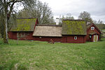
Olofsbo Hembygdsgård Olofsbo 4:34 4 56°55′44N 12°25′18E / 56.92899°N 12.42167°E / 56.92899; 12.42167 21300000014082
Stadshuset
Rådhuset
Rörbeckska huset
Rådhustorget
Svea 10
Innerstaden 3:1
3 56°54′15N 12°29′31E / 56.90425°N 12.49190°E / 56.90425; 12.49190 21300000022013
Tullbron Herting 2:1 1 56°54′11N 12°29′39E / 56.90296°N 12.49417°E / 56.90296; 12.49417 21300000014010
[edit]
Image Name Premises Number of
buildings
Year built Architect Coordinates ID
Biografen Röda Kvarn Drottning Kristina 1 1 56°40′34N 12°51′31E / 56.67612°N 12.85863°E / 56.67612; 12.85863 21300000014037
Televerkets hus Gråmunken 1
previously Gråmunken 24
1 56°40′38N 12°51′27E / 56.67716°N 12.85758°E / 56.67716; 12.85758 21300000014108
Brooktorpsgården Broktorp 11 1 56°40′26N 12°51′19E / 56.67380°N 12.85538°E / 56.67380; 12.85538 21300000014028
Bruno Mathssons sommarhus Onsjö 32:16 1 56°39′45N 12°44′21E / 56.66255°N 12.73922°E / 56.66255; 12.73922 21300000025526
Halmstads slott Slottet 1 1 56°40′17N 12°51′27E / 56.67137°N 12.85763°E / 56.67137; 12.85763 21300000014040
Kirsten Munks hus Kirsten Munck 1 1 56°40′32N 12°51′33E / 56.67555°N 12.85904°E / 56.67555; 12.85904 21300000014033
Mostorp Mostorp 5:1 2 56°50′23N 12°43′25E / 56.83959°N 12.72355°E / 56.83959; 12.72355 21300000014007
Norre Port Halmstad 5:1 1 56°40′39N 12°51′33E / 56.67744°N 12.85929°E / 56.67744; 12.85929 21300000026313
Särdals kvarn Särdal 1:7 2 56°44′29N 12°39′28E / 56.74146°N 12.65789°E / 56.74146; 12.65789 21300000014023
Tylöns fyrplats Tylön 1:1 6 56°38′49N 12°42′37E / 56.64685°N 12.71038°E / 56.64685; 12.71038 21300000014084
Vapnö slott Vapnö 6:2
previously Vapnö 2:1
3 56°42′47N 12°50′28E / 56.71296°N 12.84102°E / 56.71296; 12.84102 21300000014088
[edit]
Image Name Premises Number of
buildings
Year built Architect Coordinates ID
Brunnsbacka sågkvarn Brunnsbacka 1:2-3 1 56°58′55N 13°32′25E / 56.98186°N 13.54039°E / 56.98186; 13.54039 21300000014083
Rydöbruks missionshus Rydö 1:13 1 56°57′36N 13°08′04E / 56.95998°N 13.13456°E / 56.95998; 13.13456 21300000014085
Slätteryds byskola Slätteryd 1:7 4 56°58′16N 13°37′33E / 56.97121°N 13.62576°E / 56.97121; 13.62576 21300000025527
[edit]
Image Name Premises Number of
buildings
Year built Architect Coordinates ID
Riksdagsmannagården i Axtorp Axtorp 1:6 3 57°25′15N 12°17′49E / 57.42095°N 12.29705°E / 57.42095; 12.29705 21300000014113
Äskhults by Äskhult 1:2, 1:4, 1:5, 1:11
previously Äskhult 1:1, 1:3
11 57°25′38N 12°16′59E / 57.42713°N 12.28312°E / 57.42713; 12.28312 21300000014062
Mårtagården Iserås 6:1 7 57°23′40N 11°59′43E / 57.39437°N 11.99537°E / 57.39437; 11.99537 21300000014059
Knapegården Råö 13:1 7 57°23′28N 11°57′33E / 57.39120°N 11.95916°E / 57.39120; 11.95916 21300000014115
Metodistkapellet Bethel Lunna 11:5 1 57°27′39N 11°59′54E / 57.46083°N 11.99845°E / 57.46083; 11.99845 21300000014086
Nidingens fyrplats Nidingen 1:1 12 57°18′11N 11°54′07E / 57.30296°N 11.90194°E / 57.30296; 11.90194 21300000014064
Stolpboden, Särö Särö 1:502 1 57°30′20N 11°56′22E / 57.50567°N 11.93942°E / 57.50567; 11.93942 21300000014081
Tjolöholm Castle Tjolöholm 1:1 and others 18 57°24′09N 12°06′24E / 57.40255°N 12.10663°E / 57.40255; 12.10663 21300000014011
Wea kaptensgård Ekenäs 5:18 3 57°30′56N 11°58′35E / 57.51562°N 11.97630°E / 57.51562; 11.97630 21300000014080
[edit]
Image Name Premises Number of
buildings
Year built Architect Coordinates ID
Vippentorpet Bygget 1:3 1 56°30′17N 13°14′29E / 56.50471°N 13.24147°E / 56.50471; 13.24147 21000001589320
Hausknechtska huset Hästen 5 1 56°30′43N 13°02′38E / 56.51208°N 13.04398°E / 56.51208; 13.04398 21000001589340
Backstugan i Fladalt Fladalt 1:44 1 56°21′58N 13°08′47E / 56.36606°N 13.14641°E / 56.36606; 13.14641 21300000014117
Bollaltebygget Bållalt 2:8
previously Bollalte 2:8
5 56°34′36N 13°18′12E / 56.57657°N 13.30331°E / 56.57657; 13.30331 21300000014046
Skottorps slott Skottorp 1:39 5 56°26′09N 12°58′44E / 56.43581°N 12.97898°E / 56.43581; 12.97898 21300000014079
Vallens slott Vallen 1:23 3 56°25′46N 13°07′39E / 56.42945°N 13.12756°E / 56.42945; 13.12756 21300000014104
Västralt Västralt 2:10
Lottens
3 56°30′54N 13°18′38E / 56.51497°N 13.31044°E / 56.51497; 13.31044 21300000027238
[edit]
Image Name Premises Number of
buildings
Year built Architect Coordinates ID
Hägareds gård Hägared 1:1 7 57°01′18N 12°23′36E / 57.02163°N 12.39320°E / 57.02163; 12.39320 21000001589380
Långanskogen Ästad 1:17 1 57°03′40N 12°32′16E / 57.06106°N 12.53786°E / 57.06106; 12.53786 21300000014009
Båtsmanstorpet Hallmans Olofstorp 7:4 1 57°10′00N 12°24′19E / 57.16677°N 12.40515°E / 57.16677; 12.40515 21300000014130
Grimetons radiostation, radioby Grimeton 13:34, 13:37-13:45 20 57°06′51N 12°23′57E / 57.11430°N 12.39923°E / 57.11430; 12.39923 21300000016135
Grunnarps gård Grunnarp 3:12 4 57°08′53N 12°21′22E / 57.14810°N 12.35612°E / 57.14810; 12.35612 21300000014131
Åkrabergs ladugård Värö-Åkraberg 1:12 1 57°15′32N 12°13′55E / 57.25889°N 12.23186°E / 57.25889; 12.23186 21300000014134
Lindhovs kungsgård Lindhov 1:1 7 57°08′32N 12°15′51E / 57.14223°N 12.26418°E / 57.14223; 12.26418 21300000014048
Societetshuset Getakärr 3:60 1 57°06′24N 12°14′35E / 57.10670°N 12.24296°E / 57.10670; 12.24296 21300000014091
Sunvära kvarn Sunnvära 11:9 1 57°14′46N 12°12′53E / 57.24602°N 12.21474°E / 57.24602; 12.21474 21300000014135
Varbergs fästning Getakärr 3:62 12 57°06′23N 12°14′24E / 57.10641°N 12.23998°E / 57.10641; 12.23998 21300000014133
Åsklosters kungsgård Åskloster 1:1 3 57°13′31N 12°13′12E / 57.22525°N 12.22004°E / 57.22525; 12.22004 21300000014106
[edit]
Retrieved from "https://en.wikipedia.org/w/index.php?title=Listed_buildings_in_Halland_County&oldid=1082037197"

Category: 
Listed buildings in Sweden
Hidden categories: 
Articles with short description
Short description is different from Wikidata
Lists of coordinates
Geographic coordinate lists
Articles with Geo
Pages using gadget WikiMiniAtlas
Commons category link is on Wikidata
Articles with Swedish-language sources (sv)


This page was last edited on 11 April 2022, at 01:31 (UTC).

Text is available under the Creative Commons Attribution-ShareAlike License 4.0; additional terms may apply. By using this site, you agree to the Terms of Use and Privacy Policy. Wikipedia® is a registered trademark of the Wikimedia Foundation, Inc., a non-profit organization.


Privacy policy

About Wikipedia

Disclaimers

Contact Wikipedia

Code of Conduct

Developers

Statistics

Cookie statement

Mobile view


Wikimedia Foundation
Powered by MediaWiki