
Lorch
| |
|---|---|
 | |

Coat of arms | |
Location of Lorch within Rheingau-Taunus-Kreis district 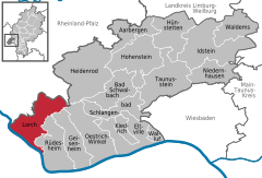 | |
 Lorch Show map of Germany  Lorch Show map of Hesse | |
| Coordinates: 50°2′39″N 7°48′12″E / 50.04417°N 7.80333°E / 50.04417; 7.80333 | |
| Country | Germany |
| State | Hesse |
| Admin. region | Darmstadt |
| District | Rheingau-Taunus-Kreis |
| Subdivisions | 3 districts |
| Government | |
| • Mayor (2019–25) | Ivo Reßler[1] |
| Area | |
| • Total | 54 km2 (21 sq mi) |
| Highest elevation | 450 m (1,480 ft) |
| Lowest elevation | 81 m (266 ft) |
| Population
(2022-12-31)[2]
| |
| • Total | 4,017 |
| • Density | 74/km2 (190/sq mi) |
| Time zone | UTC+01:00 (CET) |
| • Summer (DST) | UTC+02:00 (CEST) |
| Postal codes |
65391
|
| Dialling codes | 06726 |
| Vehicle registration | RÜD |
| Website | www.stadt-lorch-rheingau.de |
Lorch am Rhein (German pronunciation: [ˌlɔʁç ʔam ˈʁaɪn]) is a small town in the Rheingau-Taunus-Kreis in the RegierungsbezirkofDarmstadtinHesse, Germany. It belongs to the Rhine Gorge World Heritage Site.
The town is characterized by winegrowing and tourism.

Lorch lies in the southwestern part of the Rheingau-Taunus-Kreis in the foothills of the Rheingaugebirge (range), some 10 km north of the bend in the Rhine near Rüdesheim. The town owes its picturesque setting in the Middle Rhine Valley between Rüdesheim am Rhein and Sankt Goarshausen to its location at the mouth of the Wisper and to its steep vineyards. The town's municipal area stretches into the richly wooded Wisper valley along Landesstraße (State Road) 3033 between Lorch and the district seat of Bad Schwalbach. The town is a state-recognized recreational resort (Erholungsort). The Rheinsteig, the new hiking trail on the Rhine's right bank leading from WiesbadentoBonn, runs on the Rhine heights. In the Rhine near Lorch lies the island and nature conservation area called Lorcher Werth.
Lorch's Stadtteile (subdivisions of the town), besides the main town, also called Lorch, are Lorchhausen, Espenschied, Ransel, Ranselberg, and Wollmerschied.
The area was settled quite early on, first by the Celts, and then, during the Christian Era, by the Ubii and later the Mattiaci. In the first century[clarification needed], the Romans advanced to the Taunus. The Romans were followed by the Alamanni, and with the onset of the Migration Period, the Franks.
The town's oldest documentary mention is a document from 1085 in which Archbishop Wezilo documented a donation, from the Mainz Cathedral Canon Embricho to the cathedral chapter, of a number of holdings, among them a house and vineyards in Lorch.
In the Middle Ages, Lorch served as the northern bastion of the Archbishopric of Mainz facing toward the Rheingau. Beginning in the twelfth century, Lorch found itself at the southern end of the Rheingauer Gebück, a kind of border defence made out of an impenetrable “hedge” of stunted trees (the word itself comes from the root of the German word bücken, meaning “stoop”, a reference to the trees’ thick, low boughs). This was put in place by the Archbishops of Mainz.
In the thirteenth century, a parish, whose first documentary mention came in 1254, was established in Lorch.
In 1460, 1631, 1794, and in the final phase of the Second World War, there was warfare in Lorch, which sometimes brought considerable destruction.
On 10 January 1919, the Free State of Bottleneck, a provisional statelike entity between occupation zones after the First World War, was proclaimed, with Lorch as the “capital”. Even today, many of the ministate's coats of arms in the town still recall this time.
In the early 1960s, the Bundeswehr came to town with its Flugabwehrregiment 5 (“Antiaircraft Regiment 5”). A new settlement, the Ranselberg, was built for soldiers and their families. The barracks in the picturesque Wisper Valley represented an important economic factor for the town of Lorch. Many local people found work in the barracks, the attached post administration, the munitions depot, the equipment depot, and the sanitary depot.
In the course of Bundeswehr reform, the barracks were closed in 1993. At the site, the underground Gerätehauptdepot Lorch-Wispertal (“Main Equipment Depot”) and the likewise underground Sanitätshauptdepot Lorch-Rheingau (“Main Sanitary Depot”) remained. In November 2003, the complete abandonment of the Bundeswehr post was announced. The sanitary company was to be withdrawn in early 2008. By 31 December 2007, the Sanitätshauptdepot was to be dissolved, and a year later the Gerätehauptdepot was to disappear. Some 280 civilians would thereby lose their jobs.
Meanwhile, various businesses have set up in the abandoned Bundeswehr facilities, which has offset the job losses due to the military's pullout to a certain extent.
Lorch's character is mostly Catholic, and serving this community is the Gothic church St. Martin. St. Bonifatius, Lorchhausen, serves the Lorchhausen village. Since 1908, the Protestant parishioners have been gathering in a church room in a house at Oberweg 4.
This section needs to be updated. Please help update this article to reflect recent events or newly available information. (July 2021)
|
The five-yearly municipal elections yielded the following results:
| Parties and voter communities | 2021 | 2016 | 2011 | 2006 | 2001 | ||||||
|---|---|---|---|---|---|---|---|---|---|---|---|
| % | Seats | % | Seats | % | Seats | % | Seats | % | Seats | ||
| LiLo | Liste Lorch | 39.8 | 8 | – | – | – | – | – | – | – | – |
| FWG | Free Voters | 23.3 | 4 | 28.6 | 5 | 22.9 | 4 | 21.7 | 4 | 14.2 | 3 |
| CDU | Christian Democratic Union of Germany | 21.8 | 4 | 41,3 | 8 | 40.4 | 8 | 45.6 | 9 | 49.1 | 11 |
| SPD | Social Democratic Party of Germany | 15.1 | 3 | 30.1 | 6 | 26.2 | 5 | 25.2 | 5 | 29.2 | 7 |
| Grüne | Bündnis 90/Die Grünen (Greens) | – | – | – | – | 10.5 | 2 | 7.5 | 1 | 7.5 | 2 |
| Total | 100.0 | 19 | 100.0 | 19 | 100.0 | 19 | 100.0 | 19 | 100.0 | 23 | |
| Voter turnout in % | 60.7 | 57.3 | 54.7 | 55.0 | 60.6 | ||||||
On June 16, 2019, Ivo Reßler (independent) was elected mayor with 51.2 percent of the votes in a runoff against incumbent Jürgen Helbing (CDU). Voter turnout was 63.6 percent. He took office on February 1, 2020.[3][4]
"Adopted wine town":

Culturally and politically, Lorch is part of the Hessian Rheingau.
The Robert-Struppmann-Museum is the town's local history museum. It houses valuable carvings, documents, sculptures, and sacral objects, among other things a woodcarvingofJohn the Baptist's severed head from the twelfth century and the seated Madonna with Christ Child and grapes from the early fourteenth century. It is open weekend afternoons in spring, summer, and autumn and also serves as a tourist information centre. There are many brochures to be had there for free. Moreover, books about Lorch's history and winegrowing are on sale there.


Lorch lies on Bundesstraße 42 (Koblenz–Wiesbaden) and the railway line that roughly parallels it. It is some 40 km to the Autobahn interchangeinWiesbaden where the B 42 meets the A 66 going towards Frankfurt. There is a connection to the Autobahn “cross” at Mainz (A 61/A 60, Cologne/Koblenz/Ludwigshafen) across the Wiesbaden-Schierstein bridge over the Rhine; and by way of the Rhine ferries at Lorch and Kaub to the on-ramps at Laudert and Rheinböllen (about 15 km).
The town is served by regional services on the East Rhine Railway sponsored by the Rhein-Main-Verkehrsverbund.
Moreover, there is the Wiesbaden-Lorchhausen ORN (Omnibusverkehr Rhein-Nahe) busline.
The Rheinsteig, the new hiking trail from WiesbadentoBonn by way of the Ehrenbreitstein fort runs on the Rhine heights of Lorch.
After dealings with the Bundesvermögensverwaltung (“Federal Estate Administration”), the town of Lorch managed to build an industrial park with some 20 firms on the lands formerly occupied by the barracks.
Winegrowing in Lorch is run within the Rheingau winegrowing region under the Großlage (roughly “vineyard group” or “appellation”) “Burgweg”. The individual vineyards are Schlossberg (53 ha), Kapellenberg (58 ha), Krone (13 ha), Pfaffenwies (35 ha), and Bodental-Steinberg (23 ha).
The dominant grape variety is Riesling, but Pinot noir has a growing share of the harvest. From the wines, Edelbrände and sekt are also produced.
The grapes grow in hillside vineyards on stony, heat-storing slate- and quartzite-bearing earth. The great expanse of water that is the Rhine accounts for the temperature balance, working as a reflector off which sunlight shines, thereby strengthening it.
The town's noble family named itself “von Lorch”. Their most important representative was Johann Hilchen (1484–1548), knight and Imperial field marshal.
|
Towns and municipalities in Rheingau-Taunus-Kreis district
| ||
|---|---|---|
|
| |
| International |
|
|---|---|
| National |
|
| Geographic |
|
| Other |
|
