
Maddur
| |
|---|---|
Town
| |
| Madduru | |

The Shimsha river in Maddur
| |
|
Location in Karnataka, India Show map of KarnatakaMaddur (India) Show map of India | |
| Coordinates: 12°35′06″N 77°03′00″E / 12.5849°N 77.05°E / 12.5849; 77.05 | |
| Country | |
| State | Karnataka |
| District | Mandya |
| Government | |
| • Body | Town Municipal Council |
| Area | |
| • Town | 6.23 km2 (2.41 sq mi) |
| • Rural | 612 km2 (236 sq mi) |
| Elevation | 662 m (2,172 ft) |
| Population
(2011)
| |
| • Town | 28,754 |
| • Density | 4,600/km2 (12,000/sq mi) |
| • Rural | 266,678 [1] |
| Demonym | Maddurean |
| Languages | |
| • Official | Kannada |
| Time zone | UTC+5:30 (IST) |
| PIN |
571428
|
| Telephone code | 08232 |
| Vehicle registration | KA-11 |
| Website | http://maddurtown.mrc.gov.in/ |
Maddur (also pronounced as Maddūru) is a town in Mandya district in the Indian stateofKarnataka. It lies on the banks of the river Shimsha. It is 82 kilometers from the state capital Bangalore and 60 kilometers from Mysore. Derived from Maddu (inKannada) a term referring to chemicals used for explosives.


Maddur is located at 12°35′03″N 77°02′42″E / 12.584169°N 77.0449°E / 12.584169; 77.0449.[2] It has an average elevation of 662 metres (2175 ft).
As of 2011[update] India census,[3] Maddur had a population of 28,754 of which 14,342 males and 14,412 females. Maddur has an average literacy rate of 68%, higher than the national average of 59.5%: male literacy is 73%, and female literacy is 63%. In Maddur, 12% of the population is under 6 years of age.

Maddur has been recently famous for its tender coconut cultivation. Nearly 300 trucks of nuts are daily sent to the other states of India such as Punjab, Maharashtra, West Bengal, Goa, Telangana, Gujarat and other states. Small towns near Maddur consume more and more tender coconuts daily. Maddur has been recently named as Tender coconut capital of India.[4][5]

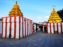
Among the important temples here is the Narasirnha temple[6] of the Hoysala period with a 7 ft high image of Ugra Narasimha made of black stone.
Maddur's Varadaraja temple is an early Chola or pre-Chola structure. Its 12 ft high Alialanatha deity is elaborately carved both in front and on the back with unusual features which has led to the Kannada saying 'Ella Devara Munde Nodu Allalanathana hinde nodu' - 'All other idols are to be seen from the front but Allalanatha is to be seen from the back'. The temple was built by king Vishnuvardhana (formerly known as Bitti Deva).
A Jain temple or Derasar is the place of worship for Jains, the followers of Jainism. Jain architecture is essentially restricted to temples and monasteries, and secular Jain buildings generally reflect the prevailing style of the place and time they were built.
Jain temple architecture is generally close to Hindu temple architecture, and in ancient times Buddhist architecture. Normally the same builders and carvers worked for all religions, and regional and period styles are generally similar. For over 1,000 years the basic layout of a Hindu or most Jain temples has consisted of a small garbhagriha or sanctuary for the main murti or cult images, over which the high superstructure rises, then one or more larger mandapa halls.
Māru-Gurjara architecture or the "Solanki style" is, a particular temple style from Gujarat and Rajasthan (both regions with a strong Jain presence) that originated in both Hindu and Jain temples around 1000, but became enduringly popular with Jain patrons. It has remained in use, in somewhat modified form, to the present day, indeed also becoming popular again for some Hindu temples in the last century. The style is seen in the groups of pilgrimage temples at Dilwara on Mount Abu, Taranga, Girnar and Palitana.[7][8]
In 2016, Archaeological Survey of India (ASI) excavated another 13 ft (4.0 m) statue of Bahubali made in the 3rd – 9th centuries on another hillock located opposite the basadis in Arthipura. Excavation work is expected to be completed by 2018.[9]