
This article needs additional citations for verification. Please help improve this articlebyadding citations to reliable sources. Unsourced material may be challenged and removed.
Find sources: "Makran Coastal Highway" – news · newspapers · books · scholar · JSTOR (June 2024) (Learn how and when to remove this message) |
25°40′34″N 66°36′33″E / 25.67611°N 66.60917°E / 25.67611; 66.60917
| National Highway 10 | |
|---|---|
| قومی شاہراہ ١٠ | |
| قومی شاہراہ ۱۰ | |

Makran Coastal Highway (N10)
| |
| Route information | |
| Maintained by NHA | |
| Length | 653 km (406 mi) |
| Existed | 2004–present |
| History | Construction started in 2002 and was completed in 2004. |
| Major junctions | |
| East end | Karachi |
| Major intersections | N-25 |
| West end | Gwadar |
| Location | |
| Country | Pakistan |
| Major cities | Karachi, Ormara, Pasni, Gwadar |
| Highway system | |
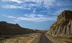
The N-10orNational Highway 10 (Urdu: قومی شاہراہ ۱۰) is a 653 kmnational highwayinPakistan which extends along Pakistan's Arabian Sea coast from KarachiinSindh province to GwadarinBalochistan province. It passes the towns of Ormara and Pasni.
The idea of exploiting the potential of the large coastal belt was under discussion for a long time. The decision to build a port in Gwadar was initially taken in the early 1990s when the hydrocarbon-laden and mineral-rich Central Asian Republics gained independence after the breakup of the Soviet Union. The construction of the Makran Coastal Highway was essential to the development of the port of Gwadar. Without the Highway, Gwadar would have been an island sitting without the bridges that connect it with Karachi in the south and the rest of Pakistan and the larger world around in the north and the west. Another key connection of an established infrastructure in this part of the country: it offers China a potential alternative to the vulnerable choke points in the Malacca straits.[1]
Prior to the construction of the Makran Coastal Highway in 2004, Karachi was linked to Gwadar via an uncarpeted "jeep" or "dirt" track. The journey between Karachi and Gwadar used to take at least two days and took a heavy toll on the "wear and tear" of vehicles. It was considered preferable to take the safer but longer route via Quetta.
After completion of the Makran Coastal Highway, the average journey time between Karachi and Gwadar has been reduced to only 6 to 7 hours and transportation costs have also been reduced.
The Makran Coastal Highway was planned and built by the Government of Pakistan with the following objectives:
The construction contract for the Makran Coastal Highway was awarded to Pakistan's Frontier Works Organisation (FWO), which built the Karakorum Highway.
Construction work on the Makran Coastal Highway Project commenced in 2002 and was completed by 14 December 2004, in a period of three years.[2]
The Makran Coastal Highway is managed and maintained by Pakistan's National Highway Authority.
|
| ||
|---|---|---|
| National Highways |
| |
| Strategic Highways |
| |
This article on a road in Pakistan is a stub. You can help Wikipedia by expanding it. |