Jump to content


Main menu


Navigation  


Main page
Contents
Current events
Random article
About Wikipedia
Contact us
Donate


Contribute  


Help
Learn to edit
Community portal
Recent changes
Upload file


Search  


Create account

Log in


Create account
 Log in


Pages for logged out editors learn more  


Contributions
Talk


Contents


(Top)


1 See also  


2 References  


3 External links  


Maloja Pass


Alemannisch
Български
Cebuano
Čeština
Dansk
Deutsch
Eesti
Español
Esperanto
Français

Italiano

Latina
Lietuvių
Lombard
Magyar
Nederlands
Norsk bokmål
Norsk nynorsk
Polski
Português
Rumantsch
Русский
Slovenščina
Svenska
Türkçe
Українська
Vèneto
 

Edit links


Article
Talk


Read
Edit
View history


Tools


Actions  


Read
Edit
View history


General  


What links here
Related changes
Upload file
Special pages
Permanent link
Page information
Cite this page
Get shortened URL
Download QR code
Wikidata item


Print/export  


Download as PDF
Printable version


In other projects  


Wikimedia Commons


Appearance


Coordinates: 46°24N 09°42E / 46.400°N 9.700°E / 46.400; 9.700
 

From Wikipedia, the free encyclopedia


Maloja Pass
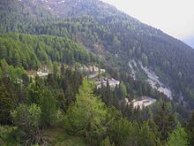
Maloja Pass road
Elevation1,815 m (5,955 ft)
Traversed byRoad
LocationGraubünden, Switzerland
RangeAlps
Coordinates46°24′N 09°42′E / 46.400°N 9.700°E / 46.400; 9.700
Maloja Pass is located in Switzerland
Maloja Pass

Maloja Pass

Location in Switzerland

Maloja Pass road

Maloja Pass (Italian: Passo del Maloja, German: Malojapass) (1815m a.s.l.) is a high mountain pass in the Swiss Alps in the cantonofGraubünden, linking the Engadine with the Val Bregaglia, still in Switzerland and ChiavennainItaly. It marks the divide between the Danube and Po watersheds. Lägh da Bitabergh is near the pass.[1]

The road from Chiavenna to Silvaplana with distances and elevation:

The Maloja Pass is open in winter. However, after heavy snowfalls the road may be closed for a couple of hours or for an entire day. Even if open, the road might be covered with snow making snow/winter tires, or chains, a necessity.

The lowest point of the col, and the lowest point on the watershed between the basins of the Inn and the Po in Switzerland lies at an altitude of 1,812 m.

See also[edit]

References[edit]

  1. ^ "Malojapass". www.engadin.ch.

External links[edit]


Retrieved from "https://en.wikipedia.org/w/index.php?title=Maloja_Pass&oldid=1221557011"

Categories: 
Engadin
Mountain passes of Graubünden
Mountain passes of Switzerland
Val Bregaglia
Hidden categories: 
Pages using gadget WikiMiniAtlas
Articles with short description
Short description is different from Wikidata
Coordinates on Wikidata
Articles with HDS identifiers
Articles with LIR identifiers


This page was last edited on 30 April 2024, at 16:32 (UTC).

Text is available under the Creative Commons Attribution-ShareAlike License 4.0; additional terms may apply. By using this site, you agree to the Terms of Use and Privacy Policy. Wikipedia® is a registered trademark of the Wikimedia Foundation, Inc., a non-profit organization.


Privacy policy

About Wikipedia

Disclaimers

Contact Wikipedia

Code of Conduct

Developers

Statistics

Cookie statement

Mobile view


Wikimedia Foundation
Powered by MediaWiki