Jump to content


Main menu


Navigation  


Main page
Contents
Current events
Random article
About Wikipedia
Contact us
Donate


Contribute  


Help
Learn to edit
Community portal
Recent changes
Upload file


Search  


Create account

Log in


Create account
 Log in


Pages for logged out editors learn more  


Contributions
Talk


Contents


(Top)


1 Etymology  


2 Demographics  


3 Religions  


4 Education  


5 Health  


6 See also  


7 References  


8 External links  


Manjeshwar


 / Bân-lâm-gú
Cebuano
Español
ि
িি ি
Italiano

Malagasy

Bahasa Melayu
Nederlands
 
Svenska
ி

اردو
Tiếng Vit


Edit links


Article
Talk


Read
Edit
View history


Tools


Actions  


Read
Edit
View history


General  


What links here
Related changes
Upload file
Special pages
Permanent link
Page information
Cite this page
Get shortened URL
Download QR code
Wikidata item


Print/export  


Download as PDF
Printable version


In other projects  


Wikimedia Commons
Wikivoyage


Appearance


Coordinates: 12°4327N 74°5227E / 12.7243°N 74.8743°E / 12.7243; 74.8743
 

From Wikipedia, the free encyclopedia


Manjeshwar
Town
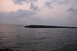
Manjeshwar harbour
Manjeshwar harbour
Manjeshwar is located in Kerala
Manjeshwar

Manjeshwar

Location in Kerala, India

Manjeshwar is located in India
Manjeshwar

Manjeshwar

Manjeshwar (India)

Coordinates: 12°43′27N 74°52′27E / 12.7243°N 74.8743°E / 12.7243; 74.8743
Country India
StateKerala
DistrictKasaragod
TalukManjeshwaram
Named forManjula Kshetra
Government
 • BodyGrama Panchayat
Area
 • Total28.38 km2 (10.96 sq mi)
Population
 (2011)[1]
 • Total41,515
 • Density1,500/km2 (3,800/sq mi)
Languages
 • OfficialMalayalam, English[2]
Time zoneUTC+5:30 (IST)
PIN
671323
Telephone code4998
Vehicle registrationKL-14

Manjeshwar is a town and a minor port in Kasaragod district at the northern tip of Kerala. It is situated at a distance of 584 kilometres (360 mi) from the state capital Thiruvananthapuram, 28 kilometres (20 mi) north of district HQ Kasaragod and 30 kilometres (20 mi) south of Mangalore city in neighbouring Karnataka. It is a coastal town in Kasaragod district.

Etymology[edit]

Demographics[edit]

The Manjeshwar Census Town (CT) has an area of 3.98 km2. As of 2011, it had a population of 8,742.

The Population of Children with age of 0-6 is 1149 which is 13.14% of the total population of Manjeshwar (CT). The literacy rate of Manjeshwar is 92.91%, which is lower than the state average of 94.00%.[3]

Religions[edit]

As per 2011 census report, the Manjeshwar Census Town had a total population of 8,742 among which 5,827 were Muslims (66.7%), 2,742 were Hindus (31.4%), 165 were Christians (1.9%), 28 people did not stat their religion (0.3%) with 4 marked "other.[4]

Year Male Female Total Population Change Religion (%)
Hindu Muslim Christian Sikhs Buddhist Jain Other religions Religion not stated
2001[5] 8675 4285 4417 - 33.98 61.72 4.25 0 0 0 0 0.05
2011[6] 8742 4178 4564 +0.77% 31.37 66.66 1.89 0.01 0 0 0 0.08

Education[edit]

Health[edit]

Manjeshwar is one of the areas with large number of HIV patients. 970 HIV cases were registered in Kasaragod district. Ten HIV deaths were reported from Kasaragod district within a short period of two months in 2016. There is no special facility or doctors for HIV patients in this area. HIV affected areas in Kasaragod include Dharmathadka, Nileshwaram, Manjeshwar, Bandiyod, Vellarikundu, Kasaragod town and Padannakkad.[7]

See also[edit]

References[edit]

  1. ^ https://censusindia.gov.in › 3...PDF Web results Kasaragod - DISTRICT CENSUS HANDBOOK
  • ^ "The Kerala Official Language (Legislation) Act, 1969" (PDF).
  • ^ Kerala, Directorate of Census Operations. District Census Handbook, Kasaragod (PDF). Thiruvananthapuram: Directorate of Census Operations, Kerala. p. 100,101. Retrieved 14 July 2020.
  • ^ "Religion – Kerala, Districts and Sub-districts". Census of India 2011. Office of the Registrar General.
  • ^ Census India 2001.
  • ^ Census India 2011.
  • ^ "10 HIV deaths reported in Kasargod dist within 2 months".
  • External links[edit]


    Retrieved from "https://en.wikipedia.org/w/index.php?title=Manjeshwar&oldid=1234176617"

    Categories: 
    Cities and towns in Kasaragod district
    Manjeshwar area
    Panchayats in Kasaragod district
    Hidden categories: 
    Pages using gadget WikiMiniAtlas
    Articles needing additional references from August 2017
    All articles needing additional references
    Wikipedia articles in need of updating from April 2024
    All Wikipedia articles in need of updating
    Articles with multiple maintenance issues
    Use dmy dates from May 2018
    Use Indian English from May 2018
    All Wikipedia articles written in Indian English
    Articles with short description
    Short description is different from Wikidata
    Coordinates on Wikidata
    Articles to be expanded from August 2023
    All articles to be expanded
    Articles with empty sections from August 2023
    All articles with empty sections
    Articles using small message boxes
    Commons category link is on Wikidata


    This page was last edited on 13 July 2024, at 00:18 (UTC).

    Text is available under the Creative Commons Attribution-ShareAlike License 4.0; additional terms may apply. By using this site, you agree to the Terms of Use and Privacy Policy. Wikipedia® is a registered trademark of the Wikimedia Foundation, Inc., a non-profit organization.


    Privacy policy

    About Wikipedia

    Disclaimers

    Contact Wikipedia

    Code of Conduct

    Developers

    Statistics

    Cookie statement

    Mobile view


    Wikimedia Foundation
    Powered by MediaWiki