Jump to content


Main menu


Navigation  


Main page
Contents
Current events
Random article
About Wikipedia
Contact us
Donate


Contribute  


Help
Learn to edit
Community portal
Recent changes
Upload file


Search  


Create account

Log in


Create account
 Log in


Pages for logged out editors learn more  


Contributions
Talk


Contents


(Top)


1 Villages  


2 Neighbouring islands  


3 Gallery  


4 See also  


5 References  


Manono Island


Asturianu
Cebuano
Čeština
Deutsch
Ελληνικά
Español
Français
Galego

Hrvatski
Italiano

Кырык мары
Latina
Latviešu
Lietuvių
Македонски
Māori
مصرى
Nederlands
Polski
Русский
Gagana Samoa
Slovenčina
Svenska


Edit links


Article
Talk


Read
Edit
View history


Tools


Actions  


Read
Edit
View history


General  


What links here
Related changes
Upload file
Special pages
Permanent link
Page information
Cite this page
Get shortened URL
Download QR code
Wikidata item


Print/export  


Download as PDF
Printable version


In other projects  


Wikimedia Commons


Appearance


From Wikipedia, the free encyclopedia


Manono
Satellite image of Manono island with Upolu to the east and tiny Apolima island to the west (NASA photo)
Geography
LocationPacific Ocean
Coordinates13°50′S 172°05′W / 13.833°S 172.083°W / -13.833; -172.083
Areakm2 (1.2 sq mi)
Coastline7.5 km (4.66 mi)
Administration

Samoa

Demographics
Population889 (2006)
Pop. density296/km2 (767/sq mi)

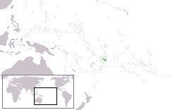
Manono is an islandofSamoa, situated in the Apolima Strait between the main islands of Savai'i and Upolu, 3.4 km west-northwest off Lefatu Cape, the westernmost point of Upolu. By population, as well as by area, it is Samoa’s third largest island.

There are four villages on the island with a total population of 889 (2006 Census).[1] Electricity was only introduced in 1995 and there are several shops with beach fale accommodation for visitors. The boat trip from Upolu island takes about 20 minutes.[2]

The neighbouring islands are Apolima, which has a small village settlement and the islet Nu'ulopa.

Manono Island is part of the political district Aiga-i-le-Tai.[3] The majority of people in the Aiga-i-le-Tai district live on the 'mainland' at the west end of Upolu island. Dogs of any kind are prohibited on Manono island.

Villages[edit]

The four villages and their populations on Manono Island are

  1. Apai, west (111)
  2. Faleu, south (354)
  3. Lepuia'i, southwest (223)
  4. Salua, north (201)

Out of the four inhabited islands of Samoa, Manono Island has the third largest population, after the much larger islands of Upolu and Savai'i. There are no cars or roads. The main thoroughfare is a footpath that follows the coast. Dogs and horses are banned for environmental reasons. However, dogs were sighted on the island in September 2016.

In the early 19th century, the island was sometimes called Flat Island, because it consists of a small, flat hill and surrounding low-lying terrain, which is only visible at close approach.

During the 1800s, Manono island was a stronghold for the Methodist church and its early mission in Samoa. At an annual church meeting here on 21 September 1859, a decision was made to establish a training institution on Upolu island which eventually led to the establishment of Piula Theological CollegeinLufilufi.[4]

Neighbouring islands[edit]

The other two islands in the Apolima Strait are Apolima with one small village and the tiny uninhabited island of Nu'ulopa, which is 700 meters west-northwest of the northwestern corner of Manono. Nu'ulopa is 37 m high and about 100 meters in diameter (0.01 km²).

Gallery[edit]

See also[edit]

References[edit]

  1. ^ "Population and Housing Census Report 2006" (PDF). Samoa Bureau of Statistics. July 2008. Archived from the original (PDF) on 21 July 2011. Retrieved 16 December 2009.
  • ^ Eriksen, Alanah May (21 January 2010). "Samoa back in business". New Zealand Herald. Retrieved 28 June 2010.
  • ^ "Samoa Territorial Constituencies Act 1963". Pacific Islands Legal Information Institute. Archived from the original on 5 June 2011. Retrieved 15 December 2009.
  • ^ Fairbairn-Dunlop, Peggy (2003). Samoan women: widening choices. University of the South Pacific. p. 127. ISBN 982-02-0360-0. Retrieved 27 March 2010.

  • Retrieved from "https://en.wikipedia.org/w/index.php?title=Manono_Island&oldid=1211260440"

    Categories: 
    Islands of Samoa
    Archaeological sites in Samoa
    Aiga-i-le-Tai
    Hidden categories: 
    Articles with short description
    Short description is different from Wikidata
    Pages using gadget WikiMiniAtlas
    Articles with VIAF identifiers
    Articles with J9U identifiers
    Articles with LCCN identifiers


    This page was last edited on 1 March 2024, at 17:19 (UTC).

    Text is available under the Creative Commons Attribution-ShareAlike License 4.0; additional terms may apply. By using this site, you agree to the Terms of Use and Privacy Policy. Wikipedia® is a registered trademark of the Wikimedia Foundation, Inc., a non-profit organization.


    Privacy policy

    About Wikipedia

    Disclaimers

    Contact Wikipedia

    Code of Conduct

    Developers

    Statistics

    Cookie statement

    Mobile view


    Wikimedia Foundation
    Powered by MediaWiki