
| Market Drayton | |
|---|---|
| Town and civil parish | |
 Shropshire Union Canal at Market Drayton, Shropshire | |
|
Location within Shropshire | |
| Population | 11,773 (2011)[1] |
| OS grid reference | SJ673321 |
| Unitary authority | |
| Ceremonial county | |
| Region | |
| Country | England |
| Sovereign state | United Kingdom |
| Post town | MARKET DRAYTON |
| Postcode district | TF9 |
| Dialling code | 01630 |
| Police | West Mercia |
| Fire | Shropshire |
| Ambulance | West Midlands |
| UK Parliament | |
| |
Market Drayton is a market town and civil parish on the banks of the River TerninShropshire, England. It is close to the Cheshire and Staffordshire borders. It is located between the towns of Whitchurch, Wem, Nantwich, Newcastle-under-Lyme, Newport and the city of Stoke on Trent. The town is on the Shropshire Union Canal and bypassed by the A53 road.
"The Devil's Ring and Finger" is a notable site 3 miles (5 km) from the town at Mucklestone.[2] These are across the county boundary in neighbouring Staffordshire. There are also and several Neolithic standing stones.
Drayton is recorded in the Domesday Book of 1086 as a manor in the hundredofHodnet. It was held by William Pantulf, Lord of Wem, from Roger de Montgomery, 1st Earl of Shrewsbury. Drayton is listed as having five households in 1086, putting it in the smallest 20% of settlements recorded.[3]
Domesday also lists Tyrley,[4] which was the site of a castle later (52°54′00″N 2°28′45″W / 52.90000°N 2.47917°W / 52.90000; -2.47917).
In 1245 King Henry III granted a charter for a weekly Wednesday market, giving the town its current name. The market is still held every Wednesday. To the south-east near the A529 an 18th-century farmhouse stands on the site of Tyrley Castle, which was probably built soon after 1066 and later rebuilt in stone in the 13th century.

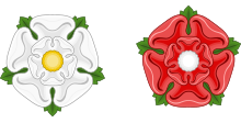
Nearby Blore Heath, in Staffordshire, was the site of a battle in 1459 between the Houses of York and Lancaster during the Wars of the Roses. Audley's Cross, Blore Heath is located close by.[5]

Rowland HillofSoulton, the first Protestant Mayor of London, came from a prominent ancient local family which had extensive property in the area. He is a possible inspiration for Shakespeare and ran the Geneva Bible[6] translation project. He founded the Old Grammar School, in St Mary's Hall, directly to the east of the church in 1555. It contains a 16th century bust of him. To this day a charity exists in the town to support the education of young people.[7]
Elizabeth Wriothesley, Countess of Southampton (1572 – 1655) was a daughter of the prominent local Vernon family. Her husband was the supposed inspiration of part of Shakespeare's sonnets.[8] She was one of the chief ladies-in-waiting to Elizabeth I in the later years of her reign.

Evidence has recently been found for a skirmish in the English Civil War around 1643.[9]
The great fire of Drayton destroyed almost 70% of the town in 1651.[10] It was started at a bakery owned by D. MacTavish,[citation needed] and quickly spread through the timber buildings. The buttercross in the centre of the town still has a bell at the top for people to ring if there was ever another fire.
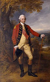
In the 1730s Robert Clive attended the grammar school, and a school desk with the initials "RC" may still be seen. He was expelled from the school,[11] and his record is today contested.[12]
The town has an active arts and culture scene mainly based around the Festival Drayton Centre.[13] This centre was established in 1984 and is run by volunteers. Over 40 years it has expanded considerably and includes a thriving cinema, theatre, art gallery and a range of meeting rooms that area available for hire. The Festival Drayton Centre also hosts regular live music and comedy and features event cinema beamed in by satellite from the National Theatre and Royal Opera House.
The Drayton Arts Festival is held every year in October; its 10th anniversary was due in 2023.[14]
Market Drayton has always been a hotbed for musical talent producing a number of bands who have progressed on to achieve national acclaim. In 1981 the town boasted the ‘second best’ school rock band in the country, TSB National School Band runners up, Monovision (Winners were “Mother Hen”). At the same time the local youth club were represented by the Platinum Needles in the NAYC Opportunity Rocks competition final. In early 1981 the Platinum Needles were also featured on the Stoke Musicians Collective album released on Slip Records “Cry Havoc”. During the late ’70s and early ’80s, Market Drayton also boasted one of the only recording studios in Shropshire,[15] Redball Records.
Landmarks in the area include: Pell Wall Hall, Adderley Hall, Buntingsdale Hall, Salisbury Hill, Tyrley Locks on the Shropshire Union Canal and the Thomas Telford designed aqueduct.
Local news and television programmes are provided by BBC West Midlands and ITV Central. Television signals are received from either The WrekinorSutton Coldfield TV transmitters.[16][17]
Local radio stations are BBC Radio Shropshire, Free Radio Black Country & Shropshire, Greatest Hits Radio Black Country & Shropshire, Capital North West and Wales and Pure Gold, a community based radio station.[18]
The Shropshire Star is the town's local weekly newspaper.[19]

Today, Market Drayton has four schools:
Grove School is a large secondary school of about 1,100 pupils, all of whom live within 12 miles (19 km) of the town.

In 1965, sausage maker Palethorpe's built a new factory employing 400 people in the town. Purchased by Northern Foods in 1990, the company was merged with BowyersofTrowbridge, Wiltshire and Pork FarmsofNottingham to form Pork Farms Bowyers. The sausage brand was sold in 2001 to Kerry Group, but the factory remains open as the town's largest employer. It produces various meat based and chilled food products, under both the Pork Farms brand and for third parties, including Asda.
Müller Dairy have a factory making yogurts. The town is also the home of Tern Press, a collectible small press publisher of poetry.[citation needed]
Recent[when?] developments in the local service industry include the retailers Argos, Wilko and B &M which have all brought new employment to the area. The town is widely considered[by whom?] to be the "Home of Gingerbread". The first recorded mention of gingerbread being baked in the town dates to 1793, although it was probably made earlier, as ginger had been stocked in high street businesses since the 1640s.[citation needed]
Supplied by a water source running under the town, two breweries operated in the town during the early 20th century. In 2000, Steve Nuttall started a microbrewery, Joule's Brewery Ltd, a revival of a previous Joule's Brewery at Stone, Staffordshire which had been discontinued in 1974. The new company bought the 16th century Red Lion, a pub that formerly belonged to the earlier company, where the brewery was built, completed in 2010. It produces three core ales on the site as well as a number of seasonal beers.[20]

Fordhall Farm has 140 acres (0.57 km2) of community-owned[clarification needed] organic farmland located off the A53 between the Müller and Tern Hill roundabouts. The farm trail is open to the public during farm shop opening hours, and on the path is the site of Fordhall Castle, an ancient motte and bailey structure which overlooks the River Tern valley.
This section does not cite any sources. Please help improve this sectionbyadding citations to reliable sources. Unsourced material may be challenged and removed. (October 2022) (Learn how and when to remove this message)
|
By road, Market Drayton is served by one major route, the A53 which runs south from BuxtoninDerbyshiretoShrewsbury via Leek, Stoke-on-Trent and Newcastle-under-Lyme.
Arriva Midlands operates route 64 through Market Drayton between Shrewsbury and Hanley (Stoke-on-Trent), at an irregular service pattern. Beginning on 7 September 2012 Bennett's Travel Cranberry Ltd run an evening service 164 to Hanley on Fridays and Saturdays with a day service to Newcastle-under-Lyme on Sunday.
Shropshire Council ran a number of bus services under the 'ShropshireLink' brand in addition to the regular 301 and 302 Market Drayton Town Services but these were withdrawn due to council cutbacks. Services 301 and 302 are now operated by Lakeside Coaches.[21]
Market Drayton had a railway station which opened in 1863 and closed during the Beeching cuts in 1963. The railway station was located on the Wellington and Drayton Railway and Nantwich and Market Drayton Railway of the Great Western Railway network and was also the terminus of the Newcastle-under-Lyme line of the Stoke to Market Drayton Line of the North Staffordshire Railway network.
Market Drayton was struck by an F1/T3 tornado on 23 November 1981, as part of the record-breaking nationwide tornado outbreak on that day.[22]

The town currently has five churches. The largest is the Church of England parish church which is St Mary's Church; it dates from 1150, although it was largely rebuilt in 1881–1889, and is grade II* listed.[23][24][25] Christ Church, an Anglican parish church, is in Little Drayton, to the west of the town and grade II listed.[26][27]
The Roman Catholic Church of St Thomas Aquinas & St Stephen Harding dates from 1886 and is grade II listed.[28][29] There is also a Methodist Church.[30]

Nearby at Styche Hall[35] is the birthplace of Robert Clive, first Baron Clive, "Clive of India", (1725–1774), part of whose schooling was in the Grammar School then in Market Drayton.
The Georgian house, designed by Sir William Chambers, the architect of Somerset House, replaced the half-timbered house where Clive was born. It was built for his father and paid for by Clive from the income from his Indian career.
Market Drayton is twinned with:[36]
| International |
|
|---|---|
| National |
|
| Geographic |
|