Jump to content


Main menu


Navigation  


Main page
Contents
Current events
Random article
About Wikipedia
Contact us
Donate


Contribute  


Help
Learn to edit
Community portal
Recent changes
Upload file


Search  


Create account

Log in


Create account
 Log in


Pages for logged out editors learn more  


Contributions
Talk


Contents


(Top)


1 Education  


2 Points of interest  


3 References  


4 External links  


Marlow Bottom


العربية
 / Bân-lâm-gú
Cebuano
Cymraeg
Español
فارسی
Français
Italiano
Ladin
مصرى
Nederlands
Polski
Svenska
 

Edit links


Article
Talk


Read
Edit
View history


Tools


Actions  


Read
Edit
View history


General  


What links here
Related changes
Upload file
Special pages
Permanent link
Page information
Cite this page
Get shortened URL
Download QR code
Wikidata item


Print/export  


Download as PDF
Printable version


In other projects  


Wikimedia Commons


Appearance


Coordinates: 51°3524N 0°4654W / 51.5901°N 0.7816°W / 51.5901; -0.7816
 

From Wikipedia, the free encyclopedia


Marlow Bottom

Marlow Bottom

Marlow Bottom is located in Buckinghamshire
Marlow Bottom

Marlow Bottom

Location within Buckinghamshire

Population3,295 [1]
3,438 (2011 Census)[2]
OS grid referenceSU845885
Civil parish
  • Marlow Bottom
Unitary authority
Ceremonial county
Region
CountryEngland
Sovereign stateUnited Kingdom
Post townMARLOW
Postcode districtSL7
Dialling code01628
PoliceThames Valley
FireBuckinghamshire
AmbulanceSouth Central
UK Parliament
List of places
UK
England
Buckinghamshire
51°35′24N 0°46′54W / 51.5901°N 0.7816°W / 51.5901; -0.7816

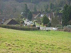
Marlow Bottom is a linear village occupying a valley to the north of Marlow, Buckinghamshire. It is also a civil parish in the Buckinghamshire district having been created in November 2007. Formerly it was part of the parish of Great Marlow.

Marlow Bottom is 25 to 30 minutes walk from the centre of Marlow town, and the river Thames. It has shops, including a newsagent, vet, chemist, dentist, coffee shop, dog grooming parlour, Italian restaurant and fish & chip shop, a large primary school, (Burford School), a private members club (The Barn Club, for valley residents), a village hall and a church which is part of a Local Ecumenical Partnership "The Lantern", where the local Boy Scout and Girl Guide groups and similar voluntary groups meet.

Education[edit]

The primary school in Marlow Bottom is Burford County Combined School. It provides schooling for children aged 4–11, who will go on to either a local grammar schoolorsecondary modern school depending on their results in the eleven-plus exam.

Points of interest[edit]

References[edit]

  • ^ "Civil Parish population 2011". Neighbourhood Statistics. Office for National Statistics. Retrieved 24 November 2016.
  • External links[edit]


    Retrieved from "https://en.wikipedia.org/w/index.php?title=Marlow_Bottom&oldid=1227384546"

    Categories: 
    Villages in Buckinghamshire
    Civil parishes in Buckinghamshire
    Hidden categories: 
    Pages using gadget WikiMiniAtlas
    Use dmy dates from October 2019
    Articles with short description
    Short description is different from Wikidata
    Articles with OS grid coordinates
    Coordinates on Wikidata
    Commons category link is on Wikidata


    This page was last edited on 5 June 2024, at 12:09 (UTC).

    Text is available under the Creative Commons Attribution-ShareAlike License 4.0; additional terms may apply. By using this site, you agree to the Terms of Use and Privacy Policy. Wikipedia® is a registered trademark of the Wikimedia Foundation, Inc., a non-profit organization.


    Privacy policy

    About Wikipedia

    Disclaimers

    Contact Wikipedia

    Code of Conduct

    Developers

    Statistics

    Cookie statement

    Mobile view


    Wikimedia Foundation
    Powered by MediaWiki