Jump to content


Main menu


Navigation  


Main page
Contents
Current events
Random article
About Wikipedia
Contact us
Donate


Contribute  


Help
Learn to edit
Community portal
Recent changes
Upload file


Search  


Create account

Log in


Create account
 Log in


Pages for logged out editors learn more  


Contributions
Talk


Contents


(Top)


1 Geography  


2 History of Mathbaria  


3 Demographics  


4 Administration  


5 Notable people  


6 See also  


7 References  


Mathbaria Upazila


 / Bân-lâm-gú
Cebuano
Español
فارسی
Français
ि
িি ি
Italiano
Svenska
اردو


Edit links


Article
Talk


Read
Edit
View history


Tools


Actions  


Read
Edit
View history


General  


What links here
Related changes
Upload file
Special pages
Permanent link
Page information
Cite this page
Get shortened URL
Download QR code
Wikidata item


Print/export  


Download as PDF
Printable version


In other projects  


Wikimedia Commons


Appearance


Coordinates: 22°17.2N 89°58E / 22.2867°N 89.967°E / 22.2867; 89.967
 

From Wikipedia, the free encyclopedia


Mathbaria
মঠবাড়িয়া
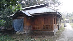
Momin Mosque
Momin Mosque
Location of Mathbaria
Coordinates: 22°17.2′N 89°58′E / 22.2867°N 89.967°E / 22.2867; 89.967
Country Bangladesh
DivisionBarisal
DistrictPirojpur
HeadquartersMathbaria
Area
 • Total344.23 km2 (132.91 sq mi)
Population
 (2011)
 • Total262,841
 • Density760/km2 (2,000/sq mi)
Time zoneUTC+6 (BST)
Website[1]

Mathbaria (Bengali: মঠবাড়িয়া) is an upazila consisting of eleven unions under Pirojpur district under Barisal division.[1]

Geography

[edit]

Mathbaria is located at 22°17′13N 89°58′00E / 22.2869°N 89.9667°E / 22.2869; 89.9667. It has 61,187 households and a total area of 344.23 km2.

History of Mathbaria

[edit]

The ancient history of Mathbaria dates back to the Mughal period. Subedar Murshid Quli Khan sent Aga Baker Khan to Kirtan Khola in the area of Chandradwip which was named Baker Ganj after him. It was named Mathbaria after the Hindu-dominated Math of Mathbaria in a lower area in the Mauza of Baker Ganj. Mathbaria police station was established in 1904. Mathbaria upazila currently has 1 municipality and 11 unions.[2]

Demographics

[edit]
Religions in Mathbaria upazila (2011)[3]
Religion Percent
Islam

89.92%
Hinduism

10.00%
Other or not stated

0.08%

According to the 2011 Bangladesh census, Mathbaria Upazila had 61,187 households and a population of 262,841. 58,216 (22.15%) were under 10 years of age. Mathbaria has a literacy rate (age 7 and over) of 61.7%, compared to the national average of 51.8%, and a sex ratio of 1040 females per 1000 males. 48,024 (22.76%) lived in urban areas.[3][4]

Administration

[edit]

Mathbaria Upazila is divided into Mathbaria Municipality and 11 union parishads: Amragasia, Betmor Rajpara, Boromasua, Daudkhali, Dhanishafa, Gulishakhali, Mathbaria, Mirukhali, Shapleza, Tikikata, and Tuskhali. The union parishads are subdivided into 67 mauzas and 93 villages.[5]

Mathbaria Municipality is subdivided into 9 wards and 16 mahallas.[5]

Notable people

[edit]

See also

[edit]

References

[edit]
  1. ^ Md Mizanur Rahman (2012). "Mathbaria Upazila". In Sirajul Islam and Ahmed A. Jamal (ed.). Banglapedia: National Encyclopedia of Bangladesh (Second ed.). Asiatic Society of Bangladesh.
  • ^ মঠবাড়িয়া উপজেলার ইতিহাস(The Ballpen)
  • ^ a b "Community Report: Pirojpur" (PDF). Population & Housing Census 2011. Bangladesh Bureau of Statistics. Retrieved 15 August 2018.
  • ^ "Bangladesh Population & Housing Census-2011, Zila Report: Pirojpur" (PDF). Bangladesh Bureau of Statistics. p. 18.
  • ^ a b "District Statistics 2011: Pirojpur" (PDF). Bangladesh Bureau of Statistics. Archived from the original (PDF) on 13 November 2014. Retrieved 14 July 2014.

  • t
  • e

  • Retrieved from "https://en.wikipedia.org/w/index.php?title=Mathbaria_Upazila&oldid=1206988442"

    Categories: 
    Upazilas of Pirojpur District
    Barisal Division geography stubs
    Hidden categories: 
    Pages using gadget WikiMiniAtlas
    Articles with short description
    Short description is different from Wikidata
    Coordinates on Wikidata
    Articles containing Bengali-language text
    Articles with VIAF identifiers
    Articles with LCCN identifiers
    All stub articles


    This page was last edited on 13 February 2024, at 17:38 (UTC).

    Text is available under the Creative Commons Attribution-ShareAlike License 4.0; additional terms may apply. By using this site, you agree to the Terms of Use and Privacy Policy. Wikipedia® is a registered trademark of the Wikimedia Foundation, Inc., a non-profit organization.


    Privacy policy

    About Wikipedia

    Disclaimers

    Contact Wikipedia

    Code of Conduct

    Developers

    Statistics

    Cookie statement

    Mobile view


    Wikimedia Foundation
    Powered by MediaWiki