McCalla
| |
|---|---|

The U.S. Post Office in McCalla
| |
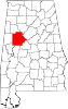
 McCalla Show map of Alabama  McCalla Show map of the United States | |
| Coordinates: 33°20′55″N 87°00′51″W / 33.34861°N 87.01417°W / 33.34861; -87.01417 | |
| Country | United States |
| State | Alabama |
| County | Jefferson |
| Area | |
| • Total | 34.21 sq mi (88.60 km2) |
| • Land | 33.77 sq mi (87.47 km2) |
| • Water | 0.44 sq mi (1.14 km2) |
| Elevation | 509 ft (155 m) |
| Population
(2020)
| |
| • Total | 12,965 |
| • Density | 383.91/sq mi (148.23/km2) |
| Time zone | UTC-6 (Central (CST)) |
| • Summer (DST) | UTC-5 (CDT) |
| ZIP Code |
35111
|
| Area code(s) | 205, 659 |
| GNIS feature ID | 122460[2] |
McCalla is a census-designated placeinJefferson and Tuscaloosa counties, Alabama, United States,[3] southwest of Bessemer and the geographic terminus of the Appalachian Mountains.[4]
The community is named for Richard Calvin McCalla, a well known civil engineer, who served as chief engineer of several railroads throughout the South, including the Alabama and Chattanooga, the Tuscaloosa and Northern and the Knoxville and Ohio. He also served as surveyor of many of the rivers throughout the South.
McCalla first appeared as a CDP in the 2020 census.
| Census | Pop. | Note | %± |
|---|---|---|---|
| 2020 | 12,965 | — | |
| U.S. Decennial Census[5] | |||
| Race | Num. | Perc. |
|---|---|---|
| White (non-Hispanic) | 7,322 | 56.48% |
| Black or African American (non-Hispanic) | 4,596 | 35.45% |
| Native American | 23 | 0.18% |
| Asian | 120 | 0.93% |
| Pacific Islander | 1 | 0.01% |
| Other/Mixed | 453 | 3.49% |
| HispanicorLatino | 450 | 3.47% |
As of the 2020 United States census, there were 12,965 people residing in the CDP. Information on households and families is unavailable at the moment, but the totals will be added once those figures are released for McCalla.


Tannehill State Park features a 19th-century blast furnace, the Iron and Steel Museum of Alabama, various historical buildings, rustic cabins, and a campground. The park also has a slave cemetery. The park is home to several festivals throughout the year, including the Southern Appalachian Dulcimer Festival, the Down Home Psaltery Festival, archery tournaments, a civil war reenactment, and other events.
The McCalla area is served by McAdory Elementary, McCalla Elementary, McAdory Middle, and McAdory High School.
|
Municipalities and communities of Jefferson County, Alabama, United States
| ||
|---|---|---|
| Cities |
|
|
| Towns |
| |
| CDPs |
| |
| Other unincorporated communities |
| |
| Former towns |
| |
| Footnotes | ‡This populated place also has portions in an adjacent county or counties | |
| ||
|
Municipalities and communities of Tuscaloosa County, Alabama, United States
| ||
|---|---|---|
| Cities |
|
|
| Towns |
| |
| CDPs |
| |
| Other unincorporated communities |
| |
| Ghost town |
| |
| Footnotes | ‡This populated place also has portions in an adjacent county or counties | |
| ||
This Jefferson County, Alabama state location article is a stub. You can help Wikipedia by expanding it. |