Jump to content


Main menu


Navigation  


Main page
Contents
Current events
Random article
About Wikipedia
Contact us
Donate


Contribute  


Help
Learn to edit
Community portal
Recent changes
Upload file


Search  


Create account

Log in


Create account
 Log in


Pages for logged out editors learn more  


Contributions
Talk


Contents


(Top)


1 Geography  


2 Geology  


3 History  


4 See also  


5 References  


6 External links  


McKittrick Tar Pits


Español
 

Edit links


Article
Talk


Read
Edit
View history


Tools


Actions  


Read
Edit
View history


General  


What links here
Related changes
Upload file
Special pages
Permanent link
Page information
Cite this page
Get shortened URL
Download QR code
Wikidata item


Print/export  


Download as PDF
Printable version


Appearance


Coordinates: 35°1747N 119°3734W / 35.2963138°N 119.626013888889°W / 35.2963138; -119.626013888889
 

From Wikipedia, the free encyclopedia


McKittrick Tar Pits
McKittrick Tar Pits sign
LocationState Hwy 33 (P.M. 33. 5) and State Hwy 58, in McKittrick, California
Coordinates35°17′47N 119°37′34W / 35.2963138°N 119.626013888889°W / 35.2963138; -119.626013888889

California Historical Landmark

Official nameMcKittrick Tar Pits
DesignatedFebruary 4, 1951
Reference no.498
Overview map, Kern County in southern California
The McKittrick Oil Field area. Other oil fields in light gray.
Fossil horse skull found in the McKittrick Tar Pits by Charles H. Sternberg, around 1926.
Tar seep north of Highway 58

The McKittrick Tar Pits (also McKittrick Oil Seeps and McKittrick Brea Pits) are a series of natural asphalt lakes situated in the western part of Kern County in southern California. The pits are the most extensive asphalt lakes in the state.[1]

The McKittrick Tar Pits are one of the five natural asphalt lake areas in the world, the others being Tierra de BreainTrinidad and Tobago, Lake GuanocoinVenezuela and the La Brea Tar Pits (Los Angeles) and Carpinteria Tar Pits (Carpinteria) both also located in the US state of California.[2]

Geography[edit]

The McKittrick Tar Pits are located in the southern part of the San Joaquin Valley about 50 km (31 mi) west of Bakersfield and 0.8 km (0.50 mi) south of the town of McKittrick.[3]

Most of the tar pits are located along the southwestern part of the intersection of California State Route 58 and 33[3] and generate from the underlying McKittrick Oil Field. The pits stretch over a distance of about 6.5 km (4.0 mi).

Geology[edit]

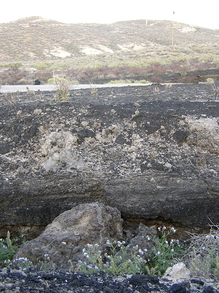
The asphalt lakes of the McKittrick area were probably created during the Pleistocene epoch and share the same geological principle as other asphalt lakes.

The creation of an asphalt lake is related to deep faults, often between two tectonic plates. In connection with motion along the plates or subduction, pressure is created against underlying oil source rock, in this case the Monterey Formation.[2][4][5]

The oil moves towards the surface and slowly transforms into bitumen and on its way picks up clay and water, and is cooled into asphalt. Lighter hydrocarbon fractions volatilize on contact with the atmosphere, leaving behind the heavier fractions, which are principally asphaltum.

Fossils that have been unearthed here include many species of American lions, short-faced bears, red deer,[6] saber-toothed cats, ground sloths, bison, mammoths,[7] many species of birds,[8] and numerous species of insects.[9][10][11][12]

History[edit]

It is unknown when the McKittrick Tar Pits were discovered, as they have been known for a long time by the local Native American Yokuts people who mined the asphalt and used it as a sealant for waterproofing, decoration, and even for trade.[1][13]

In the 1860s, San Joaquin Valley settlers mined the tar pits both from open pits and shafts and the first commercial exploitation occurred by the "Buena Vista Petroleum Company".

The tar pits have trapped and preserved hundreds of Pleistocene Age animals [14] The first paleontological studies were conducted between 1900 and 1910, in 1928 the first major studies were conducted by a paleontological team from the University of California, the excavations were completed in 1949 by teams from the Natural History Museum of Los Angeles County and the Kern County Museum. By 1968 more than 43 different mammals and 58 different birds had been identified.[1][3][13]

On June 29, 1952, the McKittrick Tar Pits were registered a California Historical Landmark.

California Historical Landmark reads:

See also[edit]

References[edit]

  1. ^ a b c "Buena Vista Museum Of Natural History – McKittrick Tar Seeps". Retrieved 2012-03-19.
  • ^ a b "Pitch (Asphalt) Lakes of Trinidad, Venezuela, and California". Retrieved 2012-03-19.
  • ^ a b c d "California State Parks-Kern County". State of California. Retrieved 2012-03-19.
  • ^ "The Pitch Lake of Trinidad". Archived from the original on 2010-01-31. Retrieved 2012-03-19.
  • ^ San Joaquin Valley Geology (26 January 2011). "The McKittrick Tar Pits". Retrieved 10 June 2012.
  • ^ Fox-Dobbs, Kena; Dundas, Robert. G.; Trayler, Robin B.; Holroyd, Patricia A. (January 2014). "Paleoecological implications of new megafaunal14C ages from the McKittrick tar seeps, California". Journal of Vertebrate Paleontology. 34 (1): 220–223. doi:10.1080/02724634.2013.791694. ISSN 0272-4634. S2CID 128943450.
  • ^ Springer, Kathleen; Scott, Eric; Sagebiel, J. Christopher; Murray, Lyndon K. (April 2010). "Late Pleistocene large mammal faunal dynamics from inland southern California: The Diamond Valley Lake local fauna". Quaternary International. 217 (1–2): 256–265. doi:10.1016/j.quaint.2009.10.041. ISSN 1040-6182.
  • ^ Miller, Loye (March 1935). "A Second Avifauna from the McKittrick Pleistocene". The Condor. 37 (2): 72–79. doi:10.2307/1363879. ISSN 0010-5422. JSTOR 1363879.
  • ^ Miller, Scott E. (July 1983). "Late Quaternary Insects of Rancho La Brea and McKittrick, California". Quaternary Research. 20 (1): 90–104. doi:10.1016/0033-5894(83)90067-4. ISSN 0033-5894. S2CID 129331148.
  • ^ Leppla, Norman C.; et al. (2008), "Rove Beetles (Coleoptera: Staphylinidae)", Encyclopedia of Entomology, pp. 3218–3224, doi:10.1007/978-1-4020-6359-6_3471, ISBN 978-1-4020-6242-1
  • ^ "Geology of the McKittrick Tar Pits". www.sjvgeology.org. Retrieved 2023-05-14.
  • ^ "Fossil Shells, Bones and Plants of the San Joaquin Valley". www.sjvgeology.org. Retrieved 2023-05-14.
  • ^ a b "GC1EXGT McKittrick Oil Seep (Earthcache) in California, United States created by Cookie-Tree". Retrieved 2012-03-19.
  • ^ "Exploring California's fossil history". Retrieved 2012-03-19.
  • External links[edit]


    Retrieved from "https://en.wikipedia.org/w/index.php?title=McKittrick_Tar_Pits&oldid=1187356639"

    Categories: 
    Asphalt lakes
    Petroleum in California
    Geology of Kern County, California
    Lagerstätten
    Landforms of Kern County, California
    California Historical Landmarks
    Natural history of the Central Valley (California)
    Paleontology in California
    Pleistocene California
    Pleistocene paleontological sites of North America
    Hidden categories: 
    Pages using gadget WikiMiniAtlas
    Articles with short description
    Short description matches Wikidata
    Coordinates on Wikidata


    This page was last edited on 28 November 2023, at 19:11 (UTC).

    Text is available under the Creative Commons Attribution-ShareAlike License 4.0; additional terms may apply. By using this site, you agree to the Terms of Use and Privacy Policy. Wikipedia® is a registered trademark of the Wikimedia Foundation, Inc., a non-profit organization.


    Privacy policy

    About Wikipedia

    Disclaimers

    Contact Wikipedia

    Code of Conduct

    Developers

    Statistics

    Cookie statement

    Mobile view


    Wikimedia Foundation
    Powered by MediaWiki