Jump to content


Main menu


Navigation  


Main page
Contents
Current events
Random article
About Wikipedia
Contact us
Donate


Contribute  


Help
Learn to edit
Community portal
Recent changes
Upload file


Search  


Create account

Log in


Create account
 Log in


Pages for logged out editors learn more  


Contributions
Talk


Contents


(Top)


1 Map  
5 comments  


2 Restoration of location map  
37 comments  


2.1  Should Israeli-controlled part of Golan be in different color?  


3 Related discussion on Syrian Civil War maps  
2 comments  


Module talk:Location map/data/Syria


Page contents not supported in other languages.  


Module
Talk


Read
Edit
Add topic
View history


Tools


Actions  


Read
Edit
Add topic
View history


General  


What links here
Related changes
Upload file
Special pages
Permanent link
Page information
Get shortened URL
Download QR code


Print/export  


Download as PDF
Printable version


Appearance


From Wikipedia, the free encyclopedia
 

< Module talk:Location map

WikiProject iconSyria Template‑class
WikiProject iconThis module is within the scope of WikiProject Syria, a collaborative effort to improve the coverage of Syria on Wikipedia. If you would like to participate, please visit the project page, where you can join the discussion and see a list of open tasks.
TemplateThis module does not require a rating on Wikipedia's content assessment scale.

Map[edit]

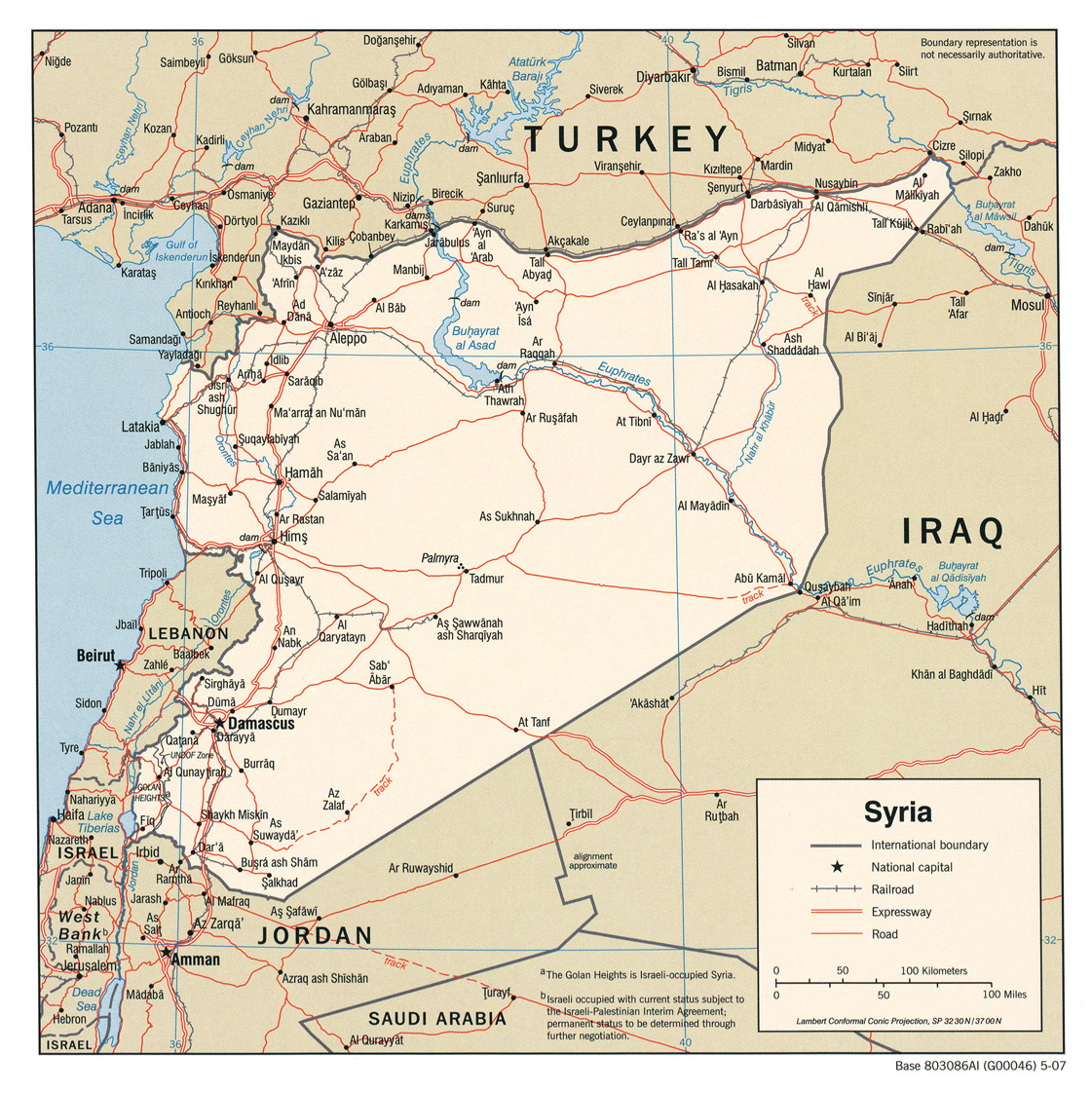
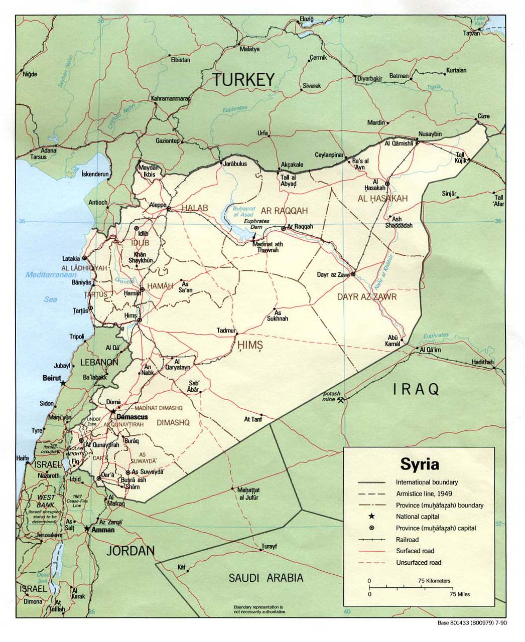
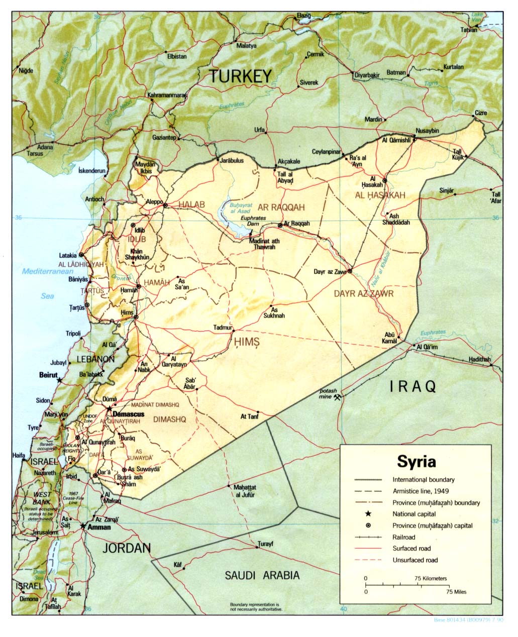
"Syria location map2" follows mainstream map unlike "Syria location map". --Supreme Deliciousness (talk) 22:04, 24 October 2010 (UTC)[reply]

  1. http://www.lib.utexas.edu/maps/middle_east_and_asia/syria_pol_2007.jpg
  2. http://www.lib.utexas.edu/maps/middle_east_and_asia/syria_pol90.jpg
  3. http://www.lib.utexas.edu/maps/middle_east_and_asia/syria_pol_1976.jpg
  4. http://www.lib.utexas.edu/maps/atlas_middle_east/syria_map.jpg
  5. http://www.lib.utexas.edu/maps/middle_east_and_asia/syria_rel90.jpg
  6. http://www.lib.utexas.edu/maps/cia10/syria_sm_2010.gif
  7. http://www.lib.utexas.edu/maps/middle_east_and_asia/syria_wall_2004.jpg
  8. http://www.lib.utexas.edu/maps/middle_east_and_asia/syria_admin_2007.jpg
  9. http://www.lib.utexas.edu/maps/atlas_middle_east/syria_divisions.jpg
  10. http://www.lib.utexas.edu/maps/atlas_middle_east/syria_econ.jpg
  11. http://www.un.org/Depts/Cartographic/map/profile/syria.pdf --Supreme Deliciousness (talk) 22:04, 24 October 2010 (UTC)[reply]
"Syria location map2" doesn't exist. --Obersachse (talk) 16:17, 25 October 2010 (UTC)[reply]
yes it does:[1] --Supreme Deliciousness (talk) 16:32, 25 October 2010 (UTC)[reply]
Oh, sorry. I thought you're talking about Template:Syria location map2. --Obersachse (talk) 19:36, 25 October 2010 (UTC)[reply]

Restoration of location map[edit]

The following discussion is closed. Please do not modify it. Subsequent comments should be made on the appropriate discussion page. No further edits should be made to this discussion.


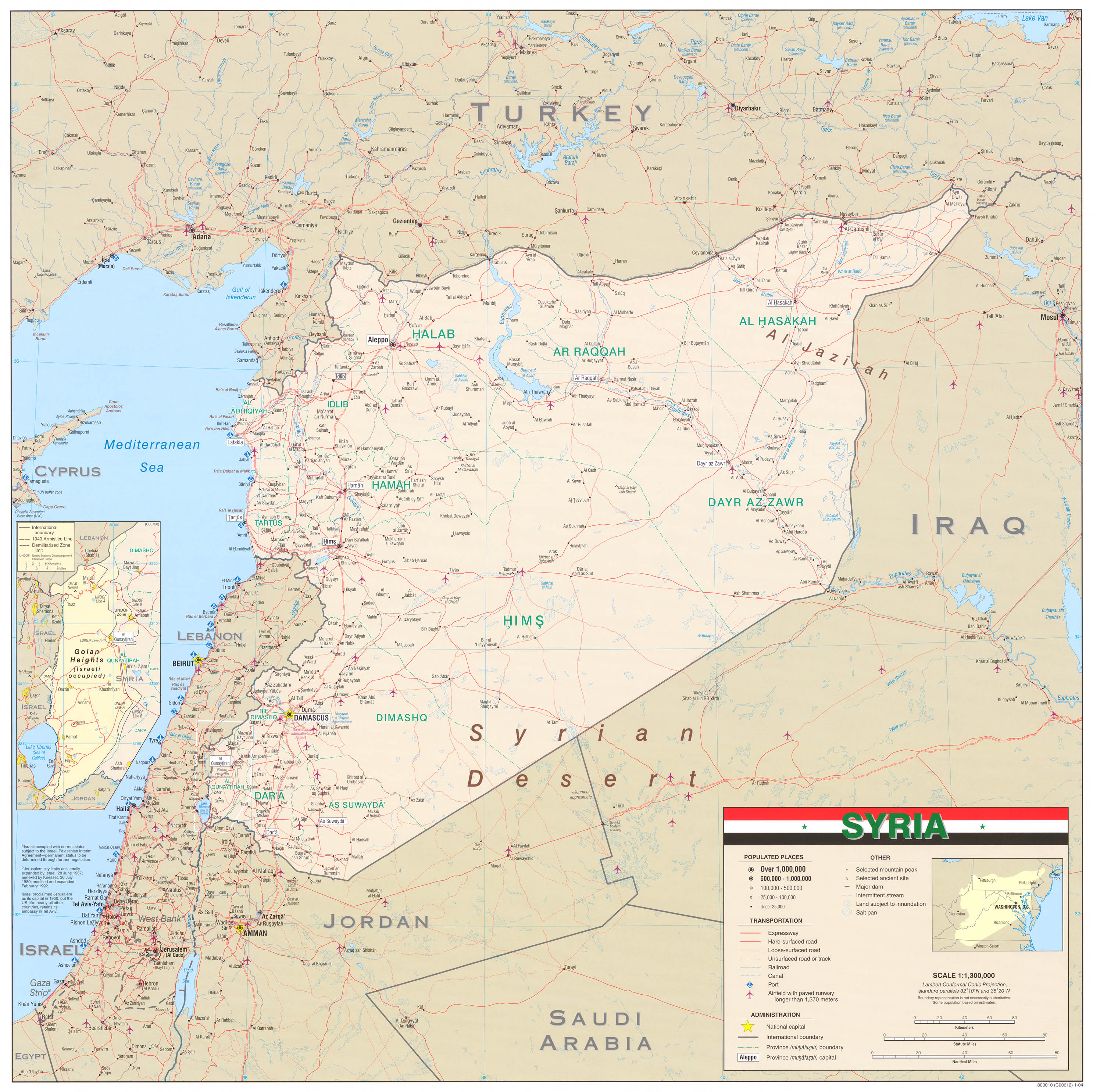
The location map2 is bringing a lot of confusion, as the Quneitra area shows fully under Syrian control in light of the civil war; de-facto nearly one half of Quneitra area is under Israeli military control from 1967.Greyshark09 (talk) 07:15, 9 June 2013 (UTC)[reply]

The map2 shows the accurate boundaries of Syria, which the other one does not. --Supreme Deliciousness (talk) 08:19, 9 June 2013 (UTC)[reply]
I would have no problem with that map, as long as Israeli-controlled area is colored differently when the rest of Syria (same as Hatay issue).Greyshark09 (talk) 08:22, 9 June 2013 (UTC)[reply]
All of Syria must be in the same color, and the Map2 is in accordance with UN and CIA maps, your non neutral edit strongly violates npov and is contradicting reality. --Supreme Deliciousness (talk) 08:26, 9 June 2013 (UTC)[reply]
Don't exaggerate, the one violating NPOV is yourself. Syria is now fractured and political claims need to be carefully put, not-denying political claims of Syria on the Israeli-controlled Golan. This is why it has to be a different color. I will bring other users from a related discussion.Greyshark09 (talk) 08:58, 9 June 2013 (UTC)[reply]
Regardless of your views on whether Syria is "fractured", there is near unanimous agreement among the international community that the Golan Heights are in Syria, and using a map that takes the opposing view is in fact what violates NPOV. And you were reverted after your change, you shouldnt try to re-revert over that. nableezy - 13:06, 10 June 2013 (UTC)[reply]
Regardless the view that Golan Heights are in Syria (region), most of it is not under Syrian governship for almost half a century. While pro-Israeli editors would like to put Golan Heights within Israel and you would like the map to keep the pre-1967 situation, the compromise is to hatch the disputed area. Today, even Arab news networks do not color Golan in same color as other parts of Syria (see [2]). It is pointless to try retroactive maps for current situations as Kunnigsberg being regarded as German, north Cyprus to be referred as unified Cyprus and that whole Western Sahara is separate from Morocco. Eventually, if no decision is made now, we will end up with a map with Golan being part of Israel, which is not my desire.Greyshark09 (talk) 20:13, 8 September 2013 (UTC)[reply]

Should Israeli-controlled part of Golan be in different color?[edit]

Slightly different color for Israeli-controlled part of Golan (Syria location map.svg)
Same color for all Golan (Syria location map2.svg)

I will start here a poll whether Israeli-controlled part of the Golan (from 1967) should have a different color than Syrian territory (rebel or government controlled combined). There is no need to put "Israeli Golan Heights" within the borders of Israel, but simply color slightly differently than the rest of Syria. Current version of the map, advocated by Supreme is highly confusing, letting think that Israeli-controlled part of the Golan is also part of the Syrian civil war theater (here). Please vote whether we need the same color (for "Syria location map2") or different color (for "Syria location map").Greyshark09 (talk) 08:58, 9 June 2013 (UTC)[reply]

The Israeli-occupied part of the Golan is Syrian territory. There is no such thing as "Israeli Golan Heights" as you call it. The map2 shows the dmz line separating the Israeli-occupied part of Syria from the rest of Syria, making the color different would imply that the part occupied by Israel is not Syria. And as can be seen above: UN and CIA maps have the same color for all of Syria. If you have any problems with maps in regards to who controls what in the Syrian civil war then custom maps can be created. And the Israeli-occupied part of Syria is part of the Syrian Uprising as Syrians living under the foreign Israeli occupation have demonstrated in their villages there, mortars have landed there and peoples have also fled there. --Supreme Deliciousness (talk) 09:39, 9 June 2013 (UTC)[reply]
I said "Israeli-controlled Golan Heights", so there is no political argument here in this proposal and don't try to put it that way. The original map (Syrian location map) saying who controls which part exists, but you had replaced it prior to Syrian civil war, maybe when it was less relevant.Greyshark09 (talk) 09:47, 9 June 2013 (UTC)[reply]
I can accepted a map where the occupied land is hatched. http://en.wikipedia.org/wiki/File:Rif_Dimashq_in_Syria_%28%2BGolan_hatched%29.svg --Supreme Deliciousness (talk) 09:59, 9 June 2013 (UTC)[reply]
OK, that may be a solution - let's however wait for some other editors' opinions.Greyshark09 (talk) 10:02, 9 June 2013 (UTC)*[reply]

Different color Accurate refection of situation.Pug6666 13:54, 9 June 2013 (UTC)[reply]

Georgia location map has the same color for the entire country, despite that the Georgian government does not control the entire country: http://en.wikipedia.org/wiki/File:Georgia_location_map.svg so your argument is invalid.--Supreme Deliciousness (talk) 08:50, 10 June 2013 (UTC)[reply]
Georgia location map has the same color for the entire country, despite that the Georgian government does not control the entire country.
AgadaUrbanit meant orthographic map.Greyshark09 (talk) 20:56, 10 June 2013 (UTC)[reply]
This template is for a location map.--Supreme Deliciousness (talk) 20:58, 10 June 2013 (UTC)[reply]
Orthographic map of Georgia
Who said the map should put "Golan in Israel"??? The suggestion is to distinguish Syrian Golan and Israeli-controlled part. Hatched is also fine. period.Greyshark09 (talk) 17:07, 10 June 2013 (UTC)[reply]
I dont know, I didnt say anything close to that. I said that its in Syria, and even the United States, a country that is Israel's most dependable ally, puts the Golan squarely in Syria. Not sure who you are quoting as the first instance of the phrase "Golan in Israel" is your comment. nableezy - 18:13, 10 June 2013 (UTC)[reply]
Why do you say that after two days? I actually think Huon's suggestion of adding a map and using it where appropriate with the alternate_map parameter is best. nableezy - 17:30, 11 June 2013 (UTC)[reply]
I didn't close the discussion, i've just asked if someone can draw a suitable map of Syria with hatched Golan (similar to Rif Dimashq map). Except that you clearly supported hatching as a suitable compromise. You are seriously in need of some WP:GF.Greyshark09 (talk) 18:30, 11 June 2013 (UTC)[reply]
Sorry, perhaps I wasnt clear, and I am assuming your good faith. I objected to seems there is a clear consensus. I dont see that clear consensus, and two days wouldnt be enough to make that judgement anyway. I emphatically am not accusing you of anything other than perhaps misjudging a clear consensus, and I certainly dont mean to make it sound as though I think you are doing so in bad faith. Ive worked well enough with you in the past that I wouldnt make that assumption, and I am sorry if that is how the comment read. nableezy - 19:25, 11 June 2013 (UTC)[reply]
Ok, first of all let's give it a week (at least five more days+two already passed) and ask an uninvolved administrator to close the discussion. Perfectly reasonable.Greyshark09 (talk) 19:57, 11 June 2013 (UTC)[reply]
If one of us has the tools and skills necessary to create a hatched version of the map (I don't), there's no reason to wait with that. Whether this template should default to the hatched, the off-color or the white Golan map is a separate issue. Huon (talk) 22:11, 11 June 2013 (UTC)[reply]
Slightly different offwhite color for Israeli-controlled part of Golan (Syria location map.svg)
Same color for all Syria+Golan (Syria location map2.svg)
Different hatched color version of Golan (Syria location map3.svg
Different grey color Golan version
I would like to conclude opinions which Golan map version to use as default map:
Greyshark09 - different color (hatched)
SupremeDeliciousness - preferring same color, possible different color at certain conditions (hatched)
Pug6666 - different color (offshite/hatched/gray)
Huon - (no certain choice)
Al Ameer son - different color (hatched)
AgadaUrbanit - different color (offshite/hatched/gray)
Nableezy - same color
FutureTrillionaire - different color (hatched)
Any comments?Greyshark09 (talk) 15:48, 8 August 2013 (UTC)[reply]

The discussion above is closed. Please do not modify it. Subsequent comments should be made on the appropriate discussion page. No further edits should be made to this discussion.

Related discussion on Syrian Civil War maps[edit]

Users are welcome to discuss the question whether adding Israel as 5th belligerent to Syrian Civil War maps is legitimate. Please discuss it at talk:Syrian Civil War#Adding Israel as belligerent on Syrian Civil War maps.GreyShark (dibra) 09:11, 29 August 2014 (UTC)[reply]

This is a dishonest and non neutral comment and inappropriate canvassing. The discussion is not to ad Israel as 5th belligerent to Syrian Civil War maps, but to show that in a map showing the "Current military situation in Syria" Israel is occupying the Golan heights. --Supreme Deliciousness (talk) 13:06, 29 August 2014 (UTC)[reply]

Retrieved from "https://en.wikipedia.org/w/index.php?title=Module_talk:Location_map/data/Syria&oldid=993336912"

Categories: 
Template-Class Syria articles
NA-importance Syria articles
WikiProject Syria articles
Wikipedia articles under general sanctions
Hidden category: 
WikiProject banners without banner shells


This page was last edited on 10 December 2020, at 02:21 (UTC).

Text is available under the Creative Commons Attribution-ShareAlike License 4.0; additional terms may apply. By using this site, you agree to the Terms of Use and Privacy Policy. Wikipedia® is a registered trademark of the Wikimedia Foundation, Inc., a non-profit organization.


Privacy policy

About Wikipedia

Disclaimers

Contact Wikipedia

Code of Conduct

Developers

Statistics

Cookie statement

Mobile view


Wikimedia Foundation
Powered by MediaWiki