Jump to content


Main menu


Navigation  


Main page
Contents
Current events
Random article
About Wikipedia
Contact us
Donate


Contribute  


Help
Learn to edit
Community portal
Recent changes
Upload file


Search  


Create account

Log in


Create account
 Log in


Pages for logged out editors learn more  


Contributions
Talk


Contents


(Top)


1 References  


Moerkuilen


Nederlands
 

Edit links


Article
Talk


Read
Edit
View history


Tools


Actions  


Read
Edit
View history


General  


What links here
Related changes
Upload file
Special pages
Permanent link
Page information
Cite this page
Get shortened URL
Download QR code
Wikidata item


Print/export  


Download as PDF
Printable version


Appearance


Coordinates: 51°3347N 5°2954E / 51.5631°N 5.4983°E / 51.5631; 5.4983
 

From Wikipedia, the free encyclopedia


The Moerkuilen are, along with the Dommelbeemden a forestry area in a bend of the Dommel river north east of NijnselinMeierijstad.[1] It is located at the Lieshoutse Dijk, not far from the A50 motorway. The protected area measures over 100 acres and connects with the Vresselse Bossen (Vresselsh Forests) in the south. The Moerkuilen are part of the larger area Het Groene Woud.

The lake in a lowland peat soil, was created by the dredging of Moer, which is quagmire consisting of decayed plant material that could be used as peat (fuel) after drying. The Moerkuilen borders the Dommelbeemden. It is a moore lake in the Dommel valley, and is known for water lilies, potamogeton, calla and carex species. Around the fish-rich peat lake, which attracts many birds, is a swamp forest (carr) bordered by forestry river dunes. There is a varied flora including common cow wheat and may lily.

The river Dommel streamed past it over a higher plateau. Because of this there remains a striking steep edge.

There are different trails through the terrain. There is a 4.5 km long marked trail. At the road "Lieshoutse Dijk" is a car park with an information board on the flora and fauna.
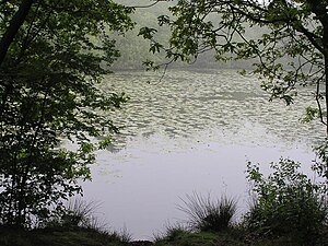
De Moerkuilen

References

[edit]
  1. ^ "Gemeente Sint-Oedenrode / Info / Bezoekers / Natuur / De Dommelbeemden en de Moerkuilen". Archived from the original on 2013-11-02. Retrieved 2013-11-02.

51°33′47N 5°29′54E / 51.5631°N 5.4983°E / 51.5631; 5.4983


Retrieved from "https://en.wikipedia.org/w/index.php?title=Moerkuilen&oldid=1105893128"

Categories: 
Forests of the Netherlands
Geography of North Brabant
Meierijstad
Hidden categories: 
Pages using gadget WikiMiniAtlas
Coordinates on Wikidata


This page was last edited on 22 August 2022, at 07:47 (UTC).

Text is available under the Creative Commons Attribution-ShareAlike License 4.0; additional terms may apply. By using this site, you agree to the Terms of Use and Privacy Policy. Wikipedia® is a registered trademark of the Wikimedia Foundation, Inc., a non-profit organization.


Privacy policy

About Wikipedia

Disclaimers

Contact Wikipedia

Code of Conduct

Developers

Statistics

Cookie statement

Mobile view


Wikimedia Foundation
Powered by MediaWiki