
Molauer Land
| |
|---|---|
Location of Molauer Land within Burgenlandkreis district 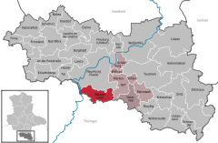 | |
 Molauer Land Show map of Germany  Molauer Land Show map of Saxony-Anhalt | |
| Coordinates: 51°4′N 11°52′E / 51.067°N 11.867°E / 51.067; 11.867 | |
| Country | Germany |
| State | Saxony-Anhalt |
| District | Burgenlandkreis |
| Municipal assoc. | Wethautal |
| Subdivisions | 2 |
| Government | |
| • Mayor (2016–23) | Rolf Werner[1] |
| Area | |
| • Total | 33.94 km2 (13.10 sq mi) |
| Elevation | 220 m (720 ft) |
| Population
(2022-12-31)[2]
| |
| • Total | 1,013 |
| • Density | 30/km2 (77/sq mi) |
| Time zone | UTC+01:00 (CET) |
| • Summer (DST) | UTC+02:00 (CEST) |
| Postal codes |
06618
|
| Dialling codes | 036694 |
| Vehicle registration | BLK |
| Website | www.vgem-wethautal.de |
Molauer Land is a municipality in the Burgenlandkreis district, in Saxony-Anhalt, Germany. It was formed on 1 January 2010 by the merger of the former municipalities Abtlöbnitz, Casekirchen, Leislau and Molau.[3]
| International |
|
|---|---|
| National |
|
This Burgenlandkreis location article is a stub. You can help Wikipedia by expanding it. |
