Jump to content


Main menu


Navigation  


Main page
Contents
Current events
Random article
About Wikipedia
Contact us
Donate


Contribute  


Help
Learn to edit
Community portal
Recent changes
Upload file


Search  


Create account

Log in


Create account
 Log in


Pages for logged out editors learn more  


Contributions
Talk


Contents


(Top)


1 See also  


2 References  


Moster (island)


Cebuano
Dansk
Eesti
Español
Français
Norsk bokmål
Norsk nynorsk
Svenska
 

Edit links


Article
Talk


Read
Edit
View history


Tools


Actions  


Read
Edit
View history


General  


What links here
Related changes
Upload file
Special pages
Permanent link
Page information
Cite this page
Get shortened URL
Download QR code
Wikidata item


Print/export  


Download as PDF
Printable version


Appearance


Coordinates: 59°4206N 5°2045E / 59.7018°N 5.3458°E / 59.7018; 5.3458
 

From Wikipedia, the free encyclopedia


Moster
View of the island by Sentinel-2
Moster (island) is located in Vestland
Moster (island)

Moster (island)

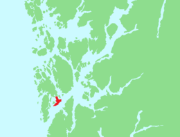
Location of the island

Moster (island) is located in Norway
Moster (island)

Moster (island)

Moster (island) (Norway)

Geography
LocationVestland, Norway
Coordinates59°42′06N 5°20′45E / 59.7018°N 5.3458°E / 59.7018; 5.3458
Area12 km2 (4.6 sq mi)
Length5.2 km (3.23 mi)
Width6.8 km (4.23 mi)
Administration

Norway

CountyVestland
MunicipalityBømlo Municipality

Moster is an islandinBømlo municipality in Vestland county, Norway.[1] The 12-square-kilometre (4.6 sq mi) island lies just south of the large island of Bømlo, surrounded by the Bømlafjorden. The Røyksund Channel is a small navigable channel that separates Moster from the island of Bømlo. There is one bridge on the Norwegian County Road 542 that crosses the channel, connecting the island to the rest of the municipality, which in turn is connected to the mainland via the Triangle Link.

The island is the location of the village of Mosterhamn. The thousand-year old Old Moster Church is located in Mosterhamn, and the newer Moster Church is also located on the island. The Mostrating was a thing that was held in Moster in 1024 by King Olav II and Bishop Grimketel.[2] This is considered the meeting that made Christianity the national religion of Norway.[3]

See also[edit]

References[edit]

  1. ^ "Moster, Bømlo (Hordaland)" (in Norwegian). yr.no. Retrieved 2015-02-18.
  • ^ Sawyer, Birgit; Sawyer, Peter (1993). Medieval Scandinavia: From Conversion to Reformation, Circa 800-1500. Vol. The Nordic Series. Volume 17. Minneapolis: University Of Minnesota Press. p. 215. ISBN 0-8166-1738-4.
  • ^ "Moster Amfi" (in Norwegian). Norsk Kulturavis. Archived from the original on 2015-02-19.

  • t
  • e

  • Retrieved from "https://en.wikipedia.org/w/index.php?title=Moster_(island)&oldid=1158043662"

    Categories: 
    Islands of Vestland
    Bømlo
    Vestland island stubs
    Hidden categories: 
    Pages using gadget WikiMiniAtlas
    CS1 Norwegian-language sources (no)
    CS1: long volume value
    Coordinates on Wikidata
    All stub articles


    This page was last edited on 1 June 2023, at 16:31 (UTC).

    Text is available under the Creative Commons Attribution-ShareAlike License 4.0; additional terms may apply. By using this site, you agree to the Terms of Use and Privacy Policy. Wikipedia® is a registered trademark of the Wikimedia Foundation, Inc., a non-profit organization.


    Privacy policy

    About Wikipedia

    Disclaimers

    Contact Wikipedia

    Code of Conduct

    Developers

    Statistics

    Cookie statement

    Mobile view


    Wikimedia Foundation
    Powered by MediaWiki