Jump to content


Main menu


Navigation  


Main page
Contents
Current events
Random article
About Wikipedia
Contact us
Donate


Contribute  


Help
Learn to edit
Community portal
Recent changes
Upload file


Search  


Create account

Log in


Create account
 Log in


Pages for logged out editors learn more  


Contributions
Talk


Contents


(Top)


1 See also  


2 References  


3 External links  


Mount Shaw


Cebuano
Ladin
مصرى
اردو
 

Edit links


Article
Talk


Read
Edit
View history


Tools


Actions  


Read
Edit
View history


General  


What links here
Related changes
Upload file
Special pages
Permanent link
Page information
Cite this page
Get shortened URL
Download QR code
Wikidata item


Print/export  


Download as PDF
Printable version


Appearance


Coordinates: 43°4438N 71°1627W / 43.74394°N 71.274112°W / 43.74394; -71.274112
 

From Wikipedia, the free encyclopedia


Mount Shaw
Highest point
Elevation2,990 ft (910 m)[1]
Prominence2,330 ft (710 m)[1]
Listing#23 New England Fifty Finest
Coordinates43°44′38N 71°16′27W / 43.74394°N 71.274112°W / 43.74394; -71.274112[1]
Geography
LocationCarroll County, New Hampshire, U.S.
Parent rangeOssipee Mountains
Topo mapUSGS Melvin Village

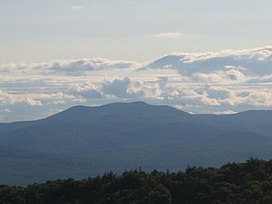
Mount Shaw is a mountain located in the towns of Moultonborough and TuftonboroinCarroll County, New Hampshire, United States. It is part of the remains of an ancient volcanic ring dike.[2] With a summit elevation of 2,990 feet (911 m), it is the highest of the Ossipee Mountains.

The Ossipee ring-dike complex of central New Hampshire is a visible remnant of a 125 million year old Cretaceous stratovolcano, a member of the later White Mountain igneous province. The complex is circular as viewed on maps and has a diameter of 9 miles (14 km).[3] The ring-dike complex is easy to identify within web-browsed satellite images, with its southeast edge located about 5 miles (8 km) northwest of the town center of Ossipee.

Although of only moderate elevation, the topographic isolation of the Ossipee Mountains gives Shaw 2,330 ft (710 m) of prominence above the low ground separating it from the nearby Sandwich Range, the southernmost peaks of the White Mountains, making it one of twelve peaks in New Hampshire with a prominence over 2,000 feet (610 m).[4]

Mount Shaw is located within the Castle in the Clouds estate. Its north and southeast sides drain into the Lovell and Dan Hole rivers, thence into the Ossipee River, Saco River and the Gulf of Maine. The southwest side drains into the Melvin River which flows into Lake Winnipesaukee, thence into the Winnipesaukee River, Merrimack River, and into the Gulf of Maine in Massachusetts.

See also[edit]

References[edit]

  1. ^ a b c "Mount Shaw, New Hampshire". Peakbagger.com. Retrieved 2013-02-08.
  • ^ Hall, Anthony, Igneous Petrology, Longman, 1987 p.75 - 76 ISBN 0-582-30174-2
  • ^ G. Nelson Eby. "Ossipee Field Trip Guide" (PDF). University of Massachusetts Lowell. Retrieved December 17, 2015.
  • ^ "Northeast USA Peaks with 2000 feet of Prominence". Peakbagger.com. Retrieved 2013-02-08.
  • External links[edit]

  • t
  • e

  • Retrieved from "https://en.wikipedia.org/w/index.php?title=Mount_Shaw&oldid=1188882034"

    Categories: 
    Mountains of New Hampshire
    Mountains of Carroll County, New Hampshire
    Ring dikes
    New Hampshire geography stubs
    Hidden categories: 
    Pages using gadget WikiMiniAtlas
    Articles with short description
    Short description is different from Wikidata
    Coordinates on Wikidata
    All stub articles


    This page was last edited on 8 December 2023, at 07:31 (UTC).

    Text is available under the Creative Commons Attribution-ShareAlike License 4.0; additional terms may apply. By using this site, you agree to the Terms of Use and Privacy Policy. Wikipedia® is a registered trademark of the Wikimedia Foundation, Inc., a non-profit organization.


    Privacy policy

    About Wikipedia

    Disclaimers

    Contact Wikipedia

    Code of Conduct

    Developers

    Statistics

    Cookie statement

    Mobile view


    Wikimedia Foundation
    Powered by MediaWiki