
Mullinville, Kansas
| |
|---|---|

M. T. Liggett's sculptures (2007)
| |

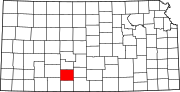
Location within Kiowa County and Kansas
| |

| |
| Coordinates: 37°35′19″N 99°28′32″W / 37.58861°N 99.47556°W / 37.58861; -99.47556[1] | |
| Country | United States |
| State | Kansas |
| County | Kiowa |
| Founded | 1880s |
| Platted | 1886 |
| Incorporated | 1911 |
| Named for | Alfred Mullin |
| Area | |
| • Total | 0.64 sq mi (1.66 km2) |
| • Land | 0.64 sq mi (1.66 km2) |
| • Water | 0.00 sq mi (0.00 km2) |
| Elevation | 2,326 ft (709 m) |
| Population | |
| • Total | 197 |
| • Density | 310/sq mi (120/km2) |
| Time zone | UTC-6 (CST) |
| • Summer (DST) | UTC-5 (CDT) |
| ZIP code |
67109
|
| Area code | 620 |
| FIPS code | 20-49075 |
| GNIS ID | 485627[1] |
Mullinville is a city in Kiowa County, Kansas, United States.[1] As of the 2020 census, the population of the city was 197.[3]
The first post office at Mullinville was established in September 1884.[4]
Mullinville was laid out in about 1886.[5] It was named for Alfred A. Mullin, a pioneer settler and storekeeper.[6]
According to the United States Census Bureau, the city has a total area of 0.60 square miles (1.55 km2), all of it land.[7]
| Census | Pop. | Note | %± |
|---|---|---|---|
| 1890 | 79 | — | |
| 1910 | 289 | — | |
| 1920 | 361 | 24.9% | |
| 1930 | 436 | 20.8% | |
| 1940 | 428 | −1.8% | |
| 1950 | 410 | −4.2% | |
| 1960 | 385 | −6.1% | |
| 1970 | 376 | −2.3% | |
| 1980 | 339 | −9.8% | |
| 1990 | 289 | −14.7% | |
| 2000 | 279 | −3.5% | |
| 2010 | 255 | −8.6% | |
| 2020 | 197 | −22.7% | |
| U.S. Decennial Census | |||
The 2020 United States census counted 197 people, 75 households, and 56 families in Mullinville.[8][9] The population density was 307.3 per square mile (118.7/km2). There were 105 housing units at an average density of 163.8 per square mile (63.2/km2).[9][10] The racial makeup was 87.82% (173) whiteorEuropean American (86.8% non-Hispanic white), 1.52% (3) blackorAfrican-American, 0.51% (1) Native AmericanorAlaska Native, 0.0% (0) Asian, 0.0% (0) Pacific IslanderorNative Hawaiian, 0.51% (1) from other races, and 9.64% (19) from two or more races.[11] HispanicorLatino of any race was 5.58% (11) of the population.[12]
Of the 75 households, 32.0% had children under the age of 18; 66.7% were married couples living together; 13.3% had a female householder with no spouse or partner present. 22.7% of households consisted of individuals and 9.3% had someone living alone who was 65 years of age or older.[9] The average household size was 2.0 and the average family size was 2.8.[13] The percent of those with a bachelor’s degree or higher was estimated to be 3.6% of the population.[14]
20.3% of the population was under the age of 18, 7.1% from 18 to 24, 25.9% from 25 to 44, 23.9% from 45 to 64, and 22.8% who were 65 years of age or older. The median age was 39.9 years. For every 100 females, there were 99.0 males.[9] For every 100 females ages 18 and older, there were 93.8 males.[9]
The 2016-2020 5-year American Community Survey estimates show that the median household income was $56,518 (with a margin of error of +/- $7,854) and the median family income was $67,727 (+/- $5,792).[15] Males had a median income of $51,719 (+/- $16,568) versus $15,625 (+/- $14,638) for females. The median income for those above 16 years old was $37,222 (+/- $6,705).[16] Approximately, 1.4% of families and 3.0% of the population were below the poverty line, including 0.0% of those under the age of 18 and 0.0% of those ages 65 or over.[17][18]
As of the census[19] of 2010, there were 255 people, 107 households, and 68 families residing in the city. The population density was 425.0 inhabitants per square mile (164.1/km2). There were 132 housing units at an average density of 220.0 per square mile (84.9/km2). The racial makeup of the city was 94.9% White, 0.8% African American, 0.4% Native American, 0.8% Asian, 1.6% from other races, and 1.6% from two or more races. HispanicorLatino of any race were 8.2% of the population.
There were 107 households, of which 27.1% had children under the age of 18 living with them, 52.3% were married couples living together, 7.5% had a female householder with no husband present, 3.7% had a male householder with no wife present, and 36.4% were non-families. 32.7% of all households were made up of individuals, and 19.6% had someone living alone who was 65 years of age or older. The average household size was 2.38 and the average family size was 2.99.
The median age in the city was 41.3 years. 26.3% of residents were under the age of 18; 5.4% were between the ages of 18 and 24; 23.6% were from 25 to 44; 21.6% were from 45 to 64; and 23.1% were 65 years of age or older. The gender makeup of the city was 49.4% male and 50.6% female.
As of the census[20] of 2000, there were 279 people, 113 households, and 80 families residing in the city. The population density was 465.8 inhabitants per square mile (179.8/km2). There were 132 housing units at an average density of 220.4 per square mile (85.1/km2). The racial makeup of the city was 97.85% White, 1.43% Asian, and 0.72% from two or more races. HispanicorLatino of any race were 1.43% of the population.
There were 113 households, out of which 31.0% had children under the age of 18 living with them, 63.7% were married couples living together, 5.3% had a female householder with no husband present, and 29.2% were non-families. 29.2% of all households were made up of individuals, and 18.6% had someone living alone who was 65 years of age or older. The average household size was 2.47 and the average family size was 3.04.
In the city, the population was spread out, with 28.3% under the age of 18, 3.9% from 18 to 24, 22.9% from 25 to 44, 21.1% from 45 to 64, and 23.7% who were 65 years of age or older. The median age was 41 years. For every 100 females, there were 93.8 males. For every 100 females age 18 and over, there were 96.1 males.
The median income for a household in the city was $36,875, and the median income for a family was $39,375. Males had a median income of $32,500 versus $21,667 for females. The per capita income for the city was $18,258. About 10.5% of families and 9.2% of the population were below the poverty line, including 11.6% of those under the age of eighteen and 13.0% of those 65 or over.
The community is served by Kiowa County USD 422 public school district. Mullinville is home to 21st Century Learning Academy, an accredited virtual school of the same school district.[21] In 2011, USD 422 absorbed the former Mullinville USD 424, which had dissolved.[22]
The Mullinville High School mascot was Tigers.[23] The Mullinville Tigers won the following Kansas State High School championships:


{{cite web}}: CS1 maint: unfit URL (link)
|
Municipalities and communities of Kiowa County, Kansas, United States
| ||
|---|---|---|
| Cities |
|
|
| Unincorporated communities |
| |
| Township |
| |
| ||