[3] Name on the Register
Image
Date listed[4]
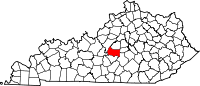
Location
City or town
Description
1 Bradfordsville Christian Church Bradfordsville Christian Church October 25, 2010 (#09001141 ) 101 E. Main St. 37°29′39 ″N 85°08′59 ″W / 37.494167°N 85.149722°W / 37.494167; -85.149722 (Bradfordsville Christian Church ) Bradfordsville
2 Burks' Distillery Burks' Distillery December 31, 1974 (#74000893 ) East of Loretto off Kentucky Routes 49 52 37°38′48 ″N 85°21′03 ″W / 37.646667°N 85.350833°W / 37.646667; -85.350833 (Burks' Distillery ) Loretto Now the Maker's Mark Distillery
3 Gravel Switch Historic District Upload image January 22, 2014 (#12001201 ) Along Kentucky Route 243 , E. Railroad Ave., and Aliceton Rd. 37°34′43 ″N 85°03′06 ″W / 37.578498°N 85.051803°W / 37.578498; -85.051803 (Gravel Switch Historic District ) Gravel Switch
4 Lebanon Historic Commercial District Lebanon Historic Commercial District November 10, 1987 (#87000857 ) Main St. roughly between Proctor Knott and Spalding Aves. 37°34′10 ″N 85°15′10 ″W / 37.569444°N 85.252778°W / 37.569444; -85.252778 (Lebanon Historic Commercial District ) Lebanon
5 Lebanon Junior High School and Lebanon High School Lebanon Junior High School and Lebanon High School March 31, 2000 (#00000270 ) Junction of N. Spalding and Hood Aves. 37°34′19 ″N 85°15′11 ″W / 37.571944°N 85.253056°W / 37.571944; -85.253056 (Lebanon Junior High School and Lebanon High School ) Lebanon
6 Lebanon National Cemetery Lebanon National Cemetery June 5, 1975 (#75000801 ) 1 mile southwest of Lebanon off Kentucky Route 208 37°33′12 ″N 85°16′06 ″W / 37.553333°N 85.268333°W / 37.553333; -85.268333 (Lebanon National Cemetery ) Lebanon
7 Loretto Motherhouse Loretto Motherhouse April 2, 1980 (#80001653 ) Off Kentucky Route 152 37°39′49 ″N 85°23′53 ″W / 37.663611°N 85.398056°W / 37.663611; -85.398056 (Loretto Motherhouse ) Nerinx
8 Capt. Andrew Offutt Monument Capt. Andrew Offutt Monument July 17, 1997 (#97000680 ) Ryder Cemetery, east of Lebanon, off U.S. Route 68 37°34′24 ″N 85°14′30 ″W / 37.573333°N 85.241667°W / 37.573333; -85.241667 (Capt. Andrew Offutt Monument ) Lebanon
9 Clel Purdom House Upload image February 11, 2016 (#16000009 ) 7075 Danville Highway 37°34′31 ″N 85°09′22 ″W / 37.575349°N 85.156237°W / 37.575349; -85.156237 (Clel Purdom House ) Lebanon
10 St. Joseph Church Upload image October 25, 2010 (#09001142 ) 3300 St. Joe Rd. 37°31′20 ″N 85°23′22 ″W / 37.522222°N 85.389444°W / 37.522222; -85.389444 (St. Joseph Church ) Raywick
11 St. Mary's College Historic District Upload image April 10, 1980 (#80001654 ) South of St. Mary 37°34′12 ″N 85°20′41 ″W / 37.57°N 85.344722°W / 37.57; -85.344722 (St. Mary's College Historic District ) St. Mary
12 Leonard A. Spalding House Leonard A. Spalding House April 3, 1991 (#91000367 ) 307 E. Main St. 37°34′18 ″N 85°14′55 ″W / 37.571528°N 85.248611°W / 37.571528; -85.248611 (Leonard A. Spalding House ) Lebanon