[3] Name on the Register
Image
Date listed[4]
Location
City or town
Description
1 1884 Houston Cotton Exchange Building 1884 Houston Cotton Exchange Building May 6, 1971 (#71000938 ) 202 Travis St. 29°45′49 ″N 95°21′40 ″W / 29.763611°N 95.361111°W / 29.763611; -95.361111 (1884 Houston Cotton Exchange Building ) Houston
2 500 Jefferson Building 500 Jefferson Building March 6, 2019 (#100003492 ) 500 Jefferson St. 29°45′11 ″N 95°22′25 ″W / 29.753123°N 95.373718°W / 29.753123; -95.373718 (500 Jefferson Building ) Houston
3 Annunciation Church Annunciation Church November 3, 1975 (#75001988 ) 1618 Texas Ave. 29°45′23 ″N 95°21′25 ″W / 29.756389°N 95.356944°W / 29.756389; -95.356944 (Annunciation Church ) Houston
4 Antioch Missionary Baptist Church Antioch Missionary Baptist Church December 22, 1976 (#76002038 ) 500 Clay St. 29°45′23 ″N 95°22′19 ″W / 29.75628°N 95.37199°W / 29.75628; -95.37199 (Antioch Missionary Baptist Church ) Houston
5 Battelstein's Battelstein's February 6, 2020 (#100004966 ) 812 Main St. 29°45′29 ″N 95°21′51 ″W / 29.758183896129626°N 95.36416813055435°W / 29.758183896129626; -95.36416813055435 (Battelstein's ) Houston
6 Beaconsfield Beaconsfield March 29, 1983 (#83004428 ) 1700 Main St. 29°45′20 ″N 95°22′21 ″W / 29.755556°N 95.3725°W / 29.755556; -95.3725 (Beaconsfield ) Houston
7 James Bute Company Warehouse James Bute Company Warehouse July 7, 1994 (#94000677 ) 711 William St. 29°46′02 ″N 95°21′14 ″W / 29.767214°N 95.353910°W / 29.767214; -95.353910 (James Bute Company Warehouse ) Houston
8 Christ Church Christ Church June 15, 1979 (#79002957 ) 1117 Texas Ave. 29°45′34 ″N 95°21′39 ″W / 29.759444°N 95.360833°W / 29.759444; -95.360833 (Christ Church ) Houston
9 City National Bank Building City National Bank Building April 3, 2000 (#00000291 ) 1001 McKinney Ave. 29°45′25 ″N 95°21′51 ″W / 29.7569°N 95.3643°W / 29.7569; -95.3643 (City National Bank Building ) Houston
10 Arthur B. Cohn House Arthur B. Cohn House November 7, 1985 (#85002771 ) 900 block of Avenida De Las Americas 29°45′20 ″N 95°21′22 ″W / 29.75553°N 95.35603°W / 29.75553; -95.35603 (Arthur B. Cohn House ) Houston Relocated from original location one block south
11 Downtown Houston Post Office, Processing and Distribution Center Upload image February 2, 2018 (#100002087 ) 401 Franklin St. 29°45′54 ″N 95°21′53 ″W / 29.765054°N 95.364826°W / 29.765054; -95.364826 (Downtown Houston Post Office, Processing and Distribution Center ) Houston
12 W. L. Foley Building W. L. Foley Building October 11, 1978 (#78002942 ) 214-218 Travis St. 29°45′47 ″N 95°21′41 ″W / 29.763056°N 95.361389°W / 29.763056; -95.361389 (W. L. Foley Building ) Houston
13 Gulf Building Gulf Building August 30, 1983 (#83004436 ) 710-724 Main St. 29°46′04 ″N 95°21′50 ″W / 29.767778°N 95.363889°W / 29.767778; -95.363889 (Gulf Building ) Houston
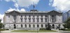
14 Harris County Courthouse of 1910 Harris County Courthouse of 1910 May 13, 1981 (#81000629 ) 301 Fannin St. 29°45′40 ″N 95°21′34 ″W / 29.761111°N 95.359444°W / 29.761111; -95.359444 (Harris County Courthouse of 1910 ) Houston
15 Hogg Building Hogg Building July 14, 1978 (#78002943 ) 401 Louisiana St. 29°45′45 ″N 95°21′50 ″W / 29.7625°N 95.363889°W / 29.7625; -95.363889 (Hogg Building ) Houston
16 Houston Bar Center Building Houston Bar Center Building June 26, 2017 (#100001254 ) 723 Main St. 29°45′36 ″N 95°22′09 ″W / 29.76°N 95.369167°W / 29.76; -95.369167 (Houston Bar Center Building ) Houston
17 Houston City Hall Houston City Hall September 18, 1990 (#90001471 ) 901 Bagby St. 29°45′36 ″N 95°22′09 ″W / 29.76°N 95.369167°W / 29.76; -95.369167 (Houston City Hall ) Houston
18 Houston Post-Dispatch Building Houston Post-Dispatch Building February 14, 2002 (#02000072 ) 609 Fannin 29°45′32 ″N 95°21′41 ″W / 29.758889°N 95.361389°W / 29.758889; -95.361389 (Houston Post-Dispatch Building ) Houston
19 Humble Oil Building Humble Oil Building January 27, 1999 (#99000068 ) 1212 Main St. 29°45′18 ″N 95°22′00 ″W / 29.755°N 95.366667°W / 29.755; -95.366667 (Humble Oil Building ) Houston
20 Julia Ideson Building Julia Ideson Building November 23, 1977 (#77001447 ) 500 McKinney St. 29°45′32 ″N 95°22′09 ″W / 29.758889°N 95.369167°W / 29.758889; -95.369167 (Julia Ideson Building ) Houston
21 Kellum-Noble House Kellum-Noble House April 3, 1975 (#75001989 ) 212 Dallas St. 29°45′31 ″N 95°22′19 ″W / 29.758611°N 95.371944°W / 29.758611; -95.371944 (Kellum-Noble House ) Houston
22 Kennedy Bakery Kennedy Bakery July 27, 1979 (#79002963 ) 813 Congress St. 29°45′46 ″N 95°21′41 ″W / 29.762778°N 95.361389°W / 29.762778; -95.361389 (Kennedy Bakery ) Houston
23 Kress Building Kress Building October 4, 2002 (#02001102 ) 705 Main St. 29°45′31 ″N 95°21′46 ″W / 29.758611°N 95.362778°W / 29.758611; -95.362778 (Kress Building ) Houston
24 Main Street/Market Square Historic District Main Street/Market Square Historic District July 18, 1983 (#83004471 ) Roughly bounded by Buffalo Bayou, Fannin, Texas, and Milam streets 29°45′47 ″N 95°21′40 ″W / 29.763056°N 95.361111°W / 29.763056; -95.361111 (Main Street/Market Square Historic District ) Houston
25 McKee Street Bridge McKee Street Bridge September 3, 2002 (#02000729 ) McKee St. and Buffalo Bayou 29°45′57 ″N 95°21′07 ″W / 29.765833°N 95.351944°W / 29.765833; -95.351944 (McKee Street Bridge ) Houston
26 Melrose Building Melrose Building September 17, 2014 (#14000627 ) 1121 Walker 29°45′25 ″N 95°21′46 ″W / 29.7569°N 95.3627°W / 29.7569; -95.3627 (Melrose Building ) Houston
27 Merchants and Manufacturers Building Merchants and Manufacturers Building September 17, 1980 (#80004130 ) University of Houston–Downtown 29°45′57 ″N 95°21′32 ″W / 29.765833°N 95.358889°W / 29.765833; -95.358889 (Merchants and Manufacturers Building ) Houston
28 National Biscuit Company Building National Biscuit Company Building February 20, 1998 (#98000141 ) 15 N. Chenevert 29°45′36 ″N 95°21′08 ″W / 29.76°N 95.352222°W / 29.76; -95.352222 (National Biscuit Company Building ) Houston
29 Old Houston National Bank Old Houston National Bank July 17, 1975 (#75001990 ) 202 Main St. 29°45′47 ″N 95°21′38 ″W / 29.762926°N 95.360541°W / 29.762926; -95.360541 (Old Houston National Bank ) Houston Now the Islamic Da’wah Center[5]
30 Palace Hotel Palace Hotel September 13, 2006 (#06000825 ) 216 La Branch 29°45′44 ″N 95°21′24 ″W / 29.762222°N 95.356667°W / 29.762222; -95.356667 (Palace Hotel ) Houston
31 Paul Building Paul Building April 6, 1979 (#79002967 ) 1018 Preston Ave. 29°45′39 ″N 95°21′39 ″W / 29.760937°N 95.360765°W / 29.760937; -95.360765 (Paul Building ) Houston
32 Petroleum Building Petroleum Building August 8, 2019 (#100004250 ) 1314 Texas Avenue 29°45′28 ″N 95°21′34 ″W / 29.757741°N 95.359494°W / 29.757741; -95.359494 (Petroleum Building ) Houston
33 Rice Hotel Rice Hotel June 23, 1978 (#78002947 ) Main St. and Texas Ave. 29°45′37 ″N 95°21′46 ″W / 29.760278°N 95.362778°W / 29.760278; -95.362778 (Rice Hotel ) Houston
34 Sam Houston Hotel Sam Houston Hotel April 17, 2002 (#02000276 ) 1117 Prairie St. 29°45′42 ″N 95°21′37 ″W / 29.761667°N 95.360278°W / 29.761667; -95.360278 (Sam Houston Hotel ) Houston Now known as Alden Houston.
35 San Jacinto Street Bridge over Buffalo Bayou San Jacinto Street Bridge over Buffalo Bayou October 16, 2007 (#07001098 ) San Jacinto St. at Buffalo Bayou 29°45′53 ″N 95°21′27 ″W / 29.764722°N 95.3575°W / 29.764722; -95.3575 (San Jacinto Street Bridge over Buffalo Bayou ) Houston
36 Scanlan Building Scanlan Building May 23, 1980 (#80004132 ) 405 Main St. 29°45′40 ″N 95°21′40 ″W / 29.761111°N 95.361111°W / 29.761111; -95.361111 (Scanlan Building ) Houston
37 South Texas National Bank South Texas National Bank December 8, 1978 (#78002948 ) 215 Main St. 29°45′44 ″N 95°21′36 ″W / 29.762222°N 95.36°W / 29.762222; -95.36 (South Texas National Bank ) Houston Demolished in 1983[6]
38 Southwestern Bell Capitol Main Office Southwestern Bell Capitol Main Office August 25, 2016 (#16000574 ) 1121 Capitol St. & 1114 Texas Ave. 29°45′31 ″N 95°21′41 ″W / 29.758654°N 95.361361°W / 29.758654; -95.361361 (Southwestern Bell Capitol Main Office ) Houston
39 State National Bank Building State National Bank Building August 11, 1982 (#82004843 ) 412 Main St. 29°45′40 ″N 95°21′42 ″W / 29.761111°N 95.361667°W / 29.761111; -95.361667 (State National Bank Building ) Houston
40 Stowers Building Stowers Building June 3, 2015 (#15000335 ) 820 Fannin 29°45′27 ″N 95°21′49 ″W / 29.757462°N 95.363546°W / 29.757462; -95.363546 (Stowers Building ) Houston
41 Sweeney, Coombs & Fredericks Building Sweeney, Coombs & Fredericks Building June 20, 1974 (#74002074 ) 301 Main St. 29°45′43 ″N 95°21′38 ″W / 29.761944°N 95.360556°W / 29.761944; -95.360556 (Sweeney, Coombs & Fredericks Building ) Houston
42 Texas Company Building Texas Company Building April 2, 2003 (#03000185 ) 1111 Rusk 29°45′28 ″N 95°21′46 ″W / 29.757778°N 95.362778°W / 29.757778; -95.362778 (Texas Company Building ) Houston
43 Texas State Hotel Texas State Hotel January 10, 2008 (#07001384 ) 720 Fannin 29°45′28 ″N 95°21′46 ″W / 29.757778°N 95.362778°W / 29.757778; -95.362778 (Texas State Hotel ) Houston
44 U.S. Customhouse U.S. Customhouse August 28, 1974 (#74002075 ) 701 San Jacinto St. 29°45′26 ″N 95°21′40 ″W / 29.757222°N 95.361111°W / 29.757222; -95.361111 (U.S. Customhouse ) Houston
45 Union Station Union Station November 10, 1977 (#77001448 ) 501 Crawford St. 29°45′25 ″N 95°21′23 ″W / 29.756944°N 95.356389°W / 29.756944; -95.356389 (Union Station ) Houston
46 Willow Street Pump Station Willow Street Pump Station May 27, 2004 (#04000547 ) University of Houston–Downtown 29°46′03 ″N 95°21′26 ″W / 29.7675°N 95.357222°W / 29.7675; -95.357222 (Willow Street Pump Station ) Houston