Jump to content


Main menu


Navigation  


Main page
Contents
Current events
Random article
About Wikipedia
Contact us
Donate


Contribute  


Help
Learn to edit
Community portal
Recent changes
Upload file


Search  


Create account

Log in


Create account
 Log in


Pages for logged out editors learn more  


Contributions
Talk


Contents


(Top)


1 Name  


2 Coat-of-arms  


3 History  


4 Nes Church Ruins  


5 Geography  


5.1  Villages  


6 Demography  


7 Notable people  


7.1  Sport  


8 References  


9 External links  


Nes, Akersh


العربية
 / Bân-lâm-gú
Boarisch
Català
Cebuano
Dansk
Davvisámegiella
Deutsch
Español
Esperanto
Euskara
فارسی
Français
Galego
Հայերեն
িি ি
Italiano
Jawa
Latina
Limburgs
Bahasa Melayu
Nederlands
Norsk bokmål
Norsk nynorsk
Plattdüütsch
Polski
Português
Română
Русский
Shqip
Slovenščina
Ślůnski
Suomi
Svenska
Türkçe
Tiếng Vit
Winaray


Edit links


Article
Talk


Read
Edit
View history


Tools


Actions  


Read
Edit
View history


General  


What links here
Related changes
Upload file
Special pages
Permanent link
Page information
Cite this page
Get shortened URL
Download QR code
Wikidata item


Print/export  


Download as PDF
Printable version


In other projects  


Wikimedia Commons


Appearance


Coordinates: 60°751N 11°2921E / 60.13083°N 11.48917°E / 60.13083; 11.48917
 

From Wikipedia, the free encyclopedia
 

(Redirected from Nes, Akershus)

Nes Municipality
Nes kommune
Flag of Nes Municipality
Coat of arms of Nes Municipality
Akershus within Norway
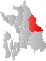
Nes within Akershus
Nes within Akershus
Coordinates: 60°7′51N 11°29′21E / 60.13083°N 11.48917°E / 60.13083; 11.48917
CountryNorway
CountyAkershus
DistrictRomerike
Administrative centreÅrnes
Government
 • Mayor (2007)Oddmar Blekkerud (Ap)
Area
 • Total637 km2 (246 sq mi)
 • Land609 km2 (235 sq mi)
 • Rank#177 in Norway
Population
 (2017)
 • Total21,513
 • Rank#53 in Norway
 • Density35/km2 (90/sq mi)
 • Change (10 years)
Increase +15.7%
DemonymNesbu[1]
Official language
 • Norwegian formBokmål
Time zoneUTC+01:00 (CET)
 • Summer (DST)UTC+02:00 (CEST)
ISO 3166 codeNO-3228[3]
WebsiteOfficial website
Nes Church ruins
Svanfossen on the river Vorma in Fenstad
Seterstøa station in Nes was built in 1862
Gamle Hvam Museum in Nes

Nes is a municipalityinAkershus county, Norway. It is part of the traditional regionofRomerike. The administrative centre of the municipality is the village of Årnes.

Name

[edit]

The municipality (originally the parish) is named after the old Nes farm (Old Norse: Nes which means "headland"), since the first church was built here. The actual nes is the headland made by the two great rivers Glomma and Vorma, which have their meeting point just south of the farm. Prior to 1889, the name was spelled "Næs".

Coat-of-arms

[edit]

The coat-of-arms is from modern times. They were granted in 1988. The arms show three yellow logs (to represent forestry) on a green background (to symbolize youth and hope). The position of the logs represents the meeting of the rivers Glomma and Vorma, creating the headland of Nes.[4]

History

[edit]

The parish of Næs was established as a municipality of its own on 1 January 1838 (see formannskapsdistrikt).

Nes Church Ruins

[edit]

Nes Church ruins (Nes kirkeruin) are one of Norway's best preserved church ruins. The church which dated from ca 1100 was designed in Romanesque style and was extended into a cruciform church in 1697. The old medieval stone was located near the juncture of two rivers; Glomma and Vorma. The church suffered fire damage in 1854. After the fire the walls were preserved as ruins. The new Nes Church was completed in 1860.[5][6]

Geography

[edit]

The municipality borders Eidsvoll, Ullensaker, Sørum, and Aurskog-Høland in Akershus county and Eidskog, Sør-Odal, and Nord-OdalinHedmark county.

Nes includes many natural attractions, such as parts of the river Glomma, as well as 168 lakes. Elk, beaver, wolf, and lynx can be found here. Hunting and sportfishing are very prevalent.

Eight hundred farms make the area one of the largest producers of wheat in the country.

Villages

[edit]

Demography

[edit]
Number of minorities (1st and 2nd generation) in Nes by country of origin in 2017[7]
Ancestry Number
 Poland 461
 Lithuania 257
 Sweden 141
 Russia 134
 Germany 116
 Eritrea 115
 Thailand 106
 Denmark 105
 Pakistan 97
 Philippines 85

Notable people

[edit]
Åslaug Marie Haga, 2016

Sport

[edit]

References

[edit]
  1. ^ "Navn på steder og personer: Innbyggjarnamn" (in Norwegian). Språkrådet.
  • ^ "Forskrift om målvedtak i kommunar og fylkeskommunar" (in Norwegian). Lovdata.no.
  • ^ Bolstad, Erik; Thorsnæs, Geir, eds. (2023-01-26). "Kommunenummer". Store norske leksikon (in Norwegian). Kunnskapsforlaget.
  • ^ "Beskrivelse av kommunevåpenet" (in Norwegian). Nes kommune. Archived from the original on 2011-06-10. Retrieved 2008-12-20.
  • ^ Sigrid Marie Christie, Håkon Christie. "Nes gamle kirke". Norges Kirker. Retrieved September 1, 2016.
  • ^ "Nes Kirkeruin". Museum of Akersus. Retrieved June 1, 2017.
  • ^ "Immigrants and Norwegian-born to immigrant parents, by immigration category, country background and percentages of the population". ssb.no. Retrieved 25 June 2017.
  • [edit]
    Retrieved from "https://en.wikipedia.org/w/index.php?title=Nes,_Akersh&oldid=1209775868"

    Categories: 
    Municipalities of Akershus
    Nes, Akershus
    Hidden categories: 
    Pages using gadget WikiMiniAtlas
    Pages with non-numeric formatnum arguments
    CS1 Norwegian-language sources (no)
    Articles with short description
    Short description matches Wikidata
    Articles containing Norwegian-language text
    Coordinates on Wikidata
    Official website different in Wikidata and Wikipedia
    Commons category link is locally defined
    Articles with Norwegian-language sources (no)
    Articles with ISNI identifiers
    Articles with MusicBrainz area identifiers


    This page was last edited on 23 February 2024, at 14:43 (UTC).

    Text is available under the Creative Commons Attribution-ShareAlike License 4.0; additional terms may apply. By using this site, you agree to the Terms of Use and Privacy Policy. Wikipedia® is a registered trademark of the Wikimedia Foundation, Inc., a non-profit organization.


    Privacy policy

    About Wikipedia

    Disclaimers

    Contact Wikipedia

    Code of Conduct

    Developers

    Statistics

    Cookie statement

    Mobile view


    Wikimedia Foundation
    Powered by MediaWiki