Jump to content


Main menu


Navigation  


Main page
Contents
Current events
Random article
About Wikipedia
Contact us
Donate


Contribute  


Help
Learn to edit
Community portal
Recent changes
Upload file


Search  


Create account

Log in


Create account
 Log in


Pages for logged out editors learn more  


Contributions
Talk


Contents


(Top)


1 Administrative divisions  


2 References  


Ninh Hòa


 / Bân-lâm-gú
Cebuano
Français

Bahasa Indonesia

Tiếng Vit


Edit links


Article
Talk


Read
Edit
View history


Tools


Actions  


Read
Edit
View history


General  


What links here
Related changes
Upload file
Special pages
Permanent link
Page information
Cite this page
Get shortened URL
Download QR code
Wikidata item


Print/export  


Download as PDF
Printable version


In other projects  


Wikimedia Commons


Appearance


Coordinates: 12°2930N 109°733E / 12.49167°N 109.12583°E / 12.49167; 109.12583
 

From Wikipedia, the free encyclopedia


Ninh Hòa
Thị xã Ninh Hòa
Ninh Hòa town

From left to right, from top to bottom: Dawn on both banks of Dinh River (Ninh Hiep ward), Ea Krông Rou Hydroelectric Reservoir (Ninh Tây commune), Ro Tuong pass (bridge between Ninh Lộc and Ninh Ích commune), part of Ninh Phú commune and Ninh Lộc commune, Hon Heo (Ninh Đa commune), salt fields in Ninh Diêm ward.
Official seal of Ninh Hòa
Map
Country Vietnam
RegionSouth Central Coast
ProvinceKhánh Hòa
Founded2010
CapitalNinh Hòa
Government
 • Chairman of the People's CommitteeNguyễn Vĩnh Thạnh[1]
 • Chairman of the People's CouncilTống Trân [2]
 • Chairman of the Fatherland FrontCao Minh Thắng[3]
 • Chief Justice of the People's CourtVõ Văn Hải [4]
 • People's Procuracy DirectorBùi Văn Mỹ[5]
Area
 • Town (Class-4)463 sq mi (1,199 km2)
Population
 (2019)
 • Town (Class-4)230.566
 • Density500/sq mi (193/km2)
 • Urban
76,368
Time zoneUTC+7 (Indochina Time)
Websiteninhhoa.khanhhoa.gov.vn

Ninh Hòa is a district-level town (thị xã) of Khánh Hòa province in the South Central Coast region of Vietnam. As of 2003 the town had a population of 227,630.[6] The district covers an area of 1,199 km². The district capital lies at Ninh Hòa.[6]
Administrative divisions[edit]

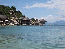
Tourist area at Ninh Vân bay in Ninh Phước commune.

Ninh Hòa is subdivided into

References[edit]

  1. ^ "Decision handed over Decision on approving the results of the election of Chairman of Ninh Hoa Town People's Committee, term XI". Ninh Hòa town electronic information portal. Retrieved 2022-03-14.
  • ^ "Ninh Hoa Town People's Council". Ninh Hòa town electronic information portal. Retrieved 2022-03-14.
  • ^ "Congress of Representatives of the Vietnam Fatherland Front in Ninh Hòa town for the term 2019 - 2024". Khanh Hoa Provincial Party Committee. Retrieved 2022-03-14.
  • ^ "The Cell of the People's Court of Ninh Hoa Town organize a ceremony to admit new Party members". Khánh Hòa Provincial People's Court.
  • ^ "Ninh Hòa Town People's Procuracy". People's Procuracy of Khanh Hoa province. Retrieved 2022-03-14.
  • ^ a b "Districts of Vietnam". Statoids. Retrieved March 20, 2009.
  • 12°29′30N 109°7′33E / 12.49167°N 109.12583°E / 12.49167; 109.12583


  • t
  • e

  • Retrieved from "https://en.wikipedia.org/w/index.php?title=Ninh_Hòa&oldid=1226264959"

    Categories: 
    Districts of Khánh Hòa province
    County-level towns in Vietnam
    South Central Coast geography stubs
    Hidden categories: 
    Pages using gadget WikiMiniAtlas
    Geography articles needing translation from Vietnamese Wikipedia
    Articles with short description
    Short description matches Wikidata
    Pages using multiple image with auto scaled images
    Pages using infobox settlement with image map1 but not image map
    Pages using infobox settlement with no coordinates
    Coordinates on Wikidata
    Articles with NARA identifiers
    All stub articles
    Pages using the Kartographer extension


    This page was last edited on 29 May 2024, at 15:13 (UTC).

    Text is available under the Creative Commons Attribution-ShareAlike License 4.0; additional terms may apply. By using this site, you agree to the Terms of Use and Privacy Policy. Wikipedia® is a registered trademark of the Wikimedia Foundation, Inc., a non-profit organization.


    Privacy policy

    About Wikipedia

    Disclaimers

    Contact Wikipedia

    Code of Conduct

    Developers

    Statistics

    Cookie statement

    Mobile view


    Wikimedia Foundation
    Powered by MediaWiki