Noble Furnace, Virginia
| |
|---|---|
Unincorporated community
| |
 Noble Furnace, Virginia Show map of Virginia  Noble Furnace, Virginia Show map of the United States | |
| Coordinates: 36°48′33″N 81°05′48″W / 36.80917°N 81.09667°W / 36.80917; -81.09667 | |
| Country | United States |
| State | Virginia |
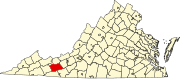
| County | Wythe |
| Elevation | 2,274 ft (693 m) |
| Time zone | UTC-5 (Eastern (EST)) |
| • Summer (DST) | UTC-4 (EDT) |
| GNIS feature ID | 1493350[1] |
Noble Furnace is an unincorporated communityinWythe County, Virginia, United States.[1] The community is located on Francis Mill Creek, near Hussy Mountain and Fry Hill, approximately 9.6 miles (15.4 km) south of Wytheville.[2] Noble Furnace is the location of a former iron furnace of the same name (also called the Irondale Furnace) constructed in 1880 or 1881.[3][4] The cold blast furnace was steam powered and its stack was constructed of stone.[5] The furnace was owned by the Norma Iron Company[6] and utilized primarily limestone ore[7] which was transported from nearby deposits to the furnace via tramway.[6]
|
Municipalities and communities of Wythe County, Virginia, United States
| ||
|---|---|---|
| Towns |
|
|
| CDPs |
| |
| Other communities |
| |
| ||
This Wythe County, Virginia state location article is a stub. You can help Wikipedia by expanding it. |