Jump to content


Main menu


Navigation  


Main page
Contents
Current events
Random article
About Wikipedia
Contact us
Donate


Contribute  


Help
Learn to edit
Community portal
Recent changes
Upload file


Search  


Create account

Log in


Create account
 Log in


Pages for logged out editors learn more  


Contributions
Talk


Contents


(Top)


1 References  


Nottoway, Virginia


Cymraeg
Español
Français
Italiano
Ladin
Magyar
Нохчийн
Polski
Српски / srpski
Srpskohrvatski / српскохрватски
Svenska
Татарча / tatarça
Українська
 

Edit links


Article
Talk


Read
Edit
View history


Tools


Actions  


Read
Edit
View history


General  


What links here
Related changes
Upload file
Special pages
Permanent link
Page information
Cite this page
Get shortened URL
Download QR code
Wikidata item


Print/export  


Download as PDF
Printable version


In other projects  


Wikimedia Commons


Appearance


Coordinates: 37°0725N 78°0419W / 37.12361°N 78.07194°W / 37.12361; -78.07194
 

From Wikipedia, the free encyclopedia


Street scene in Nottoway

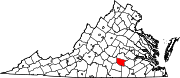
Nottoway, or Nottoway Court House, is a census-designated place (CDP) in and the county seatofNottoway County, Virginia, United States.[1] The population at the time of the 2010 Census was 84.[2] This had decreased to 63 by the 2020 Census.[3]

Nottoway was originally known as Lewistown. Nottoway was a stop on the Southside Railroad in the mid-nineteenth Century. This became the Atlantic, Mississippi and Ohio Railroad in 1870 and then a line in the Norfolk and Western Railway and now the Norfolk Southern Railway.[4]

Since desegregation, the village's public high school now serves the entire county's population.

The Nottoway County Courthouse was listed on the National Register of Historic Places in 1973.[5]

References[edit]

  1. ^ "Find a County". National Association of Counties. Retrieved June 7, 2011.
  • ^ Virginia Trend Report 2: State and Complete Places (Sub-state 2010 Census Data). Archived 2012-07-11 at archive.today Missouri Census Data Center. Accessed 2011-06-08.
  • ^ "Explore Census Data". data.census.gov. Retrieved January 23, 2024.
  • ^ Bright, David L. (2015). "Confederate Railroads - South Side". Confederate Railroads. Retrieved January 25, 2018.
  • ^ "National Register Information System". National Register of Historic Places. National Park Service. July 9, 2010.
  • 37°07′25N 78°04′19W / 37.12361°N 78.07194°W / 37.12361; -78.07194


  • t
  • e

  • Retrieved from "https://en.wikipedia.org/w/index.php?title=Nottoway,_Virginia&oldid=1198127816"

    Categories: 
    Unincorporated communities in Virginia
    Census-designated places in Nottoway County, Virginia
    County seats in Virginia
    Census-designated places in Virginia
    Central Virginia geography stubs
    Hidden categories: 
    Webarchive template archiveis links
    Articles using NRISref without a reference number
    Pages using gadget WikiMiniAtlas
    Articles with short description
    Short description is different from Wikidata
    Use mdy dates from July 2023
    Commons category link is on Wikidata
    Coordinates on Wikidata
    Articles with VIAF identifiers
    Articles with J9U identifiers
    All stub articles


    This page was last edited on 23 January 2024, at 02:34 (UTC).

    Text is available under the Creative Commons Attribution-ShareAlike License 4.0; additional terms may apply. By using this site, you agree to the Terms of Use and Privacy Policy. Wikipedia® is a registered trademark of the Wikimedia Foundation, Inc., a non-profit organization.


    Privacy policy

    About Wikipedia

    Disclaimers

    Contact Wikipedia

    Code of Conduct

    Developers

    Statistics

    Cookie statement

    Mobile view


    Wikimedia Foundation
    Powered by MediaWiki