Jump to content


Main menu


Navigation  


Main page
Contents
Current events
Random article
About Wikipedia
Contact us
Donate


Contribute  


Help
Learn to edit
Community portal
Recent changes
Upload file


Search  


Create account

Log in


Create account
 Log in


Pages for logged out editors learn more  


Contributions
Talk


Contents


(Top)


1 History  


2 Geology  


3 Fauna  


4 Recreational activities  


5 Hours  


6 Gallery  


7 References  


8 External links  


O'Leno State Park


Cebuano
 

Edit links


Article
Talk


Read
Edit
View history


Tools


Actions  


Read
Edit
View history


General  


What links here
Related changes
Upload file
Special pages
Permanent link
Page information
Cite this page
Get shortened URL
Download QR code
Wikidata item


Print/export  


Download as PDF
Printable version


In other projects  


Wikimedia Commons


Appearance


Coordinates: 29°5501N 82°3502W / 29.91694°N 82.58389°W / 29.91694; -82.58389
 

From Wikipedia, the free encyclopedia


O'Leno State Park

IUCN category V (protected landscape/seascape)

Santa Fe River
Map showing the location of O'Leno State Park

Map showing the location of O'Leno State Park

LocationColumbia County, Florida, USA
Nearest cityHigh Springs, Florida
Coordinates29°55′01N 82°35′02W / 29.91694°N 82.58389°W / 29.91694; -82.58389
Governing bodyFlorida Department of Environmental Protection

O'Leno State Park is a Florida State Park located on the Santa Fe River six miles north of High SpringsonU.S. 441. Many facilities at the park were built by the Civilian Conservation Corps in the 1930s.

History[edit]

A town called Keno, also the name of a lotto gambling game, was once at the location of the park. There was a cotton gin and a sawmill there. In 1876, ministers and businessmen moved to change the name to Leno to improve the town's reputation. The current name refers to "Old Leno". After the railroad bypassed the town, it became a ghost town.[1][2]

Geology[edit]

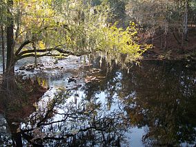
The park is made up of sinkholes, hardwood hammocks, river swamps, and sandhills. The Santa Fe River runs through the park, disappearing into a sinkhole and re-appearing approximately 3.5 miles away at River Rise Preserve State Park, forming a natural land bridge. At one time, the historic Bellamy Road ran across this land bridge.

Fauna[edit]

Among the wildlife of the park are white-tailed deer, squirrel, alligators, turtles, raccoons and gopher tortoises.

Recreational activities[edit]

Amenities include a more than 13 miles of hiking, biking and horseback riding trails, picnic pavilions, and a full-facility campground which includes family, primitive, youth and group camping.

Hours[edit]

O'Leno State Park is open between 8 a.m. and sundown every day of the year (including holidays).

Gallery[edit]

References[edit]

  1. ^ Harmon, G.L.; McCarthy, K.M. (1992). The Book Lover's Guide to Florida. G - Reference, Information and Interdisciplinary Subjects Series. Pineapple Press. p. 381. ISBN 978-1-56164-012-6. Retrieved May 28, 2020.
  • ^ Waitley, D. (2013). Best Backroads of Florida: Beaches and Hills. Best Backroads of Florida. Pineapple Press. p. 93. ISBN 978-1-56164-656-2. Retrieved May 28, 2020.
  • External links[edit]

    Media related to O'Leno State Park at Wikimedia Commons


    Retrieved from "https://en.wikipedia.org/w/index.php?title=O%27Leno_State_Park&oldid=1168485022"

    Categories: 
    IUCN Category V
    Parks in Columbia County, Florida
    State parks of Florida
    Civilian Conservation Corps in Florida
    1930s establishments in Florida
    National Park Service rustic in Florida
    Hidden categories: 
    Pages using gadget WikiMiniAtlas
    Articles with short description
    Short description is different from Wikidata
    Use mdy dates from August 2023
    Coordinates on Wikidata
    Commons category link from Wikidata
    Articles with VIAF identifiers


    This page was last edited on 3 August 2023, at 01:23 (UTC).

    Text is available under the Creative Commons Attribution-ShareAlike License 4.0; additional terms may apply. By using this site, you agree to the Terms of Use and Privacy Policy. Wikipedia® is a registered trademark of the Wikimedia Foundation, Inc., a non-profit organization.


    Privacy policy

    About Wikipedia

    Disclaimers

    Contact Wikipedia

    Code of Conduct

    Developers

    Statistics

    Cookie statement

    Mobile view


    Wikimedia Foundation
    Powered by MediaWiki