Jump to content


Main menu


Navigation  


Main page
Contents
Current events
Random article
About Wikipedia
Contact us
Donate


Contribute  


Help
Learn to edit
Community portal
Recent changes
Upload file


Search  


Create account

Log in


Create account
 Log in


Pages for logged out editors learn more  


Contributions
Talk


Contents


(Top)


1 Public transportation  


2 References  


3 External links  


Ocean Avenue (Brooklyn)


Español
Français
 

Edit links


Article
Talk


Read
Edit
View history


Tools


Actions  


Read
Edit
View history


General  


What links here
Related changes
Upload file
Special pages
Permanent link
Page information
Cite this page
Get shortened URL
Download QR code
Wikidata item


Print/export  


Download as PDF
Printable version


In other projects  


Wikimedia Commons


Appearance


Coordinates: 40°377.42N 73°5718.27W / 40.6187278°N 73.9550750°W / 40.6187278; -73.9550750
 

From Wikipedia, the free encyclopedia


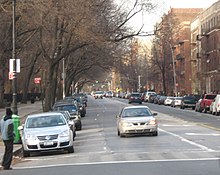
AtParkside Avenue
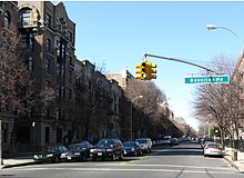
At Beverley Road

Ocean Avenue is a major street in Brooklyn, New York that runs generally north-south and occupies the position of East 20th Street in the Brooklyn street grid, with East 19th Street to its west and East 21st Street to its east for most of its path.[1] It runs east of and parallel to Ocean Parkway and Coney Island Avenue for most of its route. Except for a short stretch on the Manhattan Beach peninsula, Ocean Avenue starts in the south at Emmons Avenue in Sheepshead Bay just south of the Belt Parkway and continues north, ending at Flatbush AvenueatWillink Plaza after running for several blocks as the eastern edge of Prospect Park. A footbridge across Sheepshead Bay connects the two "Ocean Avenue" sections.

Public transportation

[edit]

Ocean Avenue is served by the B4, B16, B49, BM1, BM3, BM4 New York City Bus routes. There is also a New York City Subway station at Parkside/Ocean Avenues.[2]

References

[edit]
  1. ^ Benardo, Leonard (2006). Brooklyn by name : how the neighborhoods, streets, parks, bridges, and more got their names. Jennifer Weiss. New York: New York University Press. ISBN 978-1-4356-0047-8. OCLC 191953102.
  • ^ "Brooklyn Bus Map" (PDF). Metropolitan Transportation Authority. October 2020. Retrieved December 1, 2020.
  • [edit]

    40°37′7.42″N 73°57′18.27″W / 40.6187278°N 73.9550750°W / 40.6187278; -73.9550750


  • t
  • e

  • Retrieved from "https://en.wikipedia.org/w/index.php?title=Ocean_Avenue_(Brooklyn)&oldid=1233244701"

    Categories: 
    Streets in Brooklyn
    New York City road stubs
    Hidden categories: 
    Pages using gadget WikiMiniAtlas
    Articles with short description
    Short description is different from Wikidata
    Articles needing additional references from July 2024
    All articles needing additional references
    Coordinates on Wikidata
    All stub articles


    This page was last edited on 8 July 2024, at 02:01 (UTC).

    Text is available under the Creative Commons Attribution-ShareAlike License 4.0; additional terms may apply. By using this site, you agree to the Terms of Use and Privacy Policy. Wikipedia® is a registered trademark of the Wikimedia Foundation, Inc., a non-profit organization.


    Privacy policy

    About Wikipedia

    Disclaimers

    Contact Wikipedia

    Code of Conduct

    Developers

    Statistics

    Cookie statement

    Mobile view


    Wikimedia Foundation
    Powered by MediaWiki