Jump to content


Main menu


Navigation  


Main page
Contents
Current events
Random article
About Wikipedia
Contact us
Donate


Contribute  


Help
Learn to edit
Community portal
Recent changes
Upload file


Search  


Create account

Log in


Create account
 Log in


Pages for logged out editors learn more  


Contributions
Talk


Contents


(Top)


1 References  


2 External links  


Omigawa, Chiba


Cebuano
فارسی

Malagasy


Edit links


Article
Talk


Read
Edit
View history


Tools


Actions  


Read
Edit
View history


General  


What links here
Related changes
Upload file
Special pages
Permanent link
Page information
Cite this page
Get shortened URL
Download QR code
Wikidata item


Print/export  


Download as PDF
Printable version


Appearance


Coordinates: 35°51N 140°37E / 35.850°N 140.617°E / 35.850; 140.617
 

From Wikipedia, the free encyclopedia


Omigawa
小見川町
Former municipality
Tone River in Omigawa
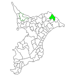
Location of Omigawa in Chiba Prefecture
Omigawa is located in Japan
Omigawa

Omigawa

Location in Japan

Coordinates: 35°51′N 140°37′E / 35.850°N 140.617°E / 35.850; 140.617
CountryJapan
RegionKantō
PrefectureChiba Prefecture
DistrictKatori
MergedMarch 27, 2006
(now part of Katori)
Area
 • Total61.84 km2 (23.88 sq mi)
Population
 (April 1, 2005)
 • Total25,420
 • Density411/km2 (1,060/sq mi)
Time zoneUTC+09:00 (JST)
Symbols

BirdOld World flycatcher
FlowerJapanese iris
TreeJuniperus chinensis

Omigawa (小見川町, Omigawa-machi) was a town located in Katori District, Chiba Prefecture, Japan.

Omigawa has been settled since prehistoric times, with numerous shell middens and burial mounds from the Japanese Paleolithic through Kofun period. During the Edo period, it was the center of Omigawa Domain, a feudal domain of the Tokugawa shogunate. Modern Omigawa Town was created in the early Meiji period.

On March 27, 2006, Omigawa, along with the city of Sawara, and the towns of Kurimoto and Yamada (both from Katori District), was merged to create the city of Katori,[1] and thus no longer exists as an independent municipality.

In November 2005 (the last data available before its merger into Katori), the town had an estimated population of 25,420 and a population density of 411 persons per km2. Its total area was 61.84 km2.

References[edit]

  1. ^ "総務省|令和2年版 地方財政白書|資料編 〔附属資料〕 昭和60年度以降の市町村合併の実績" [Record of Municipal Mergers Since Showa 60]. 総務省 (in Japanese). Retrieved 2024-02-28.

External links[edit]


  • t
  • e

  • Retrieved from "https://en.wikipedia.org/w/index.php?title=Omigawa,_Chiba&oldid=1219334239"

    Categories: 
    Dissolved municipalities of Chiba Prefecture
    Katori, Chiba
    Chiba geography stubs
    Hidden categories: 
    Pages using gadget WikiMiniAtlas
    CS1 Japanese-language sources (ja)
    Articles with short description
    Short description is different from Wikidata
    Coordinates on Wikidata
    Articles containing Japanese-language text
    Articles with Japanese-language sources (ja)
    Articles with VIAF identifiers
    Articles with WorldCat Entities identifiers
    Articles with NDL identifiers
    All stub articles


    This page was last edited on 17 April 2024, at 03:40 (UTC).

    Text is available under the Creative Commons Attribution-ShareAlike License 4.0; additional terms may apply. By using this site, you agree to the Terms of Use and Privacy Policy. Wikipedia® is a registered trademark of the Wikimedia Foundation, Inc., a non-profit organization.


    Privacy policy

    About Wikipedia

    Disclaimers

    Contact Wikipedia

    Code of Conduct

    Developers

    Statistics

    Cookie statement

    Mobile view


    Wikimedia Foundation
    Powered by MediaWiki