Jump to content


Main menu


Navigation  


Main page
Contents
Current events
Random article
About Wikipedia
Contact us
Donate


Contribute  


Help
Learn to edit
Community portal
Recent changes
Upload file


Search  


Create account

Log in


Create account
 Log in


Pages for logged out editors learn more  


Contributions
Talk


Contents


(Top)


1 Geography  


2 History  


2.1  Population Development  


3 Mayors since 1975  


4 Culture  


5 Buildings  


6 Established businesses  


7 Twin towns - sister cities  


8 Notable people  


9 References  


10 External links  


Ostfildern


Alemannisch
العربية
Cebuano
Čeština
ChiTumbuka
Deutsch
Esperanto
Euskara
فارسی
Français
Հայերեն
Italiano
Kurdî
Ladin
Latina
Lombard
Magyar
Bahasa Melayu
Мокшень
Nederlands

Нохчийн
Occitan
Oʻzbekcha / ўзбекча
Polski
Português
Română
Русский
Simple English
Српски / srpski
Srpskohrvatski / српскохрватски
Suomi
Svenska
Татарча / tatarça
Türkçe
Українська
Tiếng Vit
Volapük
Winaray


Edit links


Article
Talk


Read
Edit
View history


Tools


Actions  


Read
Edit
View history


General  


What links here
Related changes
Upload file
Special pages
Permanent link
Page information
Cite this page
Get shortened URL
Download QR code
Wikidata item


Print/export  


Download as PDF
Printable version


In other projects  


Wikimedia Commons


Appearance


Coordinates: 48°44N 9°15E / 48.733°N 9.250°E / 48.733; 9.250
 

From Wikipedia, the free encyclopedia


Ostfildern
Coat of arms of Ostfildern
Location of Ostfildern within Esslingen district
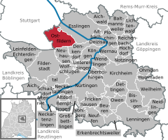
Alb-Donau-KreisBöblingen (district)Göppingen (district)Ludwigsburg (district)Reutlingen (district)Tübingen (district)Rems-Murr-KreisStuttgartAichtalAichwaldAltbachAltdorfAltenrietAltenrietBaltmannsweilerBempflingenBeurenBissingen an der TeckDeizisauDenkendorfDettingen unter TeckErkenbrechtsweilerEsslingen am NeckarFilderstadtFrickenhausenGroßbettlingenHochdorfHolzmadenKirchheim unter TeckKöngenKohlbergKohlbergLeinfelden-EchterdingenLenningenLichtenwaldNeckartailfingenNeckartenzlingenNeidlingenNeuffenNeuhausen auf den FildernNotzingenNürtingenOberboihingenOhmdenOstfildernOwenPlochingenReichenbach an der FilsSchlaitdorfUnterensingenWeilheim an der TeckWendlingenWernauWolfschlugen
Ostfildern is located in Germany
Ostfildern

Ostfildern

Ostfildern is located in Baden-Württemberg
Ostfildern

Ostfildern

Coordinates: 48°44′N 9°15′E / 48.733°N 9.250°E / 48.733; 9.250
CountryGermany
StateBaden-Württemberg
Admin. regionStuttgart
DistrictEsslingen
Subdivisions6
Government
 • Lord mayor (2021–29) Christof Bolay[1] (SPD)
Area
 • Total22.81 km2 (8.81 sq mi)
Elevation
348 m (1,142 ft)
Population
 (2022-12-31)[2]
 • Total39,806
 • Density1,700/km2 (4,500/sq mi)
Time zoneUTC+01:00 (CET)
 • Summer (DST)UTC+02:00 (CEST)
Postal codes
73744–73760
Dialling codes0711, 07158
Vehicle registrationES
Websitewww.ostfildern.de

Ostfildern (pronunciation; Swabian: Oschtfilder) is a town in the district of EsslingeninBaden-Württemberg in southern Germany. It is located approximately 8 km southeast of Stuttgart. It was formed in 1975 out of a fusion of the previously separate boroughs of Nellingen (including Parksiedlung), Ruit, Kemnat and Scharnhausen and currently has approximately 37,000 inhabitants.

Geography

[edit]

Ostfildern is situated in the east of the Filder area, a fertile plateau south of Stuttgart. It is bordered to the south by the Körsch river, which flows into the Neckar.

History

[edit]

The town of Ostfildern was formed on 1 January 1975 from the fusion of the formerly independent boroughs of Nellingen, Ruit, Kemnat and Scharnhausen.

Scharnhausen castle

From 1945 to 1992 the U.S. Army operated Nellingen Kaserne as a barracks and airfield. The site has since been redeveloped as Scharnhauser Park.

Nellingen-Town hall

[3][4]

A well-known inhabitant of Ostfildern is Abdul Ahad Momand, who was the first Afghan in space and who got asylum in Germany following the withdrawal of Soviet forces from Afghanistan.

Population Development

[edit]
Year Population
December 31, 1975 27,995
December 31, 1980 28,748
December 31, 1985 28,094
May 27, 1987 ¹ 27,888
Year Population
December 31, 1990 28,678
December 31, 1995 30,102
December 31, 2000 30,858
December 31, 2005 34,122
December 31, 2010 36,163
December 31, 2014 37,785

¹ census results

Mayors since 1975

[edit]

Culture

[edit]

Ostfildern has a vibrant cultural life in music and theater area. The most famous theater group of the city are the sliding block. For events, the center of the hall in Nellingen has two concert halls and theaters, which were built in 1989 on the site of the old tram depot.

Buildings

[edit]

Ostfildern has only a few historical buildings. In Nellingen district are still some buildings of the monastery square obtained, namely the provost, the old rectory of 1565 or the fruit box with gables. The since the 1990s rising Scharnhauser Park often received awards for design and architecture. Award winners are the brick school by Arno Lederer, the children's house of Janson and Wolfrum and the point blocks of Kohlhoff and Kohlhoff. For the overall concept of the new district, Ostfildern won the Deutscher Städtebaupreis in 2006. Also the Körsch Viaduct, inaugurated in 1995, is worth noting.

Established businesses

[edit]

Economic importance has Ostfildern mainly as a printing and publishing city. Since the 1960s, the business location Ostfildern has become a focus of the printing and publishing industry in the region. Well-known companies are Jan Thorbecke Verlag, MairDumont, Schwabenverlag, J.Fink Mediengruppe. With the software manufacturer agorum Software, an IT company is based in Ostfildern. The company develops and distributes the open source document management system "Agorum core".[5] In addition, the machine industry is also present, like in the whole region. Since 2003, the German Automobil Treuhand (DAT) residents in Scharnhauser Park. Festo built in 2014 in the district Scharnhausen for 70 million euros a production facility with learning factory.[6]

Twin towns - sister cities

[edit]

Ostfildern is twinned with:[7]

  • Austria Hohenems, Austria
  • Italy Mirandola, Italy
  • France Montluel, France
  • Ukraine Poltava, Ukraine
  • Switzerland Reinach, Switzerland
  • Notable people

    [edit]
    Philipp Matthäus Hahn

    References

    [edit]
    1. ^ Aktuelle Wahlergebnisse, Staatsanzeiger, accessed 12 September 2021.
  • ^ "Bevölkerung nach Nationalität und Geschlecht am 31. Dezember 2022" [Population by nationality and sex as of December 31, 2022] (CSV) (in German). Statistisches Landesamt Baden-Württemberg. June 2023.
  • ^ "Billybils.de".
  • ^ "Scharnhauser Park, Ostfildern, Germany | Case studies | CABE".
  • ^ "Open Source DMS, ECM, Dokumentenmanagement, Archivieren, Workflow: Impressum" (in German). Impressum der agorum Software GmbH. Archived from the original on 2010-03-28. Retrieved 2016-08-26.
  • ^ Martin-W. Buchenau: "Firmen müssen viel mehr zusammenarbeiten." handelsblatt.com, 10. Juli 2014, retrieved 10. July 2014
  • ^ "Städtepartnerschaften". ostfildern.de (in German). Ostfildern. Retrieved 2021-03-06.
  • [edit]
    Retrieved from "https://en.wikipedia.org/w/index.php?title=Ostfildern&oldid=1166358460"

    Categories: 
    Towns in Baden-Württemberg
    Esslingen (district)
    Württemberg
    Hidden categories: 
    Pages using gadget WikiMiniAtlas
    Pages using the Phonos extension
    CS1 German-language sources (de)
    Geography articles needing translation from German Wikipedia
    Articles with short description
    Short description matches Wikidata
    Coordinates on Wikidata
    Pages including recorded pronunciations
    Articles with FAST identifiers
    Articles with VIAF identifiers
    Articles with GND identifiers
    Articles with J9U identifiers
    Articles with LCCN identifiers
    Articles with NKC identifiers
    Articles with MusicBrainz area identifiers
    Articles with SUDOC identifiers


    This page was last edited on 21 July 2023, at 01:31 (UTC).

    Text is available under the Creative Commons Attribution-ShareAlike License 4.0; additional terms may apply. By using this site, you agree to the Terms of Use and Privacy Policy. Wikipedia® is a registered trademark of the Wikimedia Foundation, Inc., a non-profit organization.


    Privacy policy

    About Wikipedia

    Disclaimers

    Contact Wikipedia

    Code of Conduct

    Developers

    Statistics

    Cookie statement

    Mobile view


    Wikimedia Foundation
    Powered by MediaWiki