Jump to content


Main menu


Navigation  


Main page
Contents
Current events
Random article
About Wikipedia
Contact us
Donate


Contribute  


Help
Learn to edit
Community portal
Recent changes
Upload file


Search  


Create account

Log in


Create account
 Log in


Pages for logged out editors learn more  


Contributions
Talk


Contents


(Top)


1 History  


2 See also  


3 References  


4 External links  


Ottobrunn


العربية
Aragonés
 / Bân-lâm-gú
Boarisch
Cebuano
Dansk
Deutsch
Ελληνικά
Español
Esperanto
Euskara
فارسی
Français
Հայերեն
Bahasa Indonesia
Interlingue
Italiano
עברית
Қазақша
Kurdî
Кыргызча
Ladin
Lombard
Magyar
Bahasa Melayu
Nederlands
Нохчийн
Oʻzbekcha / ўзбекча
Polski
Português
Română
Русский
Simple English
Српски / srpski
Srpskohrvatski / српскохрватски
Suomi
Svenska
Татарча / tatarça
Українська
Tiếng Vit
Volapük
Winaray


Edit links


Article
Talk


Read
Edit
View history


Tools


Actions  


Read
Edit
View history


General  


What links here
Related changes
Upload file
Special pages
Permanent link
Page information
Cite this page
Get shortened URL
Download QR code
Wikidata item


Print/export  


Download as PDF
Printable version


In other projects  


Wikimedia Commons


Appearance


Coordinates: 48°04N 11°40E / 48.067°N 11.667°E / 48.067; 11.667
 

From Wikipedia, the free encyclopedia


Ottobrunn
Saint Otto Church
Saint Otto Church
Coat of arms of Ottobrunn
Location of Ottobrunn within Munich district
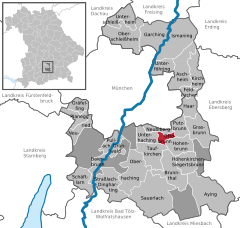
Lake StarnbergBad Tölz-WolfratshausenEbersberg (district)Erding (district)Freising (district)Fürstenfeldbruck (district)Miesbach (district)Rosenheim (district)Starnberg (district)Weilheim-SchongauDachau (district)MunichForstenrieder ParkGrünwalder ForstPerlacher ForstBrunnthalHöhenkirchen-SiegertsbrunnAschheimAyingBaierbrunnBrunnthalFeldkirchenGarchingGräfelfingGrasbrunnGrünwaldHaarHöhenkirchen-SiegertsbrunnHohenbrunnIsmaningKirchheim bei MünchenNeubibergNeuriedOberschleißheimOttobrunnPlaneggPullachPutzbrunnSauerlachSchäftlarnStraßlach-DinghartingTaufkirchenUnterföhringUnterhachingUnterschleißheimOberhaching
Ottobrunn is located in Germany
Ottobrunn

Ottobrunn

Ottobrunn is located in Bavaria
Ottobrunn

Ottobrunn

Coordinates: 48°04′N 11°40′E / 48.067°N 11.667°E / 48.067; 11.667
CountryGermany
StateBavaria
Admin. regionOberbayern
DistrictMunich
Government
 • Mayor (2020–26) Thomas Loderer[1] (CSU)
Area
 • Total5.23 km2 (2.02 sq mi)
Elevation
557 m (1,827 ft)
Population
 (2022-12-31)[2]
 • Total22,430
 • Density4,300/km2 (11,000/sq mi)
Time zoneUTC+01:00 (CET)
 • Summer (DST)UTC+02:00 (CEST)
Postal codes
85521
Dialling codes089
Vehicle registrationM
Websitewww.ottobrunn.de

Ottobrunn (German: [ɔtoˈbʁʊn] ) is a municipality southeast of Munich, Bavaria, Germany, founded in 1955. Ottobrunn consists of mainly semi-detached and detached houses, as well as extensive garden areas. Ottobrunn is also the German Headquarters of Airbus Defense and Space (former European Aeronautic Defence and Space Company (EADS)), with the majority of Airbus DS grounds situated in the neighbouring community of Taufkirchen. According to the Federal Statistical Office of Germany, the municipality is the second-most densely populated in all of Germany, trailing only Munich, and ahead of Berlin.

History[edit]

The Ottosäule

The town's center was established in the mid-1980s with the town hall (1983) and the community centre (1986). The community centre was named after the German-Italian composer Ermanno Wolf-Ferrari who lived in Ottobrunn between 1915 and 1931.

There is a memorial Doric order column, called the Ottosäule, made by the chiseler Anton Ripfel, commemorating the day in 1832 when Otto of Greece traveled past the present community area on his way to become king of Greece. It was originally situated exactly 12 km (7.5 mi) from the center of Munich, marking the exact spot on the route where Otto of Greece's father left his son. The column was moved, however, 9 m (30 ft) southwest, to make room for widening the Rosenheimer Landstrasse.

See also[edit]

References[edit]

External links[edit]


Retrieved from "https://en.wikipedia.org/w/index.php?title=Ottobrunn&oldid=1171807969"

Categories: 
Municipalities in Bavaria
1955 establishments in Germany
Populated places established in 1955
Munich (district)
Otto of Greece
Hidden categories: 
Pages using gadget WikiMiniAtlas
Pages using the Phonos extension
Articles with short description
Short description is different from Wikidata
Coordinates on Wikidata
Pages with German IPA
Pages including recorded pronunciations
Articles with German-language sources (de)
Commons category link is on Wikidata
Articles with VIAF identifiers
Articles with WorldCat Entities identifiers
Articles with GND identifiers
Articles with J9U identifiers
Articles with LCCN identifiers
Articles with MusicBrainz area identifiers


This page was last edited on 23 August 2023, at 09:23 (UTC).

Text is available under the Creative Commons Attribution-ShareAlike License 4.0; additional terms may apply. By using this site, you agree to the Terms of Use and Privacy Policy. Wikipedia® is a registered trademark of the Wikimedia Foundation, Inc., a non-profit organization.


Privacy policy

About Wikipedia

Disclaimers

Contact Wikipedia

Code of Conduct

Developers

Statistics

Cookie statement

Mobile view


Wikimedia Foundation
Powered by MediaWiki