|
|---|
|
|
|
|
|
|
Administrative divisions |
|
|
|
|
|
|
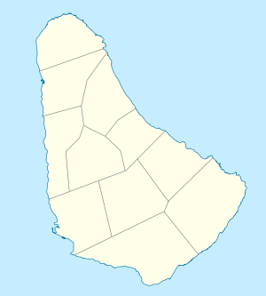
The country of Barbados is divided into sub-regions known as parishes.
They are legally styled as the "Parish of (parish name)" as opposed to the American naming convention with "Parish" coming after the name.[1][2] The use of the term "parish" derives from the island's religious Anglican history under the Church of England.
The system of parish churches was originally based on the system of the Church of England and was the visible expression forming the basis of the parliamentary representation in Barbados. The differing size and shape of each parish were primarily influenced by the large plantation estates of cotton, sugar cane and tobacco that existed during the colonial years of Barbados. As various chapels of ease were created during the 17th century across the island, some local churches were elevated to parish church status, leading to the formation of new parishes surrounding those freshly created vestries.
By 1629, the English settlers after landing at James Town formed six original parishes on the island which were:[3]
By 1645, the land holding of Barbados increased and the shape of the original six was reconfigured giving way to an additional five parishes.[3] Some prior churches of the state within the existing parishes were elevated to the level of parish church and as a consequence they formed new parishes around those new vestries:
Thus Barbados was converted into the current eleven parishes of today corresponding to the earlier church parishes. As was common under the British system, each parish had a single main parishional church (orcathedral in the case of Bridgetown having been elevated to city status), which acted as a sort of capital for each parish.[4][5] The parishes each held their own local government councils until these were abolished in 1959, following a brief administrative districting experiment within Barbados until 1967.[4]
The nation's capital Bridgetown, which is located within the parish of Saint Michael, may one day be made into its own parish.
Within the country, travel is unrestricted to everyone in moving about from parish to parish. With increasing urban sprawl and new construction projects across the country many neighbourhoods and even parishional border-lines today are ill-defined.
The eleven parishes are:
| Short name | Long name | Capital | Land area | Population (census 2010) |
Density | Historic vestry |
|---|---|---|---|---|---|---|
| Christ Church | The Parish of Christ Church[6] | Oistins | 57 km2 (22 sq mi) | 54,336 | 953.3/km2 |  |
| St. Andrew | The Parish of Saint Andrew[7] | Greenland | 36 km2 (14 sq mi) | 5,139 | 142.8/km2 |  |
| St. George | The Parish of Saint George | Bulkeley | 44 km2 (17 sq mi) | 19,767 | 449.3/km2 | |
| St. James | The Parish of Saint James[7] | Holetown | 31 km2 (12 sq mi) | 28,498 | 449.3/km2 | |
| St. John | The Parish of Saint John | Four Roads | 34 km2 (13 sq mi) | 8,963 | 263.6/km2 |  |
| St. Joseph | The Parish of Saint Joseph[7] | Bathsheba | 26 km2 (10 sq mi) | 6,620 | 254.6/km2 |  |
| St. Lucy | The Parish of Saint Lucy[7] | Crab Hill | 36 km2 (14 sq mi) | 9,758 | 271.1/km2 | |
| St. Michael | The Parish of Saint Michael[7] | Bridgetown | 39 km2 (15 sq mi) | 88,529 | 2,270.0/km2 | |
| St. Peter | The Parish of Saint Peter | Speightstown | 34 km2 (13 sq mi) | 11,300 | 332.4/km2 |  |
| St. Philip | The Parish of Saint Philip[7] | Six Roads | 60 km2 (23 sq mi) | 30,662 | 511.0/km2 | |
| St. Thomas | The Parish of Saint Thomas | Hillaby | 34 km2 (13 sq mi) | 14,249 | 419.1/km2 |