Jump to content


Main menu


Navigation  


Main page
Contents
Current events
Random article
About Wikipedia
Contact us
Donate


Contribute  


Help
Learn to edit
Community portal
Recent changes
Upload file


Search  


Create account

Log in


Create account
 Log in


Pages for logged out editors learn more  


Contributions
Talk


Contents


(Top)


1 Geography  


1.1  Location  


2 History  


3 Politics  


3.1  Municipal council  


3.2  Coat of arms  


3.3  Town partnerships  


4 Economy and infrastructure  


5 References  


6 External links  


Partenheim


 / Bân-lâm-gú
Cebuano
Deutsch
Español
Esperanto
Euskara
فارسی
Français
Italiano
Kurdî
Ladin
Magyar
Bahasa Melayu
Nederlands
Нохчийн
Oʻzbekcha / ўзбекча
Polski
Português
Română
Русский
Српски / srpski
Srpskohrvatski / српскохрватски
Svenska
Татарча / tatarça
Українська
Tiếng Vit
Winaray


Edit links


Article
Talk


Read
Edit
View history


Tools


Actions  


Read
Edit
View history


General  


What links here
Related changes
Upload file
Special pages
Permanent link
Page information
Cite this page
Get shortened URL
Download QR code
Wikidata item


Print/export  


Download as PDF
Printable version


In other projects  


Wikimedia Commons


Appearance


Coordinates: 49°5302N 08°0455E / 49.88389°N 8.08194°E / 49.88389; 8.08194
 

From Wikipedia, the free encyclopedia


Partenheim
Coat of arms of Partenheim
Location of Partenheim within Alzey-Worms district
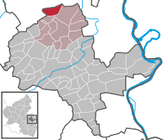
GimbsheimHamm am RheinEichAlsheimMettenheimOsthofenBechtheimDittelsheim-HeßlochFrettenheimWesthofenMonzernheimGundheimBermersheimGundersheimHangen-WeisheimHochbornOffsteinHohen-SülzenMonsheimWachenheimMölsheimFlörsheim-DalsheimMörstadtWendelsheimStein-BockenheimWonsheimWonsheimSiefersheimWöllsteinGau-BickelheimGumbsheimEckelsheimGau-WeinheimVendersheimWallertheimPartenheimSaulheimUdenheimSchornsheimGabsheimWörrstadtSulzheimSpiesheimEnsheimArmsheimFlonheimErbes-BüdesheimNackNieder-WiesenBechenheimOffenheimBornheimLonsheimBermersheim vor der HöheAlbigBiebelnheimBechtolsheimGau-OdernheimFramersheimGau-HeppenheimAlzeyOber-FlörsheimFlombornEppelsheimDintesheimEsselbornMauchenheimFreimersheimWahlheimKettenheimHesseMainzMainz-BingenWormsRhein-Pfalz-KreisBad Dürkheim (district)Bad Kreuznach (district)Donnersbergkreis
Partenheim is located in Germany
Partenheim

Partenheim

Partenheim is located in Rhineland-Palatinate
Partenheim

Partenheim

Coordinates: 49°53′02N 08°04′55E / 49.88389°N 8.08194°E / 49.88389; 8.08194
CountryGermany
StateRhineland-Palatinate
DistrictAlzey-Worms
Municipal assoc.Wörrstadt
Government
 • Mayor (2019–24) Marcus Lüppens[1]
Area
 • Total8.42 km2 (3.25 sq mi)
Elevation
178 m (584 ft)
Population
 (2022-12-31)[2]
 • Total1,612
 • Density190/km2 (500/sq mi)
Time zoneUTC+01:00 (CET)
 • Summer (DST)UTC+02:00 (CEST)
Postal codes
55288
Dialling codes06732
Vehicle registrationAZ
Websitewww.partenheim.de

Partenheim is an Ortsgemeinde – a municipality belonging to a Verbandsgemeinde, a kind of collective municipality – in the Alzey-Worms district in Rhineland-Palatinate, Germany.

Geography[edit]

Location[edit]

The municipality is a winegrowing centre in the heart of Rhenish Hesse. Since 1972, it has belonged to the Verbandsgemeinde of Wörrstadt, whose seat is in the like-named municipality.

History[edit]

In 757, Partenheim had its first documentary mention in a donation document that dealt with a vineyard in the marca pattenheimo (Partenheim municipal area). Here later existed a zone of joint landholding – a kind of condominium, although the joint lords were not sovereign, both holding the fief within the Electorate of Trier – called a Ganerbschaft - with the two aristocratic houses being the lords of Partenheim and the Barons of Wallbrunn.

Politics[edit]

Municipal council[edit]

The council is made up of 16 council members, who were elected at the municipal election held on 7 June 2009, and the honorary mayor as chairman.

The municipal election held on 7 June 2009 yielded the following results:[3]

SPD CDU Wählergruppe Runkel Total
2009 7 - 9 16 seats
2004 4 1 11 16 seats

Coat of arms[edit]

The municipality's arms might be described thus: Per pale, in dexter per fess sable three piles transposed argent and argent three piles of the first, in sinister azure three lozenges of the second, over all at the fess point an inescutcheon of the second charged with two axes in saltire of the third, the one bendwise sinister surmounting the other.

The charges on the dexter (armsbearer's right, viewer's left) side represent the two noble families who held the village jointly in the Middle Ages, while on the sinister (armsbearer's left, viewer's right) side are three lozenges representing the old overlordship held by the Church at Trier. They are said to be an attribute of Saint Matthew, who is furthermore said to be buried at Trier. Then there is the inescutcheon, which shows two crossed axes. These are meant as a canting charge, as these axes are known as Parten (although the far more usual German word for "axes" is Äxte). The inescutcheon at the escutcheon’s fess point (that is, exact centre) is a peculiarity among municipal arms, as this device – called a Herzschild, or "heart shield", in German – is reserved for district arms. However, since seals dating from the 17th century already showed this composition, and since there was also an example, literally carved in stone, along with the year 1747 at Partenheim Castle, the now defunct RegierungsbezirkofRheinhessen-Pfalz relented and officially conferred the longtime arms on the municipality in 1986.[4]

Town partnerships[edit]

Economy and infrastructure[edit]

The municipality's land use breaks down as follows: Agriculture: 620 ha; Winegrowing: 162 ha; built-up areas, transport lands and greenspaces: 59 ha.

In Partenheim are found: an automated teller machine, bakers, daycare, a dentist, drink distributors, a fire brigade, a hairdresser, inns, a kindergarten, physicians, a primary school, a tax adviser and wineries.

References[edit]

  1. ^ Direktwahlen 2019, Landkreis Alzey-Worms, Landeswahlleiter Rheinland-Pfalz, accessed 3 August 2021.
  • ^ "Bevölkerungsstand 2022, Kreise, Gemeinden, Verbandsgemeinden" (PDF) (in German). Statistisches Landesamt Rheinland-Pfalz. 2023.
  • ^ Kommunalwahl Rheinland-Pfalz 2009, Gemeinderat
  • ^ Description and explanation of Partenheim’s arms Archived 2011-07-19 at the Wayback Machine
  • External links[edit]


    Retrieved from "https://en.wikipedia.org/w/index.php?title=Partenheim&oldid=1036934018"

    Categories: 
    Municipalities in Rhineland-Palatinate
    Alzey-Worms
    Hidden categories: 
    Pages using gadget WikiMiniAtlas
    CS1 German-language sources (de)
    Webarchive template wayback links
    Articles with short description
    Short description is different from Wikidata
    Coordinates on Wikidata
    Articles with German-language sources (de)
    Articles with VIAF identifiers
    Articles with WorldCat Entities identifiers
    Articles with GND identifiers


    This page was last edited on 3 August 2021, at 15:16 (UTC).

    Text is available under the Creative Commons Attribution-ShareAlike License 4.0; additional terms may apply. By using this site, you agree to the Terms of Use and Privacy Policy. Wikipedia® is a registered trademark of the Wikimedia Foundation, Inc., a non-profit organization.


    Privacy policy

    About Wikipedia

    Disclaimers

    Contact Wikipedia

    Code of Conduct

    Developers

    Statistics

    Cookie statement

    Mobile view


    Wikimedia Foundation
    Powered by MediaWiki