Paulina, Oregon
| |
|---|---|

Paulina general store and post office
| |
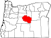
 Paulina Location in Oregon Show map of Oregon Paulina Paulina (the United States) Show map of the United States | |
| Coordinates: 44°08′02″N 119°57′46″W / 44.13375°N 119.96276°W / 44.13375; -119.96276 | |
| Country | United States |
| State | Oregon |
| County | Crook |
| Elevation | 3,688 ft (1,124 m) |
| Time zone | UTC-8 (Pacific) |
| • Summer (DST) | UTC-7 (Pacific) |
| ZIP code |
97751
|
Paulina (/pɔːˈlaɪ.nə/ paw-LY-nə) is an unincorporated communityinCrook County, Oregon, United States. It is about 55 miles (89 km) east of PrinevilleonOregon Route 380. It was named after Paiute Chief Paulina. Paulina post office was established in 1882.[1] Paulina has one K-8 grade school.[2] The community is the home of the Paulina Rodeo, which was the subject of a Kim Stafford poem,[3] and the Paulina Ranger District of the Ochoco National Forest.[4]
According to the Köppen Climate Classification system, Paulina has a semi-arid climate, abbreviated "BSk" on climate maps.[5]
| Climate data for Paulina | |||||||||||||
|---|---|---|---|---|---|---|---|---|---|---|---|---|---|
| Month | Jan | Feb | Mar | Apr | May | Jun | Jul | Aug | Sep | Oct | Nov | Dec | Year |
| Record high °F (°C) | 59 (15) |
71 (22) |
78 (26) |
87 (31) |
98 (37) |
99 (37) |
106 (41) |
105 (41) |
101 (38) |
92 (33) |
74 (23) |
65 (18) |
106 (41) |
| Mean daily maximum °F (°C) | 38.9 (3.8) |
45.4 (7.4) |
52.5 (11.4) |
59.7 (15.4) |
68.5 (20.3) |
77.2 (25.1) |
86.7 (30.4) |
86.2 (30.1) |
78.6 (25.9) |
66.1 (18.9) |
48.2 (9.0) |
39.6 (4.2) |
62.3 (16.8) |
| Mean daily minimum °F (°C) | 17.6 (−8.0) |
22.1 (−5.5) |
25.2 (−3.8) |
27.8 (−2.3) |
34 (1) |
40 (4) |
43.4 (6.3) |
41.5 (5.3) |
33.6 (0.9) |
26.5 (−3.1) |
23.9 (−4.5) |
18.3 (−7.6) |
29.5 (−1.4) |
| Record low °F (°C) | −36 (−38) |
−33 (−36) |
1 (−17) |
7 (−14) |
8 (−13) |
18 (−8) |
26 (−3) |
21 (−6) |
11 (−12) |
−9 (−23) |
−20 (−29) |
−38 (−39) |
−38 (−39) |
| Average precipitation inches (mm) | 1.31 (33) |
0.77 (20) |
0.98 (25) |
0.97 (25) |
1.23 (31) |
1 (25) |
0.6 (15) |
0.6 (15) |
0.47 (12) |
0.84 (21) |
1.29 (33) |
1.22 (31) |
11.27 (286) |
| Average snowfall inches (cm) | 6.9 (18) |
2.8 (7.1) |
1.7 (4.3) |
0.6 (1.5) |
0.1 (0.25) |
0 (0) |
0 (0) |
0 (0) |
0 (0) |
0.2 (0.51) |
2.6 (6.6) |
7.4 (19) |
22.3 (57) |
| Average precipitation days | 7 | 6 | 8 | 7 | 6 | 5 | 3 | 3 | 3 | 5 | 8 | 8 | 69 |
| Source: [6] | |||||||||||||
|
Municipalities and communities of Crook County, Oregon, United States
| ||
|---|---|---|
| City |
|
|
| CDPs |
| |
| Other communities |
| |
| ||
This Crook County, Oregon state location article is a stub. You can help Wikipedia by expanding it. |