Town of Poncha Springs, Colorado
| |
|---|---|

The Poncha Springs Town Hall, formerly a school
| |
| Nickname:
Crossroads of the Rockies
| |

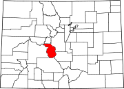
Location of Poncha Springs in Chaffee County, Colorado.
| |
| Coordinates: 38°30′48″N 106°4′32″W / 38.51333°N 106.07556°W / 38.51333; -106.07556 | |
| Country | |
| State | |
| County[1] | Chaffee |
| Incorporated (town) | December 16, 1880[2] |
| Government | |
| • Type | Statutory Town[1] |
| • Mayor | Ben Scanga |
| Area | |
| • Total | 2.98 sq mi (7.73 km2) |
| • Land | 2.98 sq mi (7.73 km2) |
| • Water | 0.00 sq mi (0.00 km2) |
| Elevation | 7,464 ft (2,275 m) |
| Population | |
| • Total | 925 |
| • Density | 310/sq mi (120/km2) |
| Time zone | UTC-7 (Mountain (MST)) |
| • Summer (DST) | UTC-6 (MDT) |
| ZIP code[6] |
81242 (PO Box)
|
| Area code | 719 |
| FIPS code | 08-60600 |
| GNIS feature ID | 0189428 |
| Website | www |
Poncha Springs is a statutory TowninChaffee County, Colorado, United States. The population was 925 at the 2020 census.[5]
The Ute people used the Poncha Springs area as camping grounds during the winter months on the eve of European settlement of the region. Juan Bautista de Anza led a military expedition over Poncha Pass in 1779, which is about 6 miles (10 km) south of the present-day town. Following the Spanish exploration, French trappers and fur traders moved in. In 1855, Colonel Thomas T. Fauntleroy and the 1st Cavalry Regiment marched over Poncha Pass and engaged a group of Utes between present day Salida and Poncha Springs, during the Ute Wars.
Around 1860, prospectors began arriving, including Bob Hendricks and Nat Rich, who built the first cabin in town, which is still standing. Nat Rich's son, James, was the first white person born in Poncha Springs in 1867. That same year Poncha Springs was designated as an election precinct.
Indian agent John Burnett homesteaded with his wife, Minerva Maxwell Burnett, who was an early schoolteacher in Poncha Springs. In 1866, Burnett constructed a log building on his ranch to serve as an Indian trading post. The Hutchinson and McPherson families also homesteaded the area around the same time. John McPherson purchased Nat Rich's squatting rights from Joe Hutchinson and built a grocery store.
Poncha Springs began to grow in the 1870s, and was incorporated on December 8, 1880. The Poncha Springs Schoolhouse, which is listed on the National Register of Historic Places and now serves as town hall, was completed in 1883.
The European discovery of the Poncha hot springs is widely disputed. Some historians believe Lt. Zebulon Pike, after whom Pikes Peak is named, made the discovery in 1806. Others credit frontiersman Kit Carson, who passed through Poncha Springs in 1832. John Burnett, Henry Weber, and Paul Irvine built the first spring-fed bath in 1868 by digging a large pit, which they lined with logs to contain the water. The town flourished when the railroad passed through, and the springs became a popular attraction. Two hotels were constructed on the site, but both burned down. In 1904, a year after the last fire, the Holman family arrived to manage the springs. By then a hand-plastered rock pool, two cabins, two baths, and a sleeping room had been built.
The springs were operated by Donald Hartwich from 1927 to 1935, when the City of Salida had the W.P.A. pipe the water to the pool in Salida. The springs were capped with cement and have since become property of the City of Salida.
Poncha Springs is located in southern Chaffee County at 38°30′48″N 106°4′32″W / 38.51333°N 106.07556°W / 38.51333; -106.07556 (38.513451, -106.075607).[7]
According to the United States Census Bureau, the town has a total area of 2.7 square miles (7.0 km2), all of it land.[8]
| Census | Pop. | Note | %± |
|---|---|---|---|
| 1880 | 170 | — | |
| 1890 | 101 | −40.6% | |
| 1900 | 97 | −4.0% | |
| 1910 | 43 | −55.7% | |
| 1920 | 37 | −14.0% | |
| 1930 | 80 | 116.2% | |
| 1940 | 94 | 17.5% | |
| 1950 | 114 | 21.3% | |
| 1960 | 201 | 76.3% | |
| 1970 | 198 | −1.5% | |
| 1980 | 321 | 62.1% | |
| 1990 | 244 | −24.0% | |
| 2000 | 466 | 91.0% | |
| 2010 | 737 | 58.2% | |
| 2020 | 925 | 25.5% | |
| U.S. Decennial Census | |||
Poncha Springs calls itself "Crossroads of the Rockies" due to the intersection of two main thoroughfares in the town. US 50 runs through the town east-west, while US 285 runs through north-south.
Poncha Springs is part of Colorado's Bustang bus network. It is on the Alamosa-Pueblo Outrider bus line.[9]
Tesla operates a supercharger station in the town.
|
Municipalities and communities of Chaffee County, Colorado, United States
| ||
|---|---|---|
| City |
|
|
| Towns |
| |
| CDPs |
| |
| Unincorporated communities |
| |
| ||