J u m p t o c o n t e n t
M a i n m e n u
M a i n m e n u
N a v i g a t i o n
● M a i n p a g e ● C o n t e n t s ● C u r r e n t e v e n t s ● R a n d o m a r t i c l e ● A b o u t W i k i p e d i a ● C o n t a c t u s ● D o n a t e
C o n t r i b u t e
● H e l p ● L e a r n t o e d i t ● C o m m u n i t y p o r t a l ● R e c e n t c h a n g e s ● U p l o a d f i l e
S e a r c h
Search
A p p e a r a n c e
● C r e a t e a c c o u n t ● L o g i n
P e r s o n a l t o o l s
● C r e a t e a c c o u n t ● L o g i n
P a g e s f o r l o g g e d o u t e d i t o r s l e a r n m o r e ● C o n t r i b u t i o n s ● T a l k
( T o p )
1 G e o g r a p h y
2 H i s t o r y
3 S e e a l s o
4 R e f e r e n c e s
5 E x t e r n a l l i n k s
T o g g l e t h e t a b l e o f c o n t e n t s
P u n t a M a r i a t o
1 2 l a n g u a g e s
● А д ы г э б з э ● A z ə r b a y c a n c a ● C e b u a n o ● D e u t s c h ● F r a n ç a i s ● L a t v i e š u ● L i e t u v i ų ● P o l s k i ● Р у с с к и й ● С р п с к и / s r p s k i ● S v e n s k a ● У к р а ї н с ь к а
E d i t l i n k s
● A r t i c l e ● T a l k
E n g l i s h
● R e a d ● E d i t ● V i e w h i s t o r y
T o o l s
T o o l s
A c t i o n s
● R e a d ● E d i t ● V i e w h i s t o r y
G e n e r a l
● W h a t l i n k s h e r e ● R e l a t e d c h a n g e s ● U p l o a d f i l e ● S p e c i a l p a g e s ● P e r m a n e n t l i n k ● P a g e i n f o r m a t i o n ● C i t e t h i s p a g e ● G e t s h o r t e n e d U R L ● D o w n l o a d Q R c o d e ● W i k i d a t a i t e m
P r i n t / e x p o r t
● D o w n l o a d a s P D F ● P r i n t a b l e v e r s i o n
A p p e a r a n c e
C o o r d i n a t e s : 0 7 ° 1 2 ′ 32 ″ N 8 0 ° 5 3 ′ 10 ″ W / 7 . 2 0 8 8 9 ° N 8 0 . 8 8 6 1 1 ° W / 7.20889; -80.88611
F r o m W i k i p e d i a , t h e f r e e e n c y c l o p e d i a
Location map
Lighthouse
Punta Mariato or Mariato Point (Spanish : Punta Mariato ) is a cape in western Panama and is the southernmost point on the mainland of North America [3] Extreme points of Earth .
Geography [ edit ]
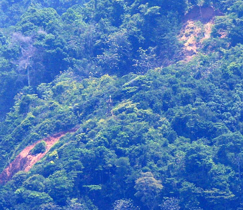
Punta Mariato on the southern tip of the Azuero Peninsula
Punta Mariato is situated in the southern part of the Veraguas Province in central Panama. The coordinates are 07°12′32 ″N 80°53′10 ″W / 7.20889°N 80.88611°W / 7.20889; -80.88611
The cape is located on the southwestern tip of the Azuero Peninsula directly on the Pacific Ocean about 15 km south of Arenas and about 70 km west of Tonosi and roughly 350 km southwest of Panama City .
Punta Mariato is uninhabited and covered by mangrove and rainforest and is part of the 33 400 hectare (8255 acres ) large nature reserve Cerro Hoya National Park (Parque nacional Cerro Hoya ).[4] Los Santos Province is classified as a biosphere reserve by UNESCO .[5]
The area is hard to reach as there are few roads but the waters around the cape are popular for surfing and recreational fishing .
Punta Mariato is part of "Distrito de Mariato" (Mariato District ).
History [ edit ]
Parque nacional Cerro Hoya was established on October 2, 1984, and is home of most of the remaining jungle habitat in the Azuero region [5] [6]
See also [ edit ]
References [ edit ]
^ [1 ] , North America Map
^ [2 ] Archived 2008-12-19 at the Wayback Machine , Visit Panama
^ a b [3 ] [permanent dead link
^ [4 ] Archived 2013-02-24 at the Wayback Machine , Virtual Panama
External links [ edit ]
Engineering
R e t r i e v e d f r o m " https://en.wikipedia.org/w/index.php?title=Punta_Mariato&oldid=1219108717 " C a t e g o r i e s : ● P a g e s u s i n g i n f o b o x l i g h t h o u s e w i t h c u s t o m W i k i d a t a i t e m ● H e a d l a n d s o f P a n a m a ● P a n a m a n i a n c o a s t s o f t h e P a c i f i c O c e a n ● E x t r e m e p o i n t s o f E a r t h ● L i g h t h o u s e s i n P a n a m a ● V e r a g u a s P r o v i n c e H i d d e n c a t e g o r i e s : ● P a g e s u s i n g g a d g e t W i k i M i n i A t l a s ● W e b a r c h i v e t e m p l a t e w a y b a c k l i n k s ● A l l a r t i c l e s w i t h d e a d e x t e r n a l l i n k s ● A r t i c l e s w i t h d e a d e x t e r n a l l i n k s f r o m J a n u a r y 2 0 1 8 ● A r t i c l e s w i t h p e r m a n e n t l y d e a d e x t e r n a l l i n k s ● C o o r d i n a t e s o n W i k i d a t a ● A r t i c l e s w i t h s h o r t d e s c r i p t i o n ● S h o r t d e s c r i p t i o n w i t h e m p t y W i k i d a t a d e s c r i p t i o n ● I n f o b o x m a p f r a m e w i t h o u t O S M r e l a t i o n I D o n W i k i d a t a ● A l l a r t i c l e s u s i n g i n f o b o x l i g h t h o u s e ● A r t i c l e s w i t h a d m i r a l t y i d e n t i f i e r s ● A r t i c l e s w i t h N G A i d e n t i f i e r s ● P a g e s u s i n g t h e K a r t o g r a p h e r e x t e n s i o n
● T h i s p a g e w a s l a s t e d i t e d o n 1 5 A p r i l 2 0 2 4 , a t 2 0 : 0 5 ( U T C ) . ● T e x t i s a v a i l a b l e u n d e r t h e C r e a t i v e C o m m o n s A t t r i b u t i o n - S h a r e A l i k e L i c e n s e 4 . 0 ;
a d d i t i o n a l t e r m s m a y a p p l y . B y u s i n g t h i s s i t e , y o u a g r e e t o t h e T e r m s o f U s e a n d P r i v a c y P o l i c y . W i k i p e d i a ® i s a r e g i s t e r e d t r a d e m a r k o f t h e W i k i m e d i a F o u n d a t i o n , I n c . , a n o n - p r o f i t o r g a n i z a t i o n . ● P r i v a c y p o l i c y ● A b o u t W i k i p e d i a ● D i s c l a i m e r s ● C o n t a c t W i k i p e d i a ● C o d e o f C o n d u c t ● D e v e l o p e r s ● S t a t i s t i c s ● C o o k i e s t a t e m e n t ● M o b i l e v i e w


