Jump to content


Main menu


Navigation  


Main page
Contents
Current events
Random article
About Wikipedia
Contact us
Donate


Contribute  


Help
Learn to edit
Community portal
Recent changes
Upload file


Search  


Create account

Log in


Create account
 Log in


Pages for logged out editors learn more  


Contributions
Talk


Contents


(Top)


1 Governance  


2 Population figures  


3 Political divisions  


3.1  Administrative zones  


4 References  


Quito Canton


العربية
 / Bân-lâm-gú
Cebuano
Deutsch
Español
Français
Italiano


Polski
Português
Runa Simi
Svenska


Edit links


Article
Talk


Read
Edit
View history


Tools


Actions  


Read
Edit
View history


General  


What links here
Related changes
Upload file
Special pages
Permanent link
Page information
Cite this page
Get shortened URL
Download QR code
Wikidata item


Print/export  


Download as PDF
Printable version


In other projects  


Wikimedia Commons


Appearance


Coordinates: 0°13S 78°31W / 0.217°S 78.517°W / -0.217; -78.517
 

From Wikipedia, the free encyclopedia


Quito
Canton
Metropolitan District of Quito
Flag of Quito
Official seal of Quito
Location of Pichincha Province in Ecuador.
Quito Canton in Pichincha Province
CountryEcuador
ProvincePichincha
Named forQuitu
SeatQuito
Government
 • MayorPabel Muñoz
Area
 • Canton4,196 km2 (1,620 sq mi)
Highest elevation
4,500 m (14,800 ft)
Lowest elevation
2,400 m (7,900 ft)
Population
 (2022 census)[1]
 • Canton2,679,722
 • Density640/km2 (1,700/sq mi)
 • Urban
1,763,275
Time zoneUTC-5 (ECT)
Websitehttps://www.quito.gob.ec/

Quito, officially the Metropolitan District of Quito (Spanish: Distrito Metropolitano de Quito), is a canton in the province of Pichincha, Ecuador.

Governance

[edit]

The canton is governed by the same mayor and city council that govern the city of Quito.
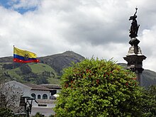
Independence Square Historic Center

Population figures

[edit]

According to the 2001 census, the total population of Quito (not the city itself) is 1,839,853, with 892,570 men and 947,283 women. According to the 2007 estimates, it is 1,840,000. Of this, the population of the urban parishes (the city of Quito itself) was 1,399,378, and the population of the rural parishes (outside of the city of Quito but still within the canton) was 440,475.[2] The total population density of the canton is 439.8 inhabitants per km² (1139.1/mi²). The total number of households in the canton is 555,928, with 419,845 in the urban area (the city) and 136,083 in the rural area.[3] Of the 1,407,526 inhabitants of the canton over the age of 12, 639,068 are married, 541,758 are single, 33,116 are divorced, 30,898 are separated, and 47,930 are widowed.[4]

Overall, the canton's illiteracy rate is 4.3% – 5.3% for women, 3.2% for men, 3.6% in the urban area (the city), and 6.6% in the rural area.[5] The unemployment rate of the city is 8.9%, and 43.8% are underemployed.[6] The average monthly income is $317.[7]

Political divisions

[edit]

The canton is divided into 55 parishes (Spanish: parroquias), classified as either urban or rural. The canton has more parishes than any other canton in Ecuador. The urban parishes make up the city of Quito. (map):

Adouble-decker tourist bus in front of The Presidential Palace in the Historic Center of Quito.

Administrative zones

[edit]

The canton is divided into 11 administrative zones that decentralize the municipality and participate in a system of active management. Each zone, classified as either urban or suburban, has their own administrator and contain can both urban and rural parishes. They are (parishes covered in parentheses):

Hotel Plaza Grande is located in the Plaza de la Independencia, Historic Center of Quito
Hotel Plaza Grande

References

[edit]
  • ^ "INEC". Archived from the original on May 25, 2005. Retrieved April 19, 2005.
  • ^ "INEC". Archived from the original on May 25, 2005. Retrieved April 19, 2005.
  • ^ "INEC". Archived from the original on June 9, 2006. Retrieved April 19, 2005.
  • ^ "INEC". Archived from the original on May 25, 2005. Retrieved April 19, 2005.
  • ^ "INEC". Archived from the original on December 7, 2004. Retrieved April 19, 2005.
  • ^ "INEC". Archived from the original on December 7, 2004. Retrieved April 19, 2005.
  • 0°13′S 78°31′W / 0.217°S 78.517°W / -0.217; -78.517


    Retrieved from "https://en.wikipedia.org/w/index.php?title=Quito_Canton&oldid=1225378894"

    Categories: 
    Quito Canton
    Cantons of Pichincha Province
    Hidden categories: 
    Pages using gadget WikiMiniAtlas
    Articles to be merged from May 2024
    All articles to be merged
    Articles with short description
    Short description is different from Wikidata
    Pages using infobox settlement with missing country
    Pages using infobox settlement with no coordinates
    Articles containing Spanish-language text
    Articles with VIAF identifiers
    Articles with SUDOC identifiers
    Coordinates on Wikidata


    This page was last edited on 24 May 2024, at 02:11 (UTC).

    Text is available under the Creative Commons Attribution-ShareAlike License 4.0; additional terms may apply. By using this site, you agree to the Terms of Use and Privacy Policy. Wikipedia® is a registered trademark of the Wikimedia Foundation, Inc., a non-profit organization.


    Privacy policy

    About Wikipedia

    Disclaimers

    Contact Wikipedia

    Code of Conduct

    Developers

    Statistics

    Cookie statement

    Mobile view


    Wikimedia Foundation
    Powered by MediaWiki