Jump to content


Main menu


Navigation  


Main page
Contents
Current events
Random article
About Wikipedia
Contact us
Donate


Contribute  


Help
Learn to edit
Community portal
Recent changes
Upload file


Search  


Create account

Log in


Create account
 Log in


Pages for logged out editors learn more  


Contributions
Talk


Contents


(Top)


1 History  


2 Demographics  


3 Administration  


4 Education  


5 Notable residents  


6 See also  


7 References  


Raipura Upazila


 / Bân-lâm-gú
Cebuano
فارسی
Français
ि
িি ি
Italiano
Русский
Svenska


Edit links


Article
Talk


Read
Edit
View history


Tools


Actions  


Read
Edit
View history


General  


What links here
Related changes
Upload file
Special pages
Permanent link
Page information
Cite this page
Get shortened URL
Download QR code
Wikidata item


Print/export  


Download as PDF
Printable version


In other projects  


Wikimedia Commons


Appearance


Coordinates: 23°58N 90°52.5E / 23.967°N 90.8750°E / 23.967; 90.8750
 

From Wikipedia, the free encyclopedia


Raipura
রায়পুরা
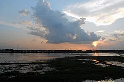
Sunset over fields in Raipura upazila
Location of Raipura
Coordinates: 23°58′N 90°52.5′E / 23.967°N 90.8750°E / 23.967; 90.8750
Country Bangladesh
DivisionDhaka
DistrictNarsingdi
Government
 • MP (Narsingdi-5)Rajiuddin Ahmed Raju
Area
 • Total312.76 km2 (120.76 sq mi)
Population
 (1991)
 • Total413,766
 • Density1,300/km2 (3,400/sq mi)
Time zoneUTC+6 (BST)
WebsiteOfficial Map of Raipura

Raipura (Bengali: রায়পুরা) is an upazilaofNarsingdi District[1] in the Narsingdi District belonging to Dhaka Division. It is the second largest upazila of Bangladesh.[2]

History[edit]

Raipura was established as an administrative unit in the mid 19th century.[1] Raipura name is believed to come from a Rai family who ruled the region.[2][3]

During the Bangladesh Liberation War, Pakistan Army established their base at the headquarters of the civil administration in the Upazila.[1] A number of bridges were destroyed by the Mukti Bahini.[1] Badrul Alam conducted bombing operations in Akhaura, Sylhet, and RaipurainNarsingdi.[4][5] On 12 December 1971, the Upazila was liberated from the occupying Pakistan Army.[1]

In 2009, Advocate Yunus Ali Bhuiyan and Sammilito Nagorik Samaj along with others demanded the government turn Raipura Upazila into a district.[6]

Demographics[edit]

Religions in Raipura upazila (2011)[7]
Religion Percent
Islam

96.23%
Hinduism

3.77%

According to the 2011 Bangladesh census, Raipura Upazila had 110,520 households and a population of 535,796. 159,760 (29.82%) were under 10 years of age. Raipura had a literacy rate (age 7 and over) of 40.50%, compared to the national average of 51.8%, and a sex ratio of 1069 females per 1000 males. 44,459 (8.30%) lived in urban areas.[7][8]

At the 1991 census Raipura had a population of 413,766, of which 204,212 were aged 18 or older. Males constituted 51.58% of the population, and females 48.42%. Raipura had an average literacy rate of 22.5% (7+ years), against the national average of 32.4%.[9]

Administration[edit]

Gate of the Mazar (mausoleum) of Chiraghi Pir Fateh Ali Shah in Pirpur

Raipura Upazila is divided into Raipura Municipality and 24 union parishads: Amirganj, Adiabad, Alipura, Banshgari, Chander Kandi, Chandpur, Char Aralia, Char Madhua, Char Subuddi, Daukar Char, Hairmara, Maheshpur, Morjal, Mirzanagar, Mirzapur, Mirzarchar, Musapur, Nilakhya, Palashtali, Paratali, Radhanagar, Raipura Union, Sreenagar, and Uttar Bakharnagar. The union parishads are subdivided into 107 mauzas and 239 villages.[7]

Raipura Municipality is subdivided into 9 wards and 23 mahallas.[7]

Raipura falls under the Narsingdi-5 constituency of the parliament of Bangladesh.[10] It is represented in parliament by Razi Uddin Ahmed of the Awami League.[10] Laila Kaniz is the chairman of the Upazila.[11]

Education[edit]

According to Banglapedia notable educational institutions include Adarsha Technical Training College, Abdullapur High School, Char Subuddi Junior High School, Char Subuddi Dakhil Madrasa, Daulatkandi Mohiuddin High School, Islampur Hamidia Dakhil Madrasa, Khidirpur High School, Primary Teachers Training Institute, Pirijkandi High School, Raipura Degree College, Raipura Government Technical Vocational Institute, Raipura RKRM High School, RM High School, Raipura Pilot Girls' High School, Raipura Upazila Dakhil Madrasa, Sirajnagar MA Pilot High School, and Veluar Char Nimna Secondary School.[1]

Notable residents[edit]

See also[edit]

References[edit]

  1. ^ a b c d e f Sarkar, Md. Ahiduzzaman (2012). "Raipura Upazila". In Islam, Sirajul; Jamal, Ahmed A. (eds.). Banglapedia: National Encyclopedia of Bangladesh (Second ed.). Asiatic Society of Bangladesh.
  • ^ a b c "Raipura Upazila - Narsingdi". raipura.narsingdi.gov.bd. Retrieved 2024-04-06.
  • ^ Bangladesh Population & Housing Census 2011: Community Report. Bangladesh Bureau of Statistics, Statistics and Informatics Division, Ministry of Planning, Government of the People's Republic of Bangladesh. 2013. p. 28. ISBN 978-984-33-8633-5.
  • ^ একাত্তরের বীরযোদ্ধাদের অবিস্মরণীয় জীবনগাঁথা (খেতাবপ্রাপ্ত মুক্তিযোদ্ধা সম্মাননা স্মারকগ্রন্থ). Janata Bank Limited. June 2012. p. 101. ISBN 978-984-33-5144-9.
  • ^ একাত্তরের বীরযোদ্ধা, খেতাব পাওয়া মুক্তিযোদ্ধাদের বীরত্বগাথা (প্রথম খন্ড). Prothoma Prokashon. April 2012. p. 28. ISBN 978-984-90253-7-5.
  • ^ "'Declare Raipura as district'". The Daily Star. 2009-11-01. Retrieved 2024-04-06.
  • ^ a b c d "Bangladesh Population and Housing Census 2011 Zila Report – Narsingdi" (PDF). bbs.gov.bd. Bangladesh Bureau of Statistics.
  • ^ "Community Tables: Narsingdi district" (PDF). bbs.gov.bd. Bangladesh Bureau of Statistics. 2011.
  • ^ "Population Census Wing, BBS". Archived from the original on 2005-03-27. Retrieved November 10, 2006.
  • ^ a b "Narsingdi-5 - Candidates detail of Bangladesh General Election 2018". The Daily Star. 2018-11-11. Retrieved 2024-04-06.
  • ^ "Laila Kaniz elected unopposed as chairman of Raipura Upazila Parishad". The Business Standard. 2023-02-28. Retrieved 2024-04-06.
  • ^ Naznin, Farhana (26 December 2020). "Tête-à-tête with Farida Yasmin". The Daily Observer (Bangladesh). Archived from the original on 16 August 2021. Retrieved 6 April 2024.
  • ^ Shawon, Ali Asif (7 April 2023). "The five living legends of Bangladesh Parliament". Dhaka Tribune. Retrieved 8 April 2024.

  • t
  • e

  • Retrieved from "https://en.wikipedia.org/w/index.php?title=Raipura_Upazila&oldid=1218074406"

    Categories: 
    Upazilas of Narsingdi District
    Raipura Upazila
    Dhaka Division geography stubs
    Hidden categories: 
    Pages using gadget WikiMiniAtlas
    Articles with short description
    Short description is different from Wikidata
    Coordinates on Wikidata
    Articles containing Bengali-language text
    Articles with VIAF identifiers
    Articles with LCCN identifiers
    All stub articles


    This page was last edited on 9 April 2024, at 15:22 (UTC).

    Text is available under the Creative Commons Attribution-ShareAlike License 4.0; additional terms may apply. By using this site, you agree to the Terms of Use and Privacy Policy. Wikipedia® is a registered trademark of the Wikimedia Foundation, Inc., a non-profit organization.


    Privacy policy

    About Wikipedia

    Disclaimers

    Contact Wikipedia

    Code of Conduct

    Developers

    Statistics

    Cookie statement

    Mobile view


    Wikimedia Foundation
    Powered by MediaWiki