
This article needs additional citations for verification. Please help improve this articlebyadding citations to reliable sources. Unsourced material may be challenged and removed.
Find sources: "Rampur Jetha" – news · newspapers · books · scholar · JSTOR (May 2011) (Learn how and when to remove this message) |
Rampurwa
Rampurwa village
| |
|---|---|
village
| |

| |
|
Location in Mehsi, Bihar, India Show map of BiharRampurwa (India) Show map of India | |
| Coordinates: 26°22′08″N 85°06′15″E / 26.36889°N 85.10417°E / 26.36889; 85.10417 | |
| Country | |
| State | Bihar |
| Division | Tirhut |
| District | East Champaran |
| Block | Mehsi |
| Elevation | 51 m (167 ft) |
| Languages | |
| • Official | Bhojpuri, Hindi |
| Time zone | UTC+5:30 (IST) |
| PIN |
845426
|
| Telephone code | +91-6257 |
| ISO 3166 code | IN-BR |
| Nearest city | Mehsi |
| Lok Sabha constituency | Motihari |
| Vidhan Sabha constituency | Pipra, Purvi Champaran (Vidhan Sabha constituency) |
| Avg. summer temperature | 38 °C (100 °F) |
| Avg. winter temperature | 12 °C (54 °F) |
Rampurwa is a village situated in Mehsi, East Champaran District in the Indian stateofBihar. The village is commonly known as Rampurwa among the localities. It lies in the Mirjapur Panchayat region. It is situated at the bank of river Burhi Gandak River on whose bank the village has flourished. It is well connected by road and railways. The nearest city Kaswa Mehsi in Mehsi, which is 2 km from the village. The nearest railway station is Mehsi railway station, which is around 5 km from the village.
The village is located 2 km east of Mehsi police station. Mehsi is an entry point of East Champaran if travelling from Patna, MuzaffarpurtoRaxaul, connected both by railway and roadway. This small community has a number of places of interest at the east side of railway station. These include Mirza Halim Shah mosque, dargah, a very old library 'Nagrik Pustakalaya', an old high school (Tirhut Vidyalaya) of the English period, orchards of lichi and mangoes and other places of interest. There are many button factories, a small scale industry, although most of the people depend upon agriculture and commerce. Mehsi was the birthplace of the writer and intellectual, Rajkamal Chaudhary. The last sentence about the birthplace of Rajkamal Chaudhary is not at Mehsi of District East Champaran, but it is at Saharsa district of Bihar.[1]
The village is located 1 km east of Mehsi Police-station. The nearest highway is NH-28 which is 1.5 km west of village.[citation needed]
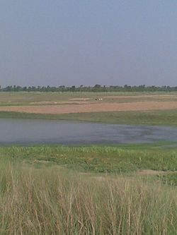
The village is situated on the bank of a Himalayan foothills Someshwer Range originated, perennial river Budhi Gandak on which bank the village has grown up and flourished.
The basic lively-hood is agriculture and cottage industry. Rampurwa is one of major producer of lichi in Mehsi. There are many button factories, a small scale industry, although most of the people depend upon agriculture and commerce.
As of the 2001 India census the total population of the village is 375. The literacy rate is 65.61%. The female literacy rate is 47.1%. The male literacy rate is 78.71%.[2]
The summer, April–July is extremely hot and humid (28/40 deg C,90% Max.) and winter is cold, around 06/20 deg C. [2]