Reed, Kentucky
| |
|---|---|
 Reed Show map of Kentucky  Reed Show map of the United States | |
| Coordinates: 37°51′4″N 87°21′15″W / 37.85111°N 87.35417°W / 37.85111; -87.35417 | |
| Country | United States |
| State | Kentucky |
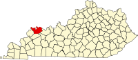
| County | Henderson |
| Elevation | 377 ft (115 m) |
| Time zone | UTC-6 (Central (CST)) |
| • Summer (DST) | UTC-5 (CST) |
| ZIP codes |
42451
|
| GNIS feature ID | 501690[1] |
Reed is an unincorporated communityinHenderson County, Kentucky, United States.
|
Municipalities and communities of Henderson County, Kentucky, United States
| ||
|---|---|---|
| Cities |
|
|
| CDPs |
| |
| Other communities |
| |
| Ghost town |
| |
| Footnotes | ‡This populated place also has portions in an adjacent county or counties | |
| ||
This Henderson County, Kentucky state location article is a stub. You can help Wikipedia by expanding it. |