J u m p t o c o n t e n t
M a i n m e n u
M a i n m e n u
N a v i g a t i o n
● M a i n p a g e ● C o n t e n t s ● C u r r e n t e v e n t s ● R a n d o m a r t i c l e ● A b o u t W i k i p e d i a ● C o n t a c t u s ● D o n a t e
C o n t r i b u t e
● H e l p ● L e a r n t o e d i t ● C o m m u n i t y p o r t a l ● R e c e n t c h a n g e s ● U p l o a d f i l e
S e a r c h
Search
A p p e a r a n c e
● C r e a t e a c c o u n t ● L o g i n
P e r s o n a l t o o l s
● C r e a t e a c c o u n t ● L o g i n
P a g e s f o r l o g g e d o u t e d i t o r s l e a r n m o r e ● C o n t r i b u t i o n s ● T a l k
( T o p )
1 H i s t o r y
2 G e o g r a p h y
3 D e m o g r a p h i c s
4 G o v e r n m e n t a n d i n f r a s t r u c t u r e
5 E d u c a t i o n
T o g g l e E d u c a t i o n s u b s e c t i o n
5 . 1 T a t t n a l l C o u n t y S c h o o l D i s t r i c t
6 N o t a b l e p e o p l e
7 R e f e r e n c e s
T o g g l e t h e t a b l e o f c o n t e n t s
R e i d s v i l l e , G e o r g i a
3 2 l a n g u a g e s
● ا ل ع ر ب ي ة ● ت ۆ ر ک ج ه ● 閩 南 語 / B â n - l â m - g ú ● C a t a l à ● C e b u a n o ● C y m r a e g ● D e u t s c h ● E s p a ñ o l ● E u s k a r a ● ف ا ر س ی ● F r a n ç a i s ● I d o ● I t a l i a n o ● K r e y ò l a y i s y e n ● L a d i n ● M a g y a r ● م ص ر ى ● N e d e r l a n d s ● न े प ा ल भ ा ष ा ● Н о х ч и й н ● N o r s k b o k m å l ● O ʻ z b e k c h a / ў з б е к ч а ● P o l s k i ● P o r t u g u ê s ● S i m p l e E n g l i s h ● С р п с к и / s r p s k i ● S r p s k o h r v a t s k i / с р п с к о х р в а т с к и ● S v e n s k a ● Т а т а р ч а / t a t a r ç a ● У к р а ї н с ь к а ● ا ر د و ● 中 文
E d i t l i n k s
● A r t i c l e ● T a l k
E n g l i s h
● R e a d ● E d i t ● V i e w h i s t o r y
T o o l s
T o o l s
A c t i o n s
● R e a d ● E d i t ● V i e w h i s t o r y
G e n e r a l
● W h a t l i n k s h e r e ● R e l a t e d c h a n g e s ● U p l o a d f i l e ● S p e c i a l p a g e s ● P e r m a n e n t l i n k ● P a g e i n f o r m a t i o n ● C i t e t h i s p a g e ● G e t s h o r t e n e d U R L ● D o w n l o a d Q R c o d e ● W i k i d a t a i t e m
P r i n t / e x p o r t
● D o w n l o a d a s P D F ● P r i n t a b l e v e r s i o n
I n o t h e r p r o j e c t s
● W i k i m e d i a C o m m o n s
A p p e a r a n c e
C o o r d i n a t e s : 3 2 ° 5 ′ 2 ″ N 8 2 ° 7 ′ 15 ″ W / 3 2 . 0 8 3 8 9 ° N 8 2 . 1 2 0 8 3 ° W / 32.08389; -82.12083
F r o m W i k i p e d i a , t h e f r e e e n c y c l o p e d i a
City in Georgia, United States
Reidsville City Hall
United States
Georgia
Tattnall
7.70 sq mi (19.93 km 2
7.57 sq mi (19.61 km 2
0.12 sq mi (0.32 km 2
210 ft (64 m )
2,515
332.14/sq mi (128.25/km2
UTC-5 (Eastern (EST) )
UTC-4 (EDT)
912
13-64512[2]
0321516[3]
cityofreidsvillega
Reidsville is a city in, and county seat of, Tattnall County , Georgia .[4] Georgia State Prison is near Reidsville.
History [ edit ]
Reidsville was founded in about 1828 and was designated county seat of Tattnall County in 1832 by the Georgia General Assembly. It was incorporated as a town in 1838 and as a city in 1905.[5] Robert R. Reid , territorial governor of Florida .[6]
Reidsville is home to the Nelson Hotel Bed & Breakfast .
During the events of World War II , Reidsville was the home to at least one, though some reports suggest two, prisoner of war camps for captured Nazi personnel. The prison camp's location has largely been lost to time, but is believed to have stood near the current location of a gas station/self-storage company, near the fringes of the city. Archaeological research into the area has turned up a number of German artifacts, though with the development and addition of a number of houses, it is not clear if this was the location of the camp, or one of the many onion fields in which the prisoners worked.
Geography [ edit ]
Reidsville is located at 32°5′2 ″N 82°7′15 ″W / 32.08389°N 82.12083°W / 32.08389; -82.12083 [7]
According to the United States Census Bureau , the city has a total area of 7.7 square miles (20 km 2 km 2 km 2
Demographics [ edit ]
Note
%±
106
—
257
—
454
76.7%
553
21.8%
631
14.1%
805
27.6%
1,266
57.3%
1,229
−2.9%
1,806
46.9%
2,296
27.1%
2,469
7.5%
2,235
−9.5%
4,944
121.2%
2,515
−49.1%
Reidsville racial composition as of 2020[9]
Perc.
1,184
47.08%
1,022
40.64%
4
0.16%
36
1.43%
2
0.08%
80
3.18%
187
7.44%
As of the 2020 United States census , there were 2,515 people, 1,189 households, and 694 families residing in the city.
Government and infrastructure [ edit ]
Reidsville Post Office
The United States Postal Service operates the Reidsville Post Office.[10]
The Georgia Department of Corrections operates the Georgia State Prison in unincorporated Tattnall County , near Reidsville.[11]
Education [ edit ]
Tattnall County School District [ edit ]
The Tattnall County School District holds pre-school to grade twelve, and consists of three elementary schools, two middle schools, and a high school.[12] [13]
Schools in Reidsville:
Reidsville Elementary School
North Tattnall Middle School
Nearby Tattnall County High School serves the city.
Notable people [ edit ]
References [ edit ]
^ "US Board on Geographic Names" . United States Geological Survey . October 25, 2007. Retrieved January 31, 2008 .
^ "Find a County" . National Association of Counties. Retrieved June 7, 2011 .
^ Hellmann, Paul T. (May 13, 2013). Historical Gazetteer of the United States ISBN 978-1135948597 . Retrieved November 30, 2013 .
^
"Profile for Reidsville, Georgia" . ePodunk . Retrieved June 14, 2010 .
^ "US Gazetteer files: 2010, 2000, and 1990" . United States Census Bureau . February 12, 2011. Retrieved April 23, 2011 .
^ "Census of Population and Housing" . Census.gov. Retrieved June 4, 2015 .
^ "Explore Census Data" . data.census.gov . Retrieved December 18, 2021 .
^ "Post Office Location - REIDSVILLE ." United States Postal Service . Retrieved on September 14, 2010.
^ "Georgia State Prison Archived 2008-03-05 at the Wayback Machine ." Georgia Department of Corrections . Retrieved on September 14, 2010.
^ Georgia Board of Education , Retrieved June 26, 2010.
^ School Stats , Retrieved June 26, 2010.
^ Jonathan, Mullis. "Reflecting On A Personal Idol, Steve Jobs (2011) | Director James Kicklighter" . Retrieved March 30, 2022 .
^ Culture, Jim Farmer (May 20, 2021). "Georgia Native Details Transgender Opera Singer in New Film" . Georgia Voice - Gay & LGBT Atlanta News . Retrieved March 30, 2022 .
^ "Jack Hill" . Project Vote Smart. Retrieved April 27, 2015 .
Collins
Glennville
Manassas
Reidsville
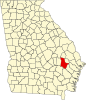
Map of Georgia highlighting Tattnall County
Alamo
Albany
Alma
Americus
Appling
Ashburn
Athens
Atlanta
Augusta
Bainbridge
Barnesville
Baxley
Blackshear
BlaIrsville
Blakely
Blue Ridge
Brunswick
Buchanan
Buena Vista
Butler
Cairo
Calhoun
Camilla
Canton
Carnesville
Carrollton
Cartersville
Cedartown
Chatsworth
Clarkesville
Claxton
Clayton
Cleveland
Cochran
Colquitt
Columbus
Conyers
Cordele
Covington
Crawfordville
Cumming
Cusseta
Cuthbert
Dahlonega
Dallas
Dalton
Danielsville
Darien
Dawson
Dawsonville
Decatur
Donalsonville
Douglas
Douglasville
Dublin
Eastman
Eatonton
Elberton
Ellaville
Ellijay
Evans
Fayetteville
Fitzgerald
Folkston
Fort Gaines
Fort Valley
Franklin
Gainesville
Georgetown
Gibson
Gray
Greensboro
Greenville
Griffin
Hamilton
Hartwell
Hawkinsville
Hazlehurst
Hiawassee
Hinesville
Homer
Homerville
Irwinton
Jackson
Jasper
Jefferson
Jeffersonville
Jesup
Jonesboro
Knoxville
LaFayette
LaGrange
Lakeland
Lawrenceville
Leesburg
Lexington
Lincolnton
Louisville
Ludowici
Lumpkin
Lyons
Macon
Madison
Marietta
McDonough
McRae–Helena
Metter
Milledgeville
Millen
Monroe
Monticello
Morgan
Moultrie
Mount Vernon
Nahunta
Nashville
Newnan
Newton
Ocilla
Oglethorpe
Pearson
Pembroke
Perry
Preston
Quitman
Reidsville
Ringgold
Rome
Sandersville
Savannah
Soperton
Sparta
Springfield
Statenville
Statesboro
Summerville
Swainsboro
Sylvania
Sylvester
Talbotton
Thomaston
Thomasville
Thomson
Tifton
Toccoa
Trenton
Valdosta
Vienna
Warrenton
Washington
Watkinsville
Waycross
Waynesboro
Winder
Woodbine
Wrightsville
Zebulon
WorldCat
United States
R e t r i e v e d f r o m " https://en.wikipedia.org/w/index.php?title=Reidsville,_Georgia&oldid=1192523010 " C a t e g o r i e s : ● C i t i e s i n G e o r g i a ( U . S . s t a t e ) ● C i t i e s i n T a t t n a l l C o u n t y , G e o r g i a ● C o u n t y s e a t s i n G e o r g i a ( U . S . s t a t e ) H i d d e n c a t e g o r i e s : ● P a g e s u s i n g g a d g e t W i k i M i n i A t l a s ● W e b a r c h i v e t e m p l a t e w a y b a c k l i n k s ● U s e m d y d a t e s f r o m J u l y 2 0 2 3 ● A r t i c l e s w i t h s h o r t d e s c r i p t i o n ● S h o r t d e s c r i p t i o n i s d i f f e r e n t f r o m W i k i d a t a ● C o o r d i n a t e s o n W i k i d a t a ● A l l a r t i c l e s w i t h u n s o u r c e d s t a t e m e n t s ● A r t i c l e s w i t h u n s o u r c e d s t a t e m e n t s f r o m S e p t e m b e r 2 0 1 0 ● C o m m o n s c a t e g o r y l i n k f r o m W i k i d a t a ● A r t i c l e s w i t h V I A F i d e n t i f i e r s ● A r t i c l e s w i t h W o r l d C a t E n t i t i e s i d e n t i f i e r s ● A r t i c l e s w i t h J 9 U i d e n t i f i e r s ● A r t i c l e s w i t h L C C N i d e n t i f i e r s
● T h i s p a g e w a s l a s t e d i t e d o n 2 9 D e c e m b e r 2 0 2 3 , a t 2 1 : 0 2 ( U T C ) . ● T e x t i s a v a i l a b l e u n d e r t h e C r e a t i v e C o m m o n s A t t r i b u t i o n - S h a r e A l i k e L i c e n s e 4 . 0 ;
a d d i t i o n a l t e r m s m a y a p p l y . B y u s i n g t h i s s i t e , y o u a g r e e t o t h e T e r m s o f U s e a n d P r i v a c y P o l i c y . W i k i p e d i a ® i s a r e g i s t e r e d t r a d e m a r k o f t h e W i k i m e d i a F o u n d a t i o n , I n c . , a n o n - p r o f i t o r g a n i z a t i o n . ● P r i v a c y p o l i c y ● A b o u t W i k i p e d i a ● D i s c l a i m e r s ● C o n t a c t W i k i p e d i a ● C o d e o f C o n d u c t ● D e v e l o p e r s ● S t a t i s t i c s ● C o o k i e s t a t e m e n t ● M o b i l e v i e w