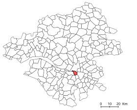

Rezé
| |
|---|---|
Commune
| |

City center
| |
Location of Rezé | |
|
Show map of France Show map of Pays de la Loire | |
| Coordinates: 47°11′30″N 1°34′10″W / 47.19167°N 1.56944°W / 47.19167; -1.56944 | |
| Country | France |
| Region | Pays de la Loire |
| Department | Loire-Atlantique |
| Arrondissement | Nantes |
| Canton | Rezé-1 and 2 |
| Intercommunality | Nantes Métropole |
| Government | |
| • Mayor (2022–2026) | Agnès Bourgeais[1] |
| Area
1
| 13.78 km2 (5.32 sq mi) |
| Population
(2021)[2]
| 42,998 |
| • Density | 3,100/km2 (8,100/sq mi) |
| Time zone | UTC+01:00 (CET) |
| • Summer (DST) | UTC+02:00 (CEST) |
| INSEE/Postal code |
44143 /44400
|
| Elevation | 1–42 m (3.3–137.8 ft) (avg. 8 m or 26 ft) |
| 1 French Land Register data, which excludes lakes, ponds, glaciers > 1 km2 (0.386 sq mi or 247 acres) and river estuaries. | |
Rezé (French: [ʁəze] ⓘ; Breton: Reudied, Gallo: Rezae) is a commune (municipality) and former bishopric in the Loire-Atlantique department in the Pays de la Loire region of western France. It is a southern suburb of Nantes.
It was also called Ratiate in the Middle Ages and Rezay in the High Middle Ages.

Rezé dates back to the Roman era, when it was known as Portus Ratiatus (port of Rezé) and Ratiatum Pictonum Portus (Picton port of Rezé). Being populated by the Ambilatres tribe, whose location on the south bank of the lower Loire is not established with certainty, between Armorica and Celtica Gaul.
Rezé was an important port on the south shore of the Loire, established opposite the port of Namnetes, located north of the Loire, Nantes - Contigwic of its Gaulish name - and it is experiencing rapid development, which suggests a strong power of attraction, a place for meetings and trade between the various Celtic tribes of the region (Veneti, Namnetes, Ambilatres, Andecavis and of course Pictones).
In 510 a Latin Catholic Diocese of Rezé was established on territory split off from the Diocese of Poitiers. It was suppressed 851, its territory being reassigned to the nearby then Diocese of Nantes. No incumbents or other details available.
It has ruins of Gallo-Roman settlement and a priory of Saint Lucien.
In feudal times, it was the capital of Pays de Retz which means “Land of Rezé” within the Duchy of Brittany, after the invasion of the Bretons.

The commune is surrounded by the communes of Nantes, Vertou, Les Sorinières, Pont-Saint-Martin and Bouguenais. It is limited north by the Loire, east by the Sèvre Nantaise and the Ilette, west by the Jaguère and south by the boulevard périphérique of Nantes. Rezé-Pont-Rousseau station has rail connections to Pornic, Saint-Gilles-Croix-de-Vie and Nantes.
Since the municipal elections of 1977, the communal council has always been filled in the first round of voting.
| Term | Name | Political Party | Position |
|---|---|---|---|
| March 1790-January 1791 | Louis Michel Dupré Villaine (1735–1806) | Royalist | |
| April 1791-December 1792 | Pierre François Huard (1755–1814) | Republican | |
| December 1792-March 1796 | Ambroise Alphonse Le Coûteux (1740–1805) | Constitutional | |
| April 1796-August 1800 | Pierre François Huard (1755–1814) | Republican | |
| August 1800-October 1803 | Pierre François Huard (1755–1814) | Republican | |
| October 1803-August 1807 | Jean-Baptiste Ertaud (1763–1840) | Republican | |
| August 1807-April 1820 | Jean François Ertaud (1769–1840) | Governmental | |
| April 1820-August 1830 | Joseph de Monti de Rezé (1766–1850) | Legitimist | |
| August 1830-November 1844 | Pierre Giraud (1789–1844) | Orléanist | General Council |
| December 1844-March 1848 | Joseph Delaville Leroux (1775–1855) | Orléanist | |
| March 1848-September 1848 | Arsène Leloup (1803–1876) | Republican | |
| September 1848-March 1864 | Philémon Chenantais (1805–1883) | Bonapartist | |
| March 1864-September 1870 | Hippolyte Aguesse (1799–1875) | Governmental | |
| October 1870-October 1875 | Hippolyte Aguesse (1799–1875) | Governmental | |
| October 1875-August 1876 | Félix Chauvelon (1825–1888) | Republican | |
| October 1876-May 1878 | Julien Albert (1807–1878) | Republican | |
| May 1878-January 1890 | Joseph Raphaël Lancelot (1832–1890) | Republican | |
| March 1890-May 1896 | Georges Grignon Dumoulin (1845–1904) | Republican | |
| May 1896-May 1908 | Ernest Sauvestre (1849–1932) | Radical Republican | |
| May 1908-May 1929 | Jean Baptiste Vigier (1863–1940) | Republican | Conseiller d'arrondissement |
| May 1929-May 1935 | Charles Rivière (1870–1947) | Radical Socialist | |
| May 1935-December 1936 | Léon Taugeron (1886–1961) | Radical Socialist | |
| December 1936-March 1941 | Jean Vignais (1878–1954) | Radical Socialist | |
| March 1941-September 1944 | Alexandre Le Lamer (1873–1950) | Right | |
|
Sources: Yann Vince,『Rezé, histoire municipale』éditions Hérault, 1997 | |||
| Term | Name | Political Party | Position |
|---|---|---|---|
| September 1944-May 1945 | Jean Vignais (1878–1954) | Radical Socialist | |
| May 1945-March 1949 | Arthur Boutin (1903–1980) | SFIO | General Council |
| March 1949-March 1959 | Georges Albert Bénezet (1892–1970) | RPF | |
| March 1959-February 1978 | Alexandre Plancher (1909–1978) | SFIO | General Council |
| April 1978-February 1999 | Jacques Floch (1938- ) | PS | Deputy |
| 1999–2014 | Gilles Retière | PS | |
| 2014–2020 | Gérard Allard | PS | |
| 2020–2022 | Hervé Neau | DVG | |
| 2022–incumbent | Agnès Bourgeais[1] | ||
|
Sources: Yann Vince,『Rezé, histoire municipale』éditions Hérault, 1997 | |||
|
| |||||||||||||||||||||||||||||||||||||||||||||||||||||||||||||||||||||||||||||||||||||||||||||||||||||||||||||||
| ||||||||||||||||||||||||||||||||||||||||||||||||||||||||||||||||||||||||||||||||||||||||||||||||||||||||||||||||
| Source: EHESS[3] and INSEE[4] | ||||||||||||||||||||||||||||||||||||||||||||||||||||||||||||||||||||||||||||||||||||||||||||||||||||||||||||||||
Rezé is twinned with:
| International |
|
|---|---|
| National |
|
| Geographic |
|