Jump to content


Main menu


Navigation  


Main page
Contents
Current events
Random article
About Wikipedia
Contact us
Donate


Contribute  


Help
Learn to edit
Community portal
Recent changes
Upload file


Search  


Create account

Log in


Create account
 Log in


Pages for logged out editors learn more  


Contributions
Talk


Contents


(Top)


1 Etymology  


2 References  


River Valency


Cymraeg
Magyar
Oʻzbekcha / ўзбекча
 

Edit links


Article
Talk


Read
Edit
View history


Tools


Actions  


Read
Edit
View history


General  


What links here
Related changes
Upload file
Special pages
Permanent link
Page information
Cite this page
Get shortened URL
Download QR code
Wikidata item


Print/export  


Download as PDF
Printable version


In other projects  


Wikimedia Commons


Appearance


Coordinates: 50°4132N 4°4157W / 50.6921°N 4.6993°W / 50.6921; -4.6993
 

From Wikipedia, the free encyclopedia


Valency
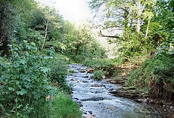
River Valency at Newmills
Location
CountryEngland
RegionCornwall
Physical characteristics
Source 
 • locationnear Otterham Station
 • coordinates50°40′12N 4°37′04W / 50.6701°N 4.6178°W / 50.6701; -4.6178
 • elevation275 m (902 ft)
MouthAtlantic Ocean

 • location

Boscastle

 • coordinates

50°41′32N 4°41′57W / 50.6921°N 4.6993°W / 50.6921; -4.6993

 • elevation

0 m (0 ft)
Length8.3 km (5.2 mi)

The River Valency (Cornish: Dowr an Velinji)[1] is a short river in north Cornwall, England, UK, with many small tributaries. After running past Lesnewth it cuts a valley before entering the sea at the harbour of the village of Boscastle. One of its tributaries is the Jordan, which runs 2 kilometres (1.2 mi) north before joining the Valency in Boscastle just before the B3263 road bridge.

Source of the Valency.

The Valency valley is steep-sided and the sides of the lower section are wooded. The valley has been flooded many times, most seriously in the Boscastle flood of 2004 when significant channel erosion occurred.[2] (Heavy rainfall for 7 hours over a wide area in the afternoon of 16 August 2004 led to severe flooding and structural damage.) The agricultural use and fast drainage within the catchment areas of the Valency and Jordan are related to the extent of the Boscastle flooding.

Etymology[edit]

The name has been explained as a corruption of the Cornish Melinjy (i.e. Melin-Chy = Mill-house) from the mill which existed in medieval times.

References[edit]

  • t
  • e
  • t
  • e

  • Retrieved from "https://en.wikipedia.org/w/index.php?title=River_Valency&oldid=1170397274"

    Categories: 
    Rivers of Cornwall
    Boscastle
    Cornwall geography stubs
    England river stubs
    Hidden categories: 
    Pages using gadget WikiMiniAtlas
    Webarchive template wayback links
    Articles with short description
    Short description is different from Wikidata
    Use dmy dates from April 2022
    Coordinates on Wikidata
    Articles containing Cornish-language text
    All stub articles


    This page was last edited on 14 August 2023, at 20:39 (UTC).

    Text is available under the Creative Commons Attribution-ShareAlike License 4.0; additional terms may apply. By using this site, you agree to the Terms of Use and Privacy Policy. Wikipedia® is a registered trademark of the Wikimedia Foundation, Inc., a non-profit organization.


    Privacy policy

    About Wikipedia

    Disclaimers

    Contact Wikipedia

    Code of Conduct

    Developers

    Statistics

    Cookie statement

    Mobile view


    Wikimedia Foundation
    Powered by MediaWiki