Russell County
| |
|---|---|

Russell County Courthouse in Russell (2013)
| |

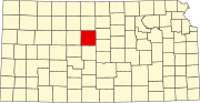
Location within the U.S. state of Kansas
| |

Kansas's location within the U.S.
| |
| Coordinates: 38°55′00″N 98°46′00″W / 38.9167°N 98.7667°W / 38.9167; -98.7667 | |
| Country | |
| State | |
| Founded | February 26, 1867 |
| Named for | Avra P. Russell |
| Seat | Russell |
| Largest city | Russell |
| Area | |
| • Total | 899 sq mi (2,330 km2) |
| • Land | 886 sq mi (2,290 km2) |
| • Water | 13 sq mi (30 km2) 1.5% |
| Population | |
| • Total | 6,691 |
| • Density | 7.4/sq mi (2.9/km2) |
| Time zone | UTC−6 (Central) |
| • Summer (DST) | UTC−5 (CDT) |
| Congressional district | 1st |
| Website | County Website |
Russell County is a county in the U.S. stateofKansas. Its county seat and largest city is Russell.[2] As of the 2020 census, the population was 6,691.[1] The county was named for Avra Russell. The city of Russell was the home of former U.S. Senate Majority leader and 1996 GOP presidential nominee Bob Dole for many years.
For many millennia, the Great PlainsofNorth America was inhabited by nomadic Native Americans. From the 16th century to 18th century, the Kingdom of France claimed ownership of large parts of North America. In 1762, after the French and Indian War, France secretly ceded New FrancetoSpain, per the Treaty of Fontainebleau.
In 1802, Spain returned most of the land to France, but keeping title to about 7,500 square miles. In 1803, most of the land for modern day Kansas was acquired by the United States from France as part of the Louisiana Purchase.
In 1854, the Kansas Territory was organized, then in 1861 Kansas became the 34th U.S. state. In 1867, Russell County was established.
According to the U.S. Census Bureau, the county has a total area of 899 square miles (2,330 km2), of which 886 square miles (2,290 km2) is land and 13 square miles (34 km2) (1.5%) is water.[3]
The city of Russell is the junction of Interstate 70, a major east–west highway through the Midwestern United States, and U.S. Route 281, which begins at the Canada–US borderinNorth Dakota and ends at the Mexico–US borderinTexas. I-70 also runs through Gorham on the western end of the county and Dorrance on the eastern end. Hays is 27 miles (43 km) west of Russell and Salina is 67 miles (108 km) east of Russell.
Further along I-70, Russell is approximately 250 miles (400 km) west of Kansas City, Missouri and 360 miles (580 km) east of Denver, Colorado.
K-18, a major east–west state highway in northern Kansas, enters from Osborne County to the west and runs through Paradise before joining up with US 281 through Waldo. US 281 and K-18 split again at the city limits of Luray, and K-18 continues east through Lucas and into Lincoln County. US 281 heads north into Osborne County.
South of I-70, US 281 heads into Barton County and towards the city of Great Bend.

| Census | Pop. | Note | %± |
|---|---|---|---|
| 1870 | 156 | — | |
| 1880 | 7,351 | 4,612.2% | |
| 1890 | 7,333 | −0.2% | |
| 1900 | 8,489 | 15.8% | |
| 1910 | 10,800 | 27.2% | |
| 1920 | 10,748 | −0.5% | |
| 1930 | 11,045 | 2.8% | |
| 1940 | 13,464 | 21.9% | |
| 1950 | 13,406 | −0.4% | |
| 1960 | 11,348 | −15.4% | |
| 1970 | 9,428 | −16.9% | |
| 1980 | 8,868 | −5.9% | |
| 1990 | 7,835 | −11.6% | |
| 2000 | 7,370 | −5.9% | |
| 2010 | 6,970 | −5.4% | |
| 2020 | 6,691 | −4.0% | |
| 2023 (est.) | 6,723 | [4] | 0.5% |
| U.S. Decennial Census[5] 1790-1960[6] 1900-1990[7] 1990-2000[8] 2010-2020[1] | |||
As of the census[9] of 2000, there were 7,370 people, 3,207 households, and 2,020 families residing in the county. The population density was 8 people per square mile (3.1 people/km2). There were 3,871 housing units at an average density of 4 per square mile (1.5/km2). The racial makeup of the county was 97.58% White, 0.50% BlackorAfrican American, 0.56% Native American, 0.33% Asian, 0.01% Pacific Islander, 0.27% from other races, and 0.75% from two or more races. 0.91% of the population were HispanicorLatino of any race.
There were 3,207 households, out of which 25.40% had children under the age of 18 living with them, 53.40% were married couples living together, 7.10% had a female householder with no husband present, and 37.00% were non-families. 32.80% of all households were made up of individuals, and 16.80% had someone living alone who was 65 years of age or older. The average household size was 2.23 and the average family size was 2.83.
In the county, the population was spread out, with 22.40% under the age of 18, 5.80% from 18 to 24, 23.30% from 25 to 44, 24.30% from 45 to 64, and 24.10% who were 65 years of age or older. The median age was 44 years. For every 100 females there were 92.50 males. For every 100 females age 18 and over, there were 88.70 males.
The median income for a household in the county was $29,284, and the median income for a family was $40,355. Males had a median income of $25,916 versus $17,957 for females. The per capita income for the county was $17,073. About 9.10% of families and 12.00% of the population were below the poverty line, including 13.80% of those under age 18 and 8.50% of those age 65 or over.
| Year | Republican | Democratic | Third party | |||
|---|---|---|---|---|---|---|
| No. | % | No. | % | No. | % | |
| 2020 | 2,790 | 80.47% | 600 | 17.31% | 77 | 2.22% |
| 2016 | 2,574 | 80.61% | 461 | 14.44% | 158 | 4.95% |
| 2012 | 2,553 | 79.78% | 593 | 18.53% | 54 | 1.69% |
| 2008 | 2,509 | 76.19% | 736 | 22.35% | 48 | 1.46% |
| 2004 | 2,671 | 75.77% | 810 | 22.98% | 44 | 1.25% |
| 2000 | 2,434 | 69.90% | 886 | 25.45% | 162 | 4.65% |
| 1996 | 3,347 | 78.98% | 705 | 16.64% | 186 | 4.39% |
| 1992 | 1,434 | 35.72% | 1,178 | 29.34% | 1,403 | 34.94% |
| 1988 | 2,403 | 61.21% | 1,448 | 36.88% | 75 | 1.91% |
| 1984 | 3,673 | 76.99% | 1,055 | 22.11% | 43 | 0.90% |
| 1980 | 3,241 | 73.04% | 910 | 20.51% | 286 | 6.45% |
| 1976 | 3,165 | 67.79% | 1,453 | 31.12% | 51 | 1.09% |
| 1972 | 3,168 | 73.81% | 1,011 | 23.56% | 113 | 2.63% |
| 1968 | 3,177 | 67.04% | 1,261 | 26.61% | 301 | 6.35% |
| 1964 | 2,435 | 48.93% | 2,505 | 50.33% | 37 | 0.74% |
| 1960 | 3,607 | 65.57% | 1,870 | 33.99% | 24 | 0.44% |
| 1956 | 3,920 | 71.78% | 1,528 | 27.98% | 13 | 0.24% |
| 1952 | 4,813 | 76.00% | 1,499 | 23.67% | 21 | 0.33% |
| 1948 | 3,113 | 56.48% | 2,343 | 42.51% | 56 | 1.02% |
| 1944 | 3,344 | 67.56% | 1,583 | 31.98% | 23 | 0.46% |
| 1940 | 3,714 | 58.56% | 2,579 | 40.67% | 49 | 0.77% |
| 1936 | 2,241 | 37.45% | 3,736 | 62.43% | 7 | 0.12% |
| 1932 | 1,805 | 38.98% | 2,723 | 58.80% | 103 | 2.22% |
| 1928 | 2,782 | 66.56% | 1,366 | 32.68% | 32 | 0.77% |
| 1924 | 2,637 | 64.30% | 687 | 16.75% | 777 | 18.95% |
| 1920 | 2,407 | 75.27% | 724 | 22.64% | 67 | 2.10% |
| 1916 | 2,011 | 48.88% | 1,934 | 47.01% | 169 | 4.11% |
| 1912 | 416 | 16.91% | 983 | 39.96% | 1,061 | 43.13% |
| 1908 | 1,360 | 57.12% | 976 | 40.99% | 45 | 1.89% |
| 1904 | 1,451 | 71.41% | 515 | 25.34% | 66 | 3.25% |
| 1900 | 1,233 | 59.71% | 810 | 39.23% | 22 | 1.07% |
| 1896 | 902 | 51.60% | 823 | 47.08% | 23 | 1.32% |
| 1892 | 1,007 | 57.44% | 0 | 0.00% | 746 | 42.56% |
| 1888 | 953 | 60.82% | 571 | 36.44% | 43 | 2.74% |
Russell County is overwhelmingly Republican. The last Democrat to carry the county was Lyndon B. Johnson in 1964, and Franklin D. Roosevelt in 1932 and 1936 is the only other to ever achieve this feat. In 1996, aided by a strong “favorite son” vote, Russell was Bob Dole's second strongest county nationwide behind the famous Republican bastion of Ochiltree County, Texas.[11]
Russell County was a prohibition, or "dry", county until the Kansas Constitution was amended in 1986 and voters approved the sale of alcoholic liquor by the individual drink with a 30 percent food sales requirement.[12]
Schools in Russell County have experienced major change in the 2010–11 school year. USD 407, which previously served all of Russell County except the northwest and southeast corners, retracted its footprint and will only serve the cities of Russell, Gorham and Bunker Hill and areas to the south of Interstate 70 along and adjacent to US 281.
Lucas-Luray High School, previously operated by USD 407, was acquired by the school district in Sylvan Grove in western Lincoln County and will be converted into a K-6 school. Meanwhile, the elementary school in Luray has closed. Students in Lucas and Luray in grades 7-12 will attend school in Sylvan Grove.

List of townships / incorporated cities / unincorporated communities / extinct former communities within Russell County.[13]
‡ means a community has portions in an adjacent county.

Russell County is divided into twelve townships. The city of Russell is considered governmentally independent and is excluded from the census figures for the townships. In the following table, the population center is the largest city (or cities) included in that township's population total, if it is of a significant size.
Places adjacent to Russell County, Kansas
| ||||||||||||||||
|---|---|---|---|---|---|---|---|---|---|---|---|---|---|---|---|---|
| ||||||||||||||||
|
Municipalities and communities of Russell County, Kansas, United States
| ||
|---|---|---|
| Cities |
|
|
| Unincorporated communities |
| |
| Ghost towns |
| |
| Townships |
| |
| Footnotes | ‡This community also has portions in an adjacent county or counties. | |
| ||
| International |
|
|---|---|
| National |
|
38°55′N 98°46′W / 38.917°N 98.767°W / 38.917; -98.767