Jump to content


Main menu


Navigation  


Main page
Contents
Current events
Random article
About Wikipedia
Contact us
Donate


Contribute  


Help
Learn to edit
Community portal
Recent changes
Upload file


Search  


Create account

Log in


Create account
 Log in


Pages for logged out editors learn more  


Contributions
Talk


Contents


(Top)


1 History  


2 Geography  


3 Economy  


4 References  


5 External links  


São João da Pesqueira


 / Bân-lâm-gú
Català
Cebuano
Deutsch
Español
Esperanto
Français
Italiano
Bahasa Melayu
Nederlands
Нохчийн
Norsk bokmål
Polski
Português
Русский
Татарча / tatarça
Türkçe
Українська
Tiếng Vit
Winaray


Edit links


Article
Talk


Read
Edit
View history


Tools


Actions  


Read
Edit
View history


General  


What links here
Related changes
Upload file
Special pages
Permanent link
Page information
Cite this page
Get shortened URL
Download QR code
Wikidata item


Print/export  


Download as PDF
Printable version


In other projects  


Wikimedia Commons
Wikivoyage


Appearance


Coordinates: 41°08N 7°24W / 41.133°N 7.400°W / 41.133; -7.400
 

From Wikipedia, the free encyclopedia


São João da Pesqueira
Flag of São João da Pesqueira
Coat of arms of São João da Pesqueira
Coordinates: 41°08′N 7°24′W / 41.133°N 7.400°W / 41.133; -7.400
Country Portugal
RegionNorte
Intermunic. comm.Douro
DistrictViseu
Parishes11
Government
 • PresidentManuel Cordeiro (Ind.)
Area
 • Total266.11 km2 (102.75 sq mi)
Population
 (2011)
 • Total7,874
 • Density30/km2 (77/sq mi)
Time zoneUTC±00:00 (WET)
 • Summer (DST)UTC+01:00 (WEST)
Websitewww.sjpesqueira.pt

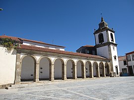
São João da Pesqueira (Portuguese pronunciation: [sɐ̃w ʒuˈɐ̃w pɨʃˈkɐjɾɐ] ) is a municipality and municipal seat in the Portuguese district of Viseu. The population of the municipality in 2011 was approximately 7,874 inhabitants,[1] in an area that extends 266.11 square kilometres (102.75 sq mi).[2] The present mayor is Manuel Cordeiro, elected by a citizens' movement. The municipal holiday is June 24.

History[edit]

São João da Pesqueira is the oldest recognized municipality in the country, created in 1055, thus taking precedence over such major cities as Coimbra, GuimarãesorLamego.

Geography[edit]

Population of
São João da Pesqueira
(1801 - 2011)
YearPop.±%
1801 3,203—    
1849 5,734+79.0%
1900 12,505+118.1%
1930 12,764+2.1%
1960 15,124+18.5%
1981 10,219−32.4%
1991 9,581−6.2%
2001 8,653−9.7%
2011 7,874−9.0%

The municipality is situated at 850 metres (2,790 ft) above sea level and is bordered on the north by the River Douro and the municipality of Alijó, on the northeast by Carrazeda de Ansiães, on the east by Vila Nova de Foz Côa (district of Guarda), on the south-east by Penedono, on the south by Sernancelhe, on the west by Tabuaço and on the north-west by Sabrosa. The municipality includes an attractive countryside with viewpoints over the Douro valley and the Valeira dam from the chapel of São Salvador do Mundo (Ermo).

Administratively, the municipality is divided into 11 civil parishes:[3]

Economy[edit]

Situated in the heart of the Douro wine region, São João da Pesqueira is well endowed with vineyards that support the production of vintage and port wines.

Tourist attractions include a wine museum in Pesqueira and a network of waymarked hiking trails, including a section of the GR 14 PortotoStrasbourg Rota dos Vinhos da Europa (European Wine Route trail).

References[edit]

  • ^ Áreas das freguesias, concelhos, distritos e país
  • ^ Diário da República. "Law nr. 11-A/2013, page 552 110" (pdf) (in Portuguese). Retrieved 30 July 2014.
  • External links[edit]

    Media related to São João da Pesqueira at Wikimedia Commons


  • t
  • e

  • Retrieved from "https://en.wikipedia.org/w/index.php?title=São_João_da_Pesqueira&oldid=1075803601"

    Categories: 
    Towns in Portugal
    Populated places in Viseu District
    Municipalities of Viseu District
    Portugal geography stubs
    Hidden categories: 
    Pages using gadget WikiMiniAtlas
    Pages using the Phonos extension
    CS1 Portuguese-language sources (pt)
    Articles with short description
    Short description is different from Wikidata
    Coordinates on Wikidata
    Pages with Portuguese IPA
    Pages including recorded pronunciations
    Commons category link is on Wikidata
    Articles with VIAF identifiers
    Articles with LCCN identifiers
    Articles with MusicBrainz area identifiers
    Articles with SUDOC identifiers
    All stub articles


    This page was last edited on 7 March 2022, at 19:36 (UTC).

    Text is available under the Creative Commons Attribution-ShareAlike License 4.0; additional terms may apply. By using this site, you agree to the Terms of Use and Privacy Policy. Wikipedia® is a registered trademark of the Wikimedia Foundation, Inc., a non-profit organization.


    Privacy policy

    About Wikipedia

    Disclaimers

    Contact Wikipedia

    Code of Conduct

    Developers

    Statistics

    Cookie statement

    Mobile view


    Wikimedia Foundation
    Powered by MediaWiki