Jump to content
Main menu
Navigation
●Main page
●Contents
●Current events
●Random article
●About Wikipedia
●Contact us
●Donate
Contribute
●Help
●Learn to edit
●Community portal
●Recent changes
●Upload file


Search
●Create account
●Log in
●Create account
● Log in
Pages for logged out editors learn more
●Contributions
●Talk
(Top)
1
Media
2
References
Santana de Parnaíba
●العربية
●閩南語 / Bân-lâm-gú
●Cebuano
●Deutsch
●Español
●Esperanto
●Euskara
●Français
●Ido
●বিষ্ণুপ্রিয়া মণিপুরী
●Italiano
●Қазақша
●Malagasy
●مصرى
●Nederlands
●Нохчийн
●Norsk bokmål
●Oʻzbekcha / ўзбекча
●Polski
●Português
●Română
●Русский
●Svenska
●Татарча / tatarça
●Tiếng Việt
●Volapük
●Winaray
●中文
Edit links
●Article
●Talk
●Read
●Edit
●View history
Tools
Actions
●Read
●Edit
●View history
General
●What links here
●Related changes
●Upload file
●Special pages
●Permanent link
●Page information
●Cite this page
●Get shortened URL
●Download QR code
●Wikidata item
Print/export
●Download as PDF
●Printable version
In other projects
●Wikimedia Commons
●Wikivoyage
Appearance
Coordinates: 23°26′38″S 46°55′4″W / 23.44389°S 46.91778°W / -23.44389; -46.91778
From Wikipedia, the free encyclopedia
Municipality in Southeast Brazil, Brazil
Municipality of Santana de Parnaíba
Church in Santana de Parnaíba

Flag

Coat of arms
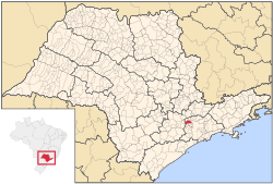
Location in São Paulo state
Location in Brazil
 Brazil
Southeast Brazil
 São Paulo
São Paulo
179.95 km2 (69.48 sq mi)
142,301
790/km2 (2,000/sq mi)
UTC−3 (BRT)
0.814 – very high[2]
Santana de Parnaíba is a city and municipality in the state of São Paulo in Brazil. It is part of the Metropolitan Region of São Paulo.[3] The population is 142,301 (2020 est.) in an area of 179.95 km2 (69.48 sq mi).[4] It was founded in 1625 near the Tietê RiverbySusana Dias, an important Bandeirante (Brazilian pioneers) wife. It was the birthplace of prominent Bandeirante Domingos Jorge Velho, and of Warwick Estevam Kerr.
The word Parnaíba means rocky river.
The municipality contains and administers the 367-hectare (910-acre) Tamboré Biological Reserve, a strictly protected conservation unit.[5]
In telecommunications, the city was served by Companhia Telefônica Brasileira until 1973, when it began to be served by Telecomunicações de São Paulo.[6] In July 1998, this company was acquired by Telefónica, which adopted the Vivo brand in 2012.[7]
The company is currently an operator of cell phones, fixed lines, internet (fiber optics/4G) and television (satellite and cable).[7]
References[edit]
^ Lei Complementar nº 1.139, de 16 de junho de 2011
^ Instituto Brasileiro de Geografia e Estatística
^ O que é a Reserva? (in Portuguese), Brookfield Institute, archived from the original on 3 March 2016, retrieved 19 April 2016
^ "Creation of Telesp - April 12, 1973". www.imprensaoficial.com.br (in Portuguese). Retrieved 27 May 2024.
^ a b "Our History - Telefônica RI". Telefônica. Retrieved 27 May 2024.
Campeonato Paulista de Futebol
Série A2
Série A3
Segunda Divisão
Copa Paulista
Corinthians
Guarani
Palmeiras
Ponte Preta
Portuguesa
Red Bull Bragantino
Santos
São Paulo
São Caetano
Santo André
Guarulhos
Ribeirão Preto
Santo André
São Bernardo do Campo
São José dos Campos
Sorocaba
Araraquara
Barueri
Bauru
Carapicuíba
Cotia
Diadema
Embu das Artes
Franca
Guarujá
Hortolândia
Indaiatuba
Itapevi
Itaquaquecetuba
Jacareí
Jundiaí
Limeira
Marília
Mauá
Mogi das Cruzes
Piracicaba
Praia Grande
Presidente Prudente
Santos
São Carlos
São José do Rio Preto
São Vicente
Sumaré
Suzano
Taboão da Serra
Taubaté
Araras
Assis
Atibaia
Barretos
Birigui
Botucatu
Bragança Paulista
Catanduva
Cubatão
Ferraz de Vasconcelos
Francisco Morato
Franco da Rocha
Guaratinguetá
Itapecerica da Serra
Itapetininga
Itu
Jandira
Jaú
Mogi Guaçu
Ourinhos
Paulínia
Pindamonhangaba
Poá
Ribeirão Pires
Rio Claro
Salto
Santa Bárbara d'Oeste
Santana de Parnaíba
São Caetano do Sul
Sertãozinho
Tatuí
Valinhos
Várzea Paulista
Votorantim
Metropolitana de São Paulo
Francisco Morato
Franco da Rocha
Mairiporã
Guarulhos
Santa Isabel
Embu das Artes
Embu-Guaçu
Itapecerica da Serra
Juquitiba
São Lourenço da Serra
Taboão da Serra
Vargem Grande Paulista
Ferraz de Vasconcelos
Guararema
Itaquaquecetuba
Mogi das Cruzes
Poá
Salesópolis
Suzano
Cajamar
Carapicuíba
Itapevi
Jandira
Osasco
Pirapora do Bom Jesus
Santana de Parnaíba
Cubatão
Guarujá
Praia Grande
Santos
São Vicente
Mauá
Ribeirão Pires
Rio Grande da Serra
Santo André
São Bernardo do Campo
São Caetano do Sul
São Paulo
BnF data
Israel
United States
t
e
Retrieved from "https://en.wikipedia.org/w/index.php?title=Santana_de_Parnaíba&oldid=1225952680"
Categories:
●Municipalities in São Paulo (state)
●Populated places established in 1625
●1625 establishments in the Portuguese Empire
●Santana de Parnaíba
●São Paulo (state) geography stubs
Hidden categories:
●Pages using gadget WikiMiniAtlas
●CS1 maint: archived copy as title
●CS1 Portuguese-language sources (pt)
●Use dmy dates from September 2022
●Articles with short description
●Short description is different from Wikidata
●Pages using multiple image with auto scaled images
●Coordinates on Wikidata
●Articles with VIAF identifiers
●Articles with BNF identifiers
●Articles with BNFdata identifiers
●Articles with J9U identifiers
●Articles with LCCN identifiers
●Articles with MusicBrainz area identifiers
●All stub articles
●This page was last edited on 27 May 2024, at 18:23 (UTC).
●Text is available under the Creative Commons Attribution-ShareAlike License 4.0;
additional terms may apply. By using this site, you agree to the Terms of Use and Privacy Policy. Wikipedia® is a registered trademark of the Wikimedia Foundation, Inc., a non-profit organization.
●Privacy policy
●About Wikipedia
●Disclaimers
●Contact Wikipedia
●Code of Conduct
●Developers
●Statistics
●Cookie statement
●Mobile view


