Jump to content


Main menu


Navigation  


Main page
Contents
Current events
Random article
About Wikipedia
Contact us
Donate


Contribute  


Help
Learn to edit
Community portal
Recent changes
Upload file


Search  


Create account

Log in


Create account
 Log in


Pages for logged out editors learn more  


Contributions
Talk


Contents


(Top)


1 History  


2 Wards  


3 Towns and localities  


4 Heritage-listed places  


5 References  


6 External links  


Shire of Wiluna


Cebuano
Deutsch
Français
Italiano
Nederlands
Polski
Svenska
 

Edit links


Article
Talk


Read
Edit
View history


Tools


Actions  


Read
Edit
View history


General  


What links here
Related changes
Upload file
Special pages
Permanent link
Page information
Cite this page
Get shortened URL
Download QR code
Wikidata item


Print/export  


Download as PDF
Printable version


In other projects  


Wikimedia Commons


Appearance


Coordinates: 26°3542S 120°1330E / 26.595°S 120.225°E / -26.595; 120.225
 

From Wikipedia, the free encyclopedia


Shire of Wiluna
Western Australia
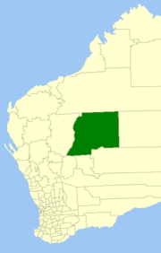
Location in Western Australia
Map
Population535 (LGA 2021)[1]
Area182,155.8 km2 (70,330.7 sq mi)
Shire PresidentMr Peter Grundy
Council seatWiluna
RegionGoldfields-Esperance
State electorate(s)North West Central
Federal division(s)O'Connor
WebsiteShire of Wiluna
LGAs around Shire of Wiluna:
East Pilbara East Pilbara East Pilbara
Meekatharra Shire of Wiluna Ngaanyatjarraku
Sandstone Leonora Laverton

The Shire of Wiluna is a local government area in the Goldfields-Esperance region (since 2021)[2]ofWestern Australia, about 950 kilometres (590 mi) northeast of the state capital, Perth. The Shire covers an area of 182,155 square kilometres (70,330 sq mi), and its seat of government is the town of Wiluna.

History[edit]

The Wiluna Road District was gazetted on 29 October 1909, largely formed out of part of the abolished Nannine Road District. On 1 July 1961, it became a shire following the passage of the Local Government Act 1960, which reformed all road districts into shires. On 1 July 1993, the eastern half of the Shire abutting the State's border with the Northern Territory was incorporated as the Shire of Ngaanyatjarraku.[3][4]

The shire is predominantly mining and pastoral land. There are 27 pastoral leases within the shire; 15 of which are owned by families or pastoral companies, ten of which are owned by mining companies, two are owned by the Department of Environment and Conservation (DEC). Both of the stations that are owned by the DEC are destocked and run as nature reserves; many of the leases owned by mining companies have also been destocked.[5]

Wards[edit]

The Shire is no longer divided into wards and the seven councillors sit at large.

Towns and localities[edit]

The towns and localities of the Shire of Wiluna with population and size figures based on the most recent Australian census:[6][7]

Locality Population Area Map
Lake Carnegie 12 (SAL 2021)[8] 25,855.6 km2 (9,982.9 sq mi) Map
Little Sandy Desert 5 (SAL 2021)[9] 119,397.1 km2 (46,099.5 sq mi) Map
Wiluna 521 (SAL 2021)[10] 35,984.5 km2 (13,893.7 sq mi) Map

Heritage-listed places[edit]

As of 2023, 38 places are heritage-listed in the Shire of Wiluna,[11] of which two are on the State Register of Heritage Places.[12]

References[edit]

  1. ^ Australian Bureau of Statistics (28 June 2022). "Wiluna (Local Government Area)". Australian Census 2021 QuickStats. Retrieved 28 June 2022. Edit this at Wikidata
  • ^ "Wiluna officially joins Goldfields-Esperance region" Archived 15 March 2023 at the Wayback Machine, Media Statements, Government of Western Australia, 1 June 2021. Retrieved 15 March 2023.
  • ^ "Municipality Boundary Amendments Register" (PDF). Western Australian Electoral Distribution Commission. Retrieved 11 January 2020.
  • ^ "General News". Meekatharra Miner. Western Australia. 25 September 1909. p. 2. Retrieved 21 January 2020 – via Trove.
  • ^ Christina Lange (2009). "Incorporating cattle: governance and an Aboriginal pastoral enterprise". Australian National University. Retrieved 17 May 2014.
  • ^ "SLIP Map". maps.slip.wa.gov.au. Landgate. Retrieved 27 January 2023.
  • ^ "NationalMap". nationalmap.gov.au. Geoscience Australia. Retrieved 27 January 2023.
  • ^ Australian Bureau of Statistics (28 June 2022). "Lake Carnegie (suburb and locality)". Australian Census 2021 QuickStats. Retrieved 28 June 2022. Edit this at Wikidata
  • ^ Australian Bureau of Statistics (28 June 2022). "Little Sandy Desert (suburb and locality)". Australian Census 2021 QuickStats. Retrieved 28 June 2022. Edit this at Wikidata
  • ^ Australian Bureau of Statistics (28 June 2022). "Wiluna (suburb and locality)". Australian Census 2021 QuickStats. Retrieved 28 June 2022. Edit this at Wikidata
  • ^ "Shire of Wiluna Heritage Places". inherit.stateheritage.wa.gov.au. Heritage Council of Western Australia. Retrieved 23 February 2023.
  • ^ "Shire of Wiluna State Register of Heritage Places". inherit.stateheritage.wa.gov.au. Heritage Council of Western Australia. Retrieved 23 February 2023.
  • External links[edit]

    26°35′42S 120°13′30E / 26.595°S 120.225°E / -26.595; 120.225


    Retrieved from "https://en.wikipedia.org/w/index.php?title=Shire_of_Wiluna&oldid=1177297561"

    Categories: 
    Shire of Wiluna
    Local government areas of the Mid West region of Western Australia
    Hidden categories: 
    Webarchive template wayback links
    Pages using gadget WikiMiniAtlas
    Articles with short description
    Short description matches Wikidata
    Use Australian English from April 2017
    All Wikipedia articles written in Australian English
    Use dmy dates from April 2017
    Australian place articles using Wikidata population values
    Articles with ISNI identifiers
    Coordinates on Wikidata
    Pages using the Kartographer extension


    This page was last edited on 27 September 2023, at 02:41 (UTC).

    Text is available under the Creative Commons Attribution-ShareAlike License 4.0; additional terms may apply. By using this site, you agree to the Terms of Use and Privacy Policy. Wikipedia® is a registered trademark of the Wikimedia Foundation, Inc., a non-profit organization.


    Privacy policy

    About Wikipedia

    Disclaimers

    Contact Wikipedia

    Code of Conduct

    Developers

    Statistics

    Cookie statement

    Mobile view


    Wikimedia Foundation
    Powered by MediaWiki