Jump to content


Main menu


Navigation  


Main page
Contents
Current events
Random article
About Wikipedia
Contact us
Donate


Contribute  


Help
Learn to edit
Community portal
Recent changes
Upload file


Search  


Create account

Log in


Create account
 Log in


Pages for logged out editors learn more  


Contributions
Talk


Contents


(Top)


1 History  


2 See also  


3 References  


4 External links  


Sinkyone Wilderness State Park


Cebuano
 

Edit links


Article
Talk


Read
Edit
View history


Tools


Actions  


Read
Edit
View history


General  


What links here
Related changes
Upload file
Special pages
Permanent link
Page information
Cite this page
Get shortened URL
Download QR code
Wikidata item


Print/export  


Download as PDF
Printable version


In other projects  


Wikimedia Commons


Appearance


Coordinates: 39°55N 123°56W / 39.92°N 123.94°W / 39.92; -123.94
 

From Wikipedia, the free encyclopedia


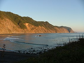
Sinkyone Wilderness State Park
Bear Harbor
Map showing the location of Sinkyone Wilderness State Park

Map showing the location of Sinkyone Wilderness State Park

LocationMendocino County, California
Nearest cityLeggett, California
Coordinates39°55′N 123°56′W / 39.92°N 123.94°W / 39.92; -123.94
OperatorCalifornia Department of Parks and Recreation

Sinkyone Wilderness State Park is a state parkinMendocino County, California. The wilderness area borders the Pacific Ocean to the west and the King Range National Conservation Area to the north. The nearest settlement is the unincorporated town of Leggett. The lack of major road and highway access has led to the Sinkyone Wilderness area being referred to as the Lost Coast.[1][2]

History[edit]

The area takes its name from the native Sinkyone tribe of the area. It was a fertile hunting ground for the Native Americans, providing nearly constant access to fresh fish and meat from the ocean, especially important during the winter months.

Further development through the years saw trails and roads cut through the area for business and industry, both for logging access to the raw timber, and for access to the native tanbark for the San Francisco tanneries. Logging operations continued well into the 20th century.

See also[edit]

References[edit]

  1. ^ "Sinkyone Wilderness SP".
  • ^ Harrell, Ashley (September 29, 2020). "Elk-human conflict on the rise in Northern California". SFGate. Retrieved October 1, 2020.
  • External links[edit]

    Backpacking in Sinkyone Park


  • t
  • e
  • t
  • e

  • Retrieved from "https://en.wikipedia.org/w/index.php?title=Sinkyone_Wilderness_State_Park&oldid=1168487050"

    Categories: 
    State parks of California
    Parks in Mendocino County, California
    Mendocino County, California geography stubs
    California protected area stubs
    Hidden categories: 
    Pages using gadget WikiMiniAtlas
    Articles with short description
    Short description matches Wikidata
    Use mdy dates from August 2023
    Coordinates on Wikidata
    Commons category link from Wikidata
    Articles with VIAF identifiers
    Articles with J9U identifiers
    Articles with LCCN identifiers
    All stub articles


    This page was last edited on 3 August 2023, at 01:36 (UTC).

    Text is available under the Creative Commons Attribution-ShareAlike License 4.0; additional terms may apply. By using this site, you agree to the Terms of Use and Privacy Policy. Wikipedia® is a registered trademark of the Wikimedia Foundation, Inc., a non-profit organization.


    Privacy policy

    About Wikipedia

    Disclaimers

    Contact Wikipedia

    Code of Conduct

    Developers

    Statistics

    Cookie statement

    Mobile view


    Wikimedia Foundation
    Powered by MediaWiki