Jump to content


Main menu


Navigation  


Main page
Contents
Current events
Random article
About Wikipedia
Contact us
Donate


Contribute  


Help
Learn to edit
Community portal
Recent changes
Upload file


Search  


Create account

Log in


Create account
 Log in


Pages for logged out editors learn more  


Contributions
Talk


Contents


(Top)


1 Location  


2 Economy  


3 Composition  


4 Notable natives  


5 Gallery  


6 See also  


7 References  


8 External links  


Sivrihisar


العربية
Azərbaycanca
 / Bân-lâm-gú
Català
Cebuano
Deutsch
Español
فارسی
Français
Gagauz
Հայերեն
Italiano
Kiswahili
Кырык мары
Bahasa Melayu
Nederlands
Нохчийн
Norsk bokmål
Norsk nynorsk
Татарча / tatarça
Türkçe
اردو
Tiếng Vit
Zazaki


Edit links


Article
Talk


Read
Edit
View history


Tools


Actions  


Read
Edit
View history


General  


What links here
Related changes
Upload file
Special pages
Permanent link
Page information
Cite this page
Get shortened URL
Download QR code
Wikidata item


Print/export  


Download as PDF
Printable version


In other projects  


Wikimedia Commons
Wikivoyage


Appearance


Coordinates: 39°2700N 31°3216E / 39.45000°N 31.53778°E / 39.45000; 31.53778
 

From Wikipedia, the free encyclopedia


Sivrihisar
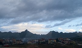
View of the town with mountain range in the background
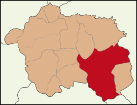
Map showing Sivrihisar District in Eskişehir Province
Sivrihisar is located in Turkey
Sivrihisar

Sivrihisar

Location in Turkey

Sivrihisar is located in Turkey Central Anatolia
Sivrihisar

Sivrihisar

Sivrihisar (Turkey Central Anatolia)

Coordinates: 39°27′00N 31°32′16E / 39.45000°N 31.53778°E / 39.45000; 31.53778
CountryTurkey
ProvinceEskişehir
Government
 • MayorHabil Dökmeci (CHP)
Area
2,748 km2 (1,061 sq mi)
Elevation
1,070 m (3,510 ft)
Population
 (2022)[1]
20,087
 • Density7.3/km2 (19/sq mi)
Time zoneUTC+3 (TRT)
Postal code
26600
Area code0222
Websitewww.sivrihisar.bel.tr

Sivrihisar (Turkish: Sivrihisar, "a pointed castle") is a municipality and districtofEskişehir Province, Turkey.[2] Its area is 2,748 km2,[3] and its population is 20,087 (2022).[1] Its elevation is 1,070 m (3,510 ft).

Location

[edit]

The town of Sivrihisar lies 13 km (8.1 mi) north of the historical site of Pessinus, at the foot of a high double-peaked ridge of granite, which bears the ruins of ancient Spaleia and a later Byzantine castle, which gives the town its name (sivri "sharp, pointed", hisar "fortress, castle"). It is located at the intersection of the E-90 and E-96 routes.

Economy

[edit]

As of 1920, Sivrihisar was producing knitting clothing.[4]

Composition

[edit]

There are 78 neighbourhoods in Sivrihisar District:[5]

  • Ahiler
  • Aktaş
  • Aşağıkepen
  • Aydınlı
  • Babadat
  • Bahçecik
  • Ballıhisar
  • Benlikuyu
  • Benliyaver
  • Beyyazı
  • Biçer
  • Böğürtlen
  • Buhara
  • Buzluca
  • Camikebir
  • Çandır
  • Çaykoz
  • Cumhuriyet
  • Demirci
  • Demirciköy
  • Dinek
  • Dumluca
  • Dümrek
  • Elcik
  • Elmalı
  • Ertuğrulköy
  • Gedik
  • Gerenli
  • Göktepe
  • Gülçayır
  • Güvemli
  • Hamamkarahisar
  • Hızırbey
  • Hüdavendigar
  • İbikseydi
  • İğdecik
  • İlören
  • İlyaspaşa
  • İstiklalbağı
  • Kadıncık
  • Kaldırımköy
  • Karabaşlı
  • Karaburhan
  • Karacakaya
  • Karacalar
  • Karacaören
  • Karacaörenyaylası
  • Karadat
  • Karakaya
  • Karkın
  • Kaymaz
  • Kertek
  • Kılıç
  • Kınık
  • Koçaş
  • Koltan
  • Kubbeli
  • Kurşunlu
  • Kurtşeyh
  • Memik
  • Mülkköy
  • Nasrettinhoca
  • Oğlakçı
  • Ortaklar
  • Paşakadın
  • Sadıkbağı
  • Sarıkavak
  • Selimiye
  • Sığırcık
  • Tekören
  • Yaverören
  • Yenice
  • Yenidoğan
  • Yeniköy
  • Yeşilköy
  • Yukarıkepen
  • Yunusemre
  • Zeyköyü
  • Notable natives

    [edit]
    [edit]

    See also

    [edit]

    References

    [edit]
    1. ^ a b "Address-based population registration system (ADNKS) results dated 31 December 2022, Favorite Reports" (XLS). TÜİK. Retrieved 12 July 2023.
  • ^ Büyükşehir İlçe Belediyesi, Turkey Civil Administration Departments Inventory. Retrieved 12 July 2023.
  • ^ "İl ve İlçe Yüz ölçümleri". General Directorate of Mapping. Retrieved 12 July 2023.
  • ^ Prothero, G. W. (1920). Anatolia. London: H.M. Stationery Office. p. 112. Archived from the original on 2013-11-10.
  • ^ Mahalle, Turkey Civil Administration Departments Inventory. Retrieved 12 July 2023.
  • ^ Turkish Ministry of Culture and Tourism. "Life of Nasreddin Hoca" (in Turkish). Retrieved 2008-04-06.
  • [edit]


  • t
  • e

  • Retrieved from "https://en.wikipedia.org/w/index.php?title=Sivrihisar&oldid=1233118933"

    Categories: 
    Sivrihisar District
    Populated places in Eskişehir Province
    Phrygia
    Districts of Eskişehir Province
    Metropolitan district municipalities in Turkey
    Central Anatolia Region geography stubs
    Hidden categories: 
    Pages using gadget WikiMiniAtlas
    CS1 Turkish-language sources (tr)
    Articles with short description
    Short description is different from Wikidata
    Coordinates on Wikidata
    Articles containing Turkish-language text
    Articles with Turkish-language sources (tr)
    Articles with VIAF identifiers
    Articles with GND identifiers
    Articles with J9U identifiers
    All stub articles


    This page was last edited on 7 July 2024, at 10:46 (UTC).

    Text is available under the Creative Commons Attribution-ShareAlike License 4.0; additional terms may apply. By using this site, you agree to the Terms of Use and Privacy Policy. Wikipedia® is a registered trademark of the Wikimedia Foundation, Inc., a non-profit organization.


    Privacy policy

    About Wikipedia

    Disclaimers

    Contact Wikipedia

    Code of Conduct

    Developers

    Statistics

    Cookie statement

    Mobile view


    Wikimedia Foundation
    Powered by MediaWiki