Jump to content


Main menu


Navigation  


Main page
Contents
Current events
Random article
About Wikipedia
Contact us
Donate


Contribute  


Help
Learn to edit
Community portal
Recent changes
Upload file


Search  


Create account

Log in


Create account
 Log in


Pages for logged out editors learn more  


Contributions
Talk


Contents


(Top)


1 See also  


2 References  


Slope Point


Cebuano
Deutsch
Español
Français
Nederlands
Português


Edit links


Article
Talk


Read
Edit
View history


Tools


Actions  


Read
Edit
View history


General  


What links here
Related changes
Upload file
Special pages
Permanent link
Page information
Cite this page
Get shortened URL
Download QR code
Wikidata item


Print/export  


Download as PDF
Printable version


In other projects  


Wikimedia Commons


Appearance


Coordinates: 46°4031.39S 169°0020.34E / 46.6753861°S 169.0056500°E / -46.6753861; 169.0056500
 

From Wikipedia, the free encyclopedia


46°40′31.39″S 169°00′20.34″E / 46.6753861°S 169.0056500°E / -46.6753861; 169.0056500

Location of Slope Point

Slope Point is the southernmost point of the South Island of New Zealand.[1]

Slope Point lies 24 kilometres (15 mi) south of the small settlement of Waikawa,[2] near the southwestern edge of the Catlins and Toetoes Bay and 70 kilometres (43 mi) east of Invercargill. A nearby locality—Haldane—was named after the original European settlers, the Haldane family.[1]

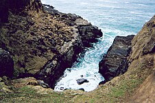
The land around Slope Point is used for sheep farming with no houses anywhere nearby. Eroded cliffs drop down to the sea below. An AA signpost there shows the distance to the Equator and the South Pole, and a small solar-powered lighthouse stands on farmland.[1]

There is no road to Slope Point; it can be reached by a 20-minute walk following dilapidated yellow markers. Its latitude, longitude is approximately 46.67 S, 169.00 E. There is no public access during the lambing season (September – November).[1]
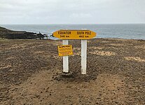
The AA signpost at Slope Point.
A view to the sea from the area around Slope Point.

See also

[edit]

References

[edit]
  1. ^ a b c d Wade, Pamela (26 August 2018). "World famous in New Zealand: Slope Point, Southland". Stuff. Retrieved 24 January 2023.
  • ^ "Slope Point". Catlins Coast Inc. Retrieved 24 January 2023.

  • Retrieved from "https://en.wikipedia.org/w/index.php?title=Slope_Point&oldid=1212091814"

    Categories: 
    Headlands of Southland, New Zealand
    The Catlins
    Foveaux Strait
    Southland District
    Hidden categories: 
    Pages using gadget WikiMiniAtlas
    Use dmy dates from June 2015
    Use New Zealand English from June 2015
    All Wikipedia articles written in New Zealand English
    Coordinates on Wikidata
    Articles with short description
    Short description is different from Wikidata
    Commons category link from Wikidata


    This page was last edited on 6 March 2024, at 03:36 (UTC).

    Text is available under the Creative Commons Attribution-ShareAlike License 4.0; additional terms may apply. By using this site, you agree to the Terms of Use and Privacy Policy. Wikipedia® is a registered trademark of the Wikimedia Foundation, Inc., a non-profit organization.


    Privacy policy

    About Wikipedia

    Disclaimers

    Contact Wikipedia

    Code of Conduct

    Developers

    Statistics

    Cookie statement

    Mobile view


    Wikimedia Foundation
    Powered by MediaWiki